The Quest for Mount Sinai
By GM Matheny
It is necessary to read The Quest for the Red Sea Crossing FIRST, or you will be at a loss as to why Israel started where they did.
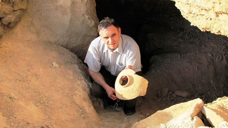
A pharaoh of Egypt went to Mount Sinai and engraved his named there!
In December 2013, an inscription made by a King of Egypt was found at Mount Gharib, which I have proposed as Mount Sinai. And more than a hundred years ago, a hieroglyphic inscription was found in the East Nile Delta, also made by a king of Egypt, describing an expedition to a location the scholars have hotly debated. But the location is now confirmed, for the same king made both inscriptions, and he found something there that only Israel could have left.
This book can also be bought on Amazon.com
https://www.amazon.com/dp/B07DBF8TYV.
Both paperback and eBook.
(The footnotes in here will appear as large numbers.)
By GM Matheny
It is necessary to read The Quest for the Red Sea Crossing FIRST, or you will be at a loss as to why Israel started where they did.
A pharaoh of Egypt went to Mount Sinai and engraved his named there!
In December 2013, an inscription made by a King of Egypt was found at Mount Gharib, which I have proposed as Mount Sinai. And more than a hundred years ago, a hieroglyphic inscription was found in the East Nile Delta, also made by a king of Egypt, describing an expedition to a location the scholars have hotly debated. But the location is now confirmed, for the same king made both inscriptions, and he found something there that only Israel could have left.
This book can also be bought on Amazon.com
https://www.amazon.com/dp/B07DBF8TYV.
Both paperback and eBook.
(The footnotes in here will appear as large numbers.)
In December 2013, an inscription made by a King of Egypt was found at Mount Gharib, which I have proposed as Mount Sinai. And more than a hundred years ago, a hieroglyphic inscription was found in the East Nile Delta, also made by a king of Egypt, describing an expedition to a location the scholars have hotly debated. But the location is now confirmed, for the same king made both inscriptions, and he found something there that only Israel could have left.
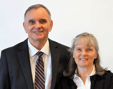
Author and wife Nancy
GM Matheny was a navy diver on the nuclear submarine USS Halibut SSGN-587 and received the Legion of Merit for a special operation. He is a graduate of Pacific Coast Baptist Bible College, 1979. He and his wife, Nancy, and their six children, arrived in Romania in 1991, where they serve as missionaries. He authored the books The Quest for the Great Stones of the Prophet Jeremiah, The Quest for Red Sea Crossing and GOD & SPIES: Recently Declassified Top Secret Operation
The Quest for Mount Sinai
Today there are nine different locations for Israel’s Red Sea crossing and more than twenty mountains that claim the title of Mount Sinai. One would think that after two hundred years of archaeology, we would have narrowed it down to a few choices; instead, now there is a growing number of opinions for the route of the Exodus and where the location of Mount Sinai was. What is wrong?
Almost everyone is starting the Exodus from the east side of the Nile Delta. And therefore must have the sea crossing east of that, either at the Bitter lakes, Gulf of Suez, or Gulf of Aqaba. This is also why they are not looking in the Eastern Desert of Egypt for Mount Sinai. Because if the Israelites crossed the sea at either one of these areas (Isthmus or Gulf of Aqaba), then they would not cross the sea again in order to reach the Eastern Desert.
This book was originally from the book EXODUS: The Route * Sea Crossing * God’s Mountain, published by XULON PRESS, but was separated into two books; The Quest for the Red Sea Crossing and The Quest for Mount Sinai, both by GM Matheny. To understand why Israel started her journeys in the area of Old Cairo, one will need to read our book The Quest for the Red Sea Crossing, https://www.amazon.com/dp/1982966114
But in short, both Josephus (1st century AD, Jewish historian) and Artapanus (3rd–2nd century BC, Jewish historian) have Israel starting the Exodus on the west side of the Nile. Israel would have crossed the flooded Nile and as such all four of the place names as given in Exodus 14:2 (Pi-hahiroth, Migdol, Baal-zephon and the sea) can easily be found.
In December 2013, an inscription made by a King of Egypt was found at Mount Gharib, which I have proposed as Mount Sinai. And more than a hundred years ago, a hieroglyphic inscription was found in the East Nile Delta, also made by a king of Egypt, describing an expedition to a location the scholars have hotly debated. But the location is now confirmed, for the same king made both inscriptions, and he found something there that only Israel could have left.
Author and wife Nancy
GM Matheny was a navy diver on the nuclear submarine USS Halibut SSGN-587 and received the Legion of Merit for a special operation. He is a graduate of Pacific Coast Baptist Bible College, 1979. He and his wife, Nancy, and their six children, arrived in Romania in 1991, where they serve as missionaries. He authored the books The Quest for the Great Stones of the Prophet Jeremiah, The Quest for Red Sea Crossing and GOD & SPIES: Recently Declassified Top Secret Operation
The Quest for Mount Sinai
Today there are nine different locations for Israel’s Red Sea crossing and more than twenty mountains that claim the title of Mount Sinai. One would think that after two hundred years of archaeology, we would have narrowed it down to a few choices; instead, now there is a growing number of opinions for the route of the Exodus and where the location of Mount Sinai was. What is wrong?
Almost everyone is starting the Exodus from the east side of the Nile Delta. And therefore must have the sea crossing east of that, either at the Bitter lakes, Gulf of Suez, or Gulf of Aqaba. This is also why they are not looking in the Eastern Desert of Egypt for Mount Sinai. Because if the Israelites crossed the sea at either one of these areas (Isthmus or Gulf of Aqaba), then they would not cross the sea again in order to reach the Eastern Desert.
This book was originally from the book EXODUS: The Route * Sea Crossing * God’s Mountain, published by XULON PRESS, but was separated into two books; The Quest for the Red Sea Crossing and The Quest for Mount Sinai, both by GM Matheny. To understand why Israel started her journeys in the area of Old Cairo, one will need to read our book The Quest for the Red Sea Crossing, https://www.amazon.com/dp/1982966114
But in short, both Josephus (1st century AD, Jewish historian) and Artapanus (3rd–2nd century BC, Jewish historian) have Israel starting the Exodus on the west side of the Nile. Israel would have crossed the flooded Nile and as such all four of the place names as given in Exodus 14:2 (Pi-hahiroth, Migdol, Baal-zephon and the sea) can easily be found.

Annual flood before the Aswan Dam.
Photograph Giza Pyramids © October 31, 1927.
The above picture is used by permission,
Museum of Fine Arts, Boston. The annual inundation averaged twenty-four feet above the Nile with the flooded waters being six miles across from Cairo to the Great Pyramid. The Egyptians called this land the Land of Papyrus and when flooded the Sea of Papyrus, the equivalent of the Hebrew words “Yam Suf” which is translated Red Sea. The Quest for the Red Sea Crossing only teaches one sea crossing by Israel and in deep water not multiple sea crossings, or in shallow water as critics have said.
All rights reserved solely by the author, Copyright © 2014 by G.M. Matheny. No part of this book may be reproduced in any form without the permission of the author. Scripture quotations are taken from The King James Bible (KJB). All quotations, whether from the Bible, archaeologists, or scholars, are italicized. Bold print or underlining used in verses or quotations of others reflects my emphasis. For the meaning of the Bible words in the original languages, I will be using Gesenius’ Lexicon and Strong’s Concordance, hereafter labeled Strong’s.
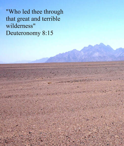
“And thou shalt remember all the way which the LORD thy God led thee these forty years in the wilderness, to humble thee, and to prove thee, to know what was in thine heart, whether thou wouldest keep his commandments, or no. And he humbled thee, and suffered thee to hunger, and fed thee with manna, which thou knewest not, neither did thy fathers know; that he might make thee know that man doth not live by bread only, but by every word that proceedeth out of the mouth of the LORD doth man live. Thy raiment waxed not old upon thee, neither did thy foot swell, these forty years. Thou shalt also consider in thine heart, that, as a man chasteneth his son, so the LORD thy God chasteneth thee” (Deuteronomy 8:2–5).
Table of Contents
Preface
The wanderings of Israel.
Chapter One
Mount Sinai was by the “country of the Troglodytes,” near where Moses stayed in Midian and in Arabia.
Chapter Two
Encampments of Shur, Wilderness of Etham, Marah, Elim, Red Sea, Wilderness of Sin, Dophkah, Alush, and Rephidim.
Chapter Three
Encampments of Wilderness of Sinai, Taberah, Kibroth-hattaavah, Hazeroth,
Rithmah, Rimmon-parez, Libnah, and No. 17: Rissah.
Chapter Four
“Eleven days to Kadesh.”
Chapter Five
Encampments of Kadesh-barnea, Beersheba, Paran, Kehelathah, plus Mount Seir and the southwest border of Israel.
Chapter Six
The Mountain of God, Mount Sinai, Mount Horeb.
Photograph Giza Pyramids © October 31, 1927.
The above picture is used by permission,
Museum of Fine Arts, Boston. The annual inundation averaged twenty-four feet above the Nile with the flooded waters being six miles across from Cairo to the Great Pyramid. The Egyptians called this land the Land of Papyrus and when flooded the Sea of Papyrus, the equivalent of the Hebrew words “Yam Suf” which is translated Red Sea. The Quest for the Red Sea Crossing only teaches one sea crossing by Israel and in deep water not multiple sea crossings, or in shallow water as critics have said.
All rights reserved solely by the author, Copyright © 2014 by G.M. Matheny. No part of this book may be reproduced in any form without the permission of the author. Scripture quotations are taken from The King James Bible (KJB). All quotations, whether from the Bible, archaeologists, or scholars, are italicized. Bold print or underlining used in verses or quotations of others reflects my emphasis. For the meaning of the Bible words in the original languages, I will be using Gesenius’ Lexicon and Strong’s Concordance, hereafter labeled Strong’s.
“And thou shalt remember all the way which the LORD thy God led thee these forty years in the wilderness, to humble thee, and to prove thee, to know what was in thine heart, whether thou wouldest keep his commandments, or no. And he humbled thee, and suffered thee to hunger, and fed thee with manna, which thou knewest not, neither did thy fathers know; that he might make thee know that man doth not live by bread only, but by every word that proceedeth out of the mouth of the LORD doth man live. Thy raiment waxed not old upon thee, neither did thy foot swell, these forty years. Thou shalt also consider in thine heart, that, as a man chasteneth his son, so the LORD thy God chasteneth thee” (Deuteronomy 8:2–5).
Table of Contents
Preface
The wanderings of Israel.
Chapter One
Mount Sinai was by the “country of the Troglodytes,” near where Moses stayed in Midian and in Arabia.
Chapter Two
Encampments of Shur, Wilderness of Etham, Marah, Elim, Red Sea, Wilderness of Sin, Dophkah, Alush, and Rephidim.
Chapter Three
Encampments of Wilderness of Sinai, Taberah, Kibroth-hattaavah, Hazeroth,
Rithmah, Rimmon-parez, Libnah, and No. 17: Rissah.
Chapter Four
“Eleven days to Kadesh.”
Chapter Five
Encampments of Kadesh-barnea, Beersheba, Paran, Kehelathah, plus Mount Seir and the southwest border of Israel.
Chapter Six
The Mountain of God, Mount Sinai, Mount Horeb.
Preface
The wanderings
of Israel.
Anyone not familiar with this subject will be surprised by how much debate there is about the Exodus and which route the children of Israel took. When I first realized this debate was raging, I thought, “What is the matter with these people? Surely they could have figured this out by now. Just look on the map!” And I reasoned, “All they have to do is find a few of the place names that are given in the Bible and then backtrack from Mount Sinai with the average distance traveled per day.” So, I got out my Sunday school map of the Sinai Peninsula and looked for Mount Sinai, but to my surprise, it had a question mark next to it. Scholars were not even sure where it was. Yes, I had a lot to learn.
Confirmation of sites. I believed these encampments could be found: “seek, and ye shall find,” and in most cases, I believe we were successful. Because I had to learn from scratch, I will explain those things that were new to me.
Which source can we trust? Reading today’s commentaries on the Bible can be helpful, but there are Bible commentaries (by Jewish historians) that are two thousand years old! A few were written by those who saw the temple service and would have had access to scrolls no longer available. I learned more from them than from reading modern commentaries. There are some things I would not have understood about the Exodus without these ancient writings!
The ancient writers do not always agree among themselves, just as the scholars of today obviously disagree, since there are nine different crossing locations for the sea and more than twenty mountains that claim the title Mount Sinai. Where history, archaeology, or traditions contradict each other, then the Bible will be the ultimate authority and judge of what is error or correct; it was, after all, the original source of the Exodus. There are times I will quote an ancient source knowing I could not possibly agree with all the legends or traditions written therein. On the other hand, I believe the Bible and I believe the miracles of the Bible--all of them! I believe the biblical account of the Exodus and I interpret it the same way I would interpret an account of an event recorded in a newspaper. I do not believe like the critics who say the Exodus was a “fabricated history” by Jewish priests to provide their people with a past. The Exodus and the miracles of the Bible all happened as stated (I Corinthians 10:1–11), and though one may make an allegory from them, the events are historical.
Thankfully, there are scholars who believe the Bible, but most do not, especially when it disagrees with their theories. Would you expect scholars who do not believe the Bible to find any evidence for the Exodus? How hard would they look for it? How much time and money would you spend looking for something you did not believe existed? They do not like their source of information coming from the Bible that teaches about God, creation, and miracles. Yet, they will readily cherish any papyrus they find in the sand of Egypt, whose author would have believed in Egyptian mythology and worshiped a multitude of Egyptian gods, half of which were animals! Some even inform us that we should not interpret the miracles of the Bible literally. But Christ and His apostles interpreted the miracles of the Hebrew Scriptures (Old Testament) literally (Noah and the flood, Lot and the fire and brimstone that rained down from heaven, etc. Luke 17:26–29). They like to tell you that Moses could not have written the Pentateuch (the first five books of the Bible), as the last page records his death. It is, however, understood that the scribes of that day would have finished this part of Deuteronomy (under Joshua’s supervision) and may have written down other portions during the life of Moses, though under his supervision. However, these same textual scholars will divide the Pentateuch into different parts (Jahwist text, Elohist text, Deuteronomist text, Priestly text, hence J, E, D, and P text), which they believe were written by different authors at different times and later combined, and all of them hundreds of years after the time of Moses and the Exodus. But these are imaginary works, and no ancient text has ever been found that backs this up. On the other hand, there are thousands of ancient Hebrew texts in scrolls or fragments, including from the Dead Sea Scrolls, all in the form of our present-day Bible! Christ attributes all the Pentateuch to the authorship of Moses (Mark 1:44, Mark 7:10, Mark 10:2–3, Luke 16:31, Luke 24:27 and 44, John 5:46, and many other verses).
If archaeologists believe the Exodus happened, they still are not in agreement as to when it took place. And when searching for evidence of the Exodus, they will look for artifacts from the time periods of MB (Middle Bronze Age) II “C” (1650–1550 BC), or LB (Late Bronze) Age I (1550–1400 BC), or LB II “A” (1400–1300 BC), or LB “B” (1300–1200 BC), etc. And unless one can show finds for their particular Bronze Age period, or their personal chronology, his theory will not be accepted but declared invalid. This might shake some at first, but one should not forget these “experts” do not agree among themselves!
It is not the intent of this book to explain who the pharaoh was of the Exodus or the date it took place, though the ancients believed it was during the reign of Ahmose, the first king of the Eighteenth Dynasty. There are, however, reasons why this may not be so, explained later. Because the events of the Exodus took place three and a half millennia ago, I do not give “exact dates” that would be argued over, but I round off to the nearest decade or even the nearest century.
We are told Israel could not have survived in the desert. That it would have been difficult for such a multitude wandering the desert to have lived for more than a few weeks. Yes, and the same could be said about one person in the desert. They forget God, Who supplied water, meat (quail), and daily bread (Nehemiah 9:20). “Yea, forty years didst thou sustain them in the wilderness, so that they lacked nothing; their clothes waxed not old, and their feet swelled not” (Nehemiah 9:21). As others have brought out, the Israelites the critics are looking for never existed, because they do not believe God provided for His people, but the truth is, Israel “lacked nothing”!
The experts believe encampments of such a multitude would have left some sort of rubbish for them to track, but they are still trying to figure out which route the children of Israel followed. There was no thrown away, worn-out clothing, no piles of leftover manna (it melted Exodus 16:21), no broken pottery (discussed later), and no soda bottles or gum wrappers to follow.
The detractors’ inability to find the encampments of Israel is what they offer as proof! They only recently found (2002) the “workers village” for the pyramids of the Giza Plateau. It is estimated this town housed twenty thousand people and was built out of bricks, whereas the children of Israel lived in tents. And this discovery only came after archeologists had searched every inch of the Giza Plateau for the last two hundred years of archaeology.
Traditions. Besides archaeology and history, there are traditions to consider. In truth, traditions are not the most trustworthy sources and may have been created simply to help out the local tourism industry. I once heard a certain city in Europe claimed to have “all seventeen graves” of the original twelve apostles! So though I was not looking for any signs that said “Moses slept here,” still, traditions are expected to have been passed down if one has the right route for the Exodus, and there are more traditions for this route than all the others put together!
A number of quotes in this book come from the book Legends of the Jews (compiled in 1909) and concern for the accuracy of such legends is understandable. This work was compiled by Louis Ginzberg, and in his preface he said, “In the present work, The Legends of the Jews, I have made the first attempt to gather from the original sources all Jewish legends, insofar as they refer to biblical personages and events, and reproduce them with the greatest attainable completeness and accuracy.” For original sources, he lists both Jewish and Christian writings.
Problems with place names. You may be surprised, as I was, by all the spelling differences among maps, even those of today. Sometimes, out in the middle of the desert, it depended on who pronounced the name, an Egyptian or a Bedouin. Sometimes, it was because of the Arabic language, which does not have certain letters that we have in our alphabet. There is no p in Arabic replaced with f and sometimes b, and no v replaced with b. Also, Arabic has some letters we do not have, which at first are hard to pronounce. Only a third of the letters in Arabic have a clear equivalent in our alphabet. Even when another language has the same sounds, one can still confuse the letters of s for z, or g for j; also, c, k, q, and g can get mixed up, and even t for d.
One can read books that will say if an Arabic place name has no meaning in the Arabic language, then it was transcribed from another language, which in the Eastern Desert would be from ancient Egyptian, Bedouin, or even the Midianite language. But this was not always the case, especially on older maps, which were made by French and German explorers who wrote down Arabic names as they sounded to them, leading to multiple spellings. You probably would not recognize your own name if someone from another country wrote it down as it sounded to him. British archaeologist Sir Wilkinson, who wrote down the names for the Eastern Desert, where the majority of the place names will be found, said, “I have kept in view, as much as possible, the English pronunciation, guiding my mode of spelling by the sound of a word, rather than by its Arabic orthography...now and then introduced a ‘p,’ which letter does not exist in Arabic, but which nevertheless comes near to the pronunciation in certain words.”1
I would like to add something here about the magnitude of the problem involved in finding these names that were written thirty-five hundred years ago in the Bible. First, there are at least eight languages in play, including ancient Egyptian, the Midianite language, and then the Greeks, who changed many names when they conquered Egypt. They were followed by the Romans, who gave many of the sites Latin names, then the Arabs, who conquered Egypt fourteen hundred years ago and gave hundreds of names in the Arabic language, and there are also some Bedouin names in the Eastern Desert of Egypt. Then, of course, we have Hebrew names from the Bible that we are reading in English. It is also possible there may be a few Turkish names from the Ottoman Empire.
The good news is that most of the place names on the Eastern Desert of Egypt are from one language, Arabic. The bad news is that on these older maps we will be using that 90 percent of these place names were transcribed into the Latin or the Roman alphabet, which we use in English. Though this helps us pronounce the names, it does not give us the meanings of the words. Translators do not like working with place names, but they especially do not like it when you cannot give them the original script of the language, in this case, the names written in Arabic. I claim no expertise on any of the original languages, but in most cases, even those who do would not help on this without the original script, and even when I did get the names in the original script, they could only explain the definitions of 10 percent or less of the place names. Even Sir Wilkinson only gave the meanings for a few names he wrote down. This was the single biggest problem I had!
The best help I found came from two Egyptian men, one who worked in a bank and the other a librarian, and both spoke English fluently. This will not be thought of as a “scientific method,” but Arabic was their own language and, more importantly, they lived in the Eastern Desert of Egypt and were already familiar with many of these names, an advantage that the other translators did not have. I also was able to confirm all of the place names they translated with ones I found on the Internet.
Neither the Egyptian hieroglyphics nor the Hebrew script used vowels when originally written, and in most cases, even the Arabic written today does not use vowels. Scholars say the vowel pointing for the Hebrew letters came during the Middle Ages and were added after these place names (and other words) were written. The Hebrews and the Egyptians, of course, did use vowels when speaking, but the placement of vowels in ancient Egyptian writings came later and is more conjecture than science. When it comes to the vowels, some translators will plainly tell you they are not sure, while others leave you with the impression they are fairly certain. Some translators will look to the Coptic or Greek languages, which did have vowels, to see how they spelled place names in Egypt. But those who recorded place names in Egypt did so often hundreds of years after the first time a site was named in hieroglyphics and cannot solve many of the problems. And so translators, when working with Egyptian hieroglyphics, will add vowels according to how they think the word would have been pronounced. This is another reason why it is possible to get a number of spellings for one word. For example, the Egyptian god, Atum, can be found with spellings of Tem, Temu, Tum, and Atem, but without the vowels it is just Tm.
The border of Egypt. When referring to countries or seas mentioned in the Bible, remember that the boundary lines on today’s maps are not the same as in the days of Moses. When you look at a map and view the Red Sea, Egypt, or Ethiopia, their locations are where they are today. We will have to look at the boundary lines as described in the Bible, not of those on a modern-day map. Secondly, when a site is located, if not in agreement, you will have to ask yourself the question, “Why?” Is it just because you have seen the site put on a map at a different location, or because the Bible places it there? You will have to be willing to look at the evidence that is brought forth. On my part, there were sites I had real problems with at first, when considering their new locations. Not because the Bible placed them where I had been taught, but because sites and boundaries had been dictated by tradition and repetition, so much so it was hard to imagine them being in any other location.
Some of the modern paintings of Christ are not those of a first-century Jew. Christ was a Jew by His mother, not the long, blond-haired, blue-eyed Anglo-Saxon that some have imagined. If the reader is not open to looking at God’s Word and the ancient Jewish sources (that place things in different locations), then some things will be forced and he will be looking in the wrong places. I believe the biggest hindrance to accepting this route, and therefore the location of Mount Sinai, will not be because of a lack of evidence, but fighting the traditional “Anglo-Saxon” diagram some have imagined was the route of the Exodus.
Should history and archaeology be important to Christians? I do believe we should put the focus on studying the theology of the Bible, but there is an incredible amount of information in the Hebrew Scriptures about Egypt and the cities there, and it was given by God! In truth, there are things that are “weightier matters,” as Christ said in reference to the weightier matters of the Law of God, but we should not ignore the other things in the Scriptures, “these ought ye to have done, and not to leave the other undone” (Matthew: 23:23). The history and archaeology of the Bible should not be explained by the scholars who do not believe in the supernatural and then sell their books to our young people, who are left with the impression the Bible is not trustworthy.
Some pretend it does not matter if one who writes about the Bible believes in miracles, the creation account, the resurrection, or even God, but this would be as naive as to believe that opposing political parties are unbiased when explaining each other’s views. Any researcher should at least study the Book that claims to be God’s Word and books written by those who believe in it. It only takes one small light at an exit door to show the way out of unbelief and error.
It is my sincere hope that, even with my limitations in this subject, God will be honored and His Name lifted up. “But there is a God in heaven that revealeth secrets…” (Daniel 2:28). I gladly, therefore, give Him credit for all that is right in this book, but like anyone, I certainly could have made mistakes (hopefully only small ones). There are, however, some things in this book, many things, which I have not read anywhere else on this subject.
What good will it do? I suppose someone could have asked that when Moses first brought the Ten Commandments down off Mt. Sinai, and three thousand people died because of their idolatry (Exodus 32:28).
The Bible says, “If they hear not Moses and the prophets, neither will they be persuaded, though one rose from the dead” (Luke 16:31). Some believe it is a waste of time to show people evidence to get them to believe, for if they believe not the Bible (“Moses and the prophets”), even if someone rose from the dead, they would not believe. This application was not meant for everyone. Lazarus rose from the dead, and “many of the Jews went away, and believed on Jesus” (John 12:9-11). God is not obligated to do this, nor is He our personal magician to work miracles for us at our will. But when He wants, there are times when He will do things such as the resurrection of Lazarus or smaller things to help the unbelief of some. And it is true that if someone does not want to believe, he will not, even if God works a miracle. We are told not to cast our “pearls before swine.” The chief priests did not believe when Lazarus was raised from the dead. Instead, they wanted to kill him (John 12:10). And it is more blessed to believe without seeing Lazarus or Christ raised from the dead, yet the Lord said, “Thomas, because thou hast seen me, thou hast believed…” (John 20:29). I am not teaching you should seek a sign (Matthew 12:39), nor do I know how many this would help, or for whom God would allow such. But the Apostle Paul would have never been saved by preaching alone. He had to be “knocked off his high horse” (Acts 9:3-6) before he would look up. With this said, what is wrong with trying to explain some things to people and giving them reasons to believe? The field of archaeology has been used by some to turn people away from the truth of God’s Word. There are books that will strengthen your faith, and there are books with “oppositions of science falsely so called” (I Timothy 6:20–21) that will take your faith away (I Timothy 6:20, Colossians 2:8). Many of the reasons I will give, come right out of the Bible, and these things were not written in vain, so hopefully, they will show how accurate God’s Word is.
My purpose is not to try and prove the Bible; it is true already. “All scripture is given by inspiration of God…” (II Timothy 3:16). Ultimately, faith comes from the Bible (Romans 10:17), not from artifacts buried in the sand. I looked for the route of the Exodus not to see if it was true, but because I already believed it was true.
“And the people came up out of Jordan on the tenth day of the first month, and encamped in Gilgal, in the east border of Jericho. And those twelve stones, which they took out of Jordan, did Joshua pitch in Gilgal. And he spake unto the children of Israel, saying, When your children shall ask their fathers in time to come, saying, What mean these stones? Then ye shall let your children know, saying, Israel came over this Jordan on dry land. For the LORD your God dried up the waters of Jordan from before you, until ye were passed over, as the LORD your God did to the Red sea, which he dried up from before us, until we were gone over: That all the people of the earth might know the hand of the LORD, that it is mighty: that ye might fear the LORD your God for ever” (Joshua 4:19–24).
It will be noticed that I am quoting from books that were published before 1923 (public domain). In a few cases, some were published after 1923, but their copyright was not renewed. In other cases, my quotes fall under “fair use” as provided for in section 107 of the US Copyright Law, which says, “the reproduction of a particular work may be considered fair, such as criticism, comment…” My quotes of this type are all less than one sentence. It sounds as if it would be easy to get permission from others to quote their books, but not if they believe differently than you about the Exodus. Most of my requests to quote a source received no response. I am not saying this to complain, it is understandable. But I do not want the readers to think they are somehow missing out on the most up-to-date information. I, of course, read all the information I could find, both old and new, pro and con, and surprisingly, in most cases, the older works were more helpful and interesting, especially the ancient writings of the Jews and classical writers.
Miles Per Day
The encampments of the children of Israel are found in their proper order, with a reasonable distance traveled between them and an accessible route for their multitude.
How many miles a day could such a multitude have traveled with wagons (Numbers 7:3–8), children, the elderly, flocks, and all? For those who say Israel could not have traveled more than five or six miles a day because of the need to graze their herds and flocks, they need only look to the covered wagon trains and cattle drives of the western US. Wagon trains, unless hindered by forest, could travel twelve to sixteen miles a day. Cattle drives are said to have averaged fifteen miles a day or more, and their cattle actually gained weight at this pace. Their cattle grazed at noon and at night. Though it was not the norm, Barnes’ Notes on the Bible makes an interesting comment about miles per day from Genesis 31:20–24, saying it “would give him twelve days to travel three hundred English miles.” That would be twenty-five miles a day with children and herds. In truth, they (Jacob and his family) were fleeing from Laban, pushing themselves, but this shows that it was possible, and they sustained it for twelve days.
Western sheep cannot be compared to the sturdy Bedouin sheep of the Middle East. The United Nations Food and Agriculture Organization (FAO) website on Bedouin flocks, “Awassi sheep,” said, “flocks may be driven for as much as 35 km (21.75 miles) in 24 hours” (Williamson, 1949). http://www.fao.org/docrep/011/aj003e/AJ003E05.htm#fg21
The longest day’s march we have on the Exodus route is seventeen miles. The rate of fourteen miles a day was about the average on our route in the Eastern Desert of Egypt. There are, however, some scholars who want us to believe the average distance traveled was barely five miles a day, or that Israel traveled the absurd distance of sixty, seventy or more miles a day.
The children of Israel were prepared for this journey, being slaves used to hard work and rough living conditions, and at the start of their journey “there was not one feeble person among their tribes” (Psalms 105:37). In the same chapter, verse 39, it said the cloudy pillar that led them was as a “covering,” which would have given shade during the day on the hot desert and made it possible for them to travel at night. “And the LORD went before them by day in a pillar of a cloud, to lead them the way; and by night in a pillar of fire, to give them light; to go by day and night” (Exodus 13:21, Deuteronomy 1:33).
There are two variables in these miles-per-day averages. We do not know all the stops the Israelites made, nor do we know how long they stayed at each stop to rest. There are two times the Bible says Israel went three days, but only one stop is named (Exodus 15:22 and Numbers 10:33). They would have stopped each day, but no name is given for an encampment except the last one, probably because nothing exceptional happened at these stops or no name existed there. (In the desert, one would not expect to find a name at each location.) But this means there were most likely other stops not mentioned, and we learn that at the third place named after leaving Mount Sinai, forty days had gone by. Three days to get to Taberah (Numbers 10:33), thirty days of eating flesh at Kibroth-hattaavah (Numbers 11:19–20), and at least a week at Hazeroth, where Miriam (Numbers 12:15) had to wait outside the camp. My point is, they were able to rest sometimes between days of travel, which would make a big difference in how many miles a day they averaged. It should not be assumed, therefore, that it was only a one-day’s march between all the stations or that they only passed one night at each encampment.
Maps. The primary map used is an 1844 map by John Arrowsmith, used by permission from the David Rumsey Map Collection, www.davidrumsey.com. I like this map, as it is easy to read and has most of the place names on it where Israel traveled. There are other maps, also from the David Rumsey Collection, which will be used because they show a better view of the landscape. The 1844 map received the place names for the Eastern Desert from Sir John Gardner Wilkinson.2 Sir Wilkinson made the original survey of the Eastern Desert and was the first to copy many of these names; I will, therefore, be using a number of his quotes.
It will be important to keep in mind the geography of Egypt. “Lower” Egypt is in the north, and “Upper” Egypt is in the south! The Nile flows from south to the north, the opposite of the Mississippi river; it is easy to forget this and become confused. As to pictures of burnt mountains, inscriptions, pillars, etc., these will be addressed later in this book. The first time I quote an ancient writer, besides giving his name, I will also give the approximate date he wrote and what his occupation was, but thereafter, unless helpful to the point being made, I may give only the name. Also, as much as possible, I wanted this work to be in the form of a story, not a phone book with only names and addresses, so though I believe it is well researched, it will not be all technical details.
ENDNOTES
1. John Murray. Sir John Gardner Wilkinson. A Handbook for Travelers in Egypt (1867), 42.
2. The 1844 map by John Arrowsmith has written on the Red Sea area the following: “The detail in the Egyptian Desert between Suez & Kenneh is copied from an original M.S. Drawing by J. Wilkinson, Esq.
On the way to Mount Sinai.
Seven encampments (stations)—Succoth, Etham, Marah, Wilderness of Sin, Rephidim, Kibroth-hattaavah and Libnah—either had some uncertainty with their location or problem with the meaning of the Arabic name and will be labeled “possible.” But even these seven encampments are not guesses; they are still in the right order and with good reasons for choosing them as the right encampments. There are, however, nine encampments I believe are more than coincidences: (1) Elim, (2) Red Sea (the second time the Israelites encamped by it), (3) Dophkah, (4) Alush, (5) Wilderness of Sinai, (6) Hazeroth, (7) Rithmah, (8) Rimmon-parez, and (9) Kadesh-barnea. This is not counting Mount Seir or Mount Sinai, as Israel did not camp on these mountains but only near them.
All encampments are given in the order found in the Bible, and nine are either (1) on the map that will be used, or (2) names that describe them are on the map, or (3) from historical documents that placed them at that location.
The encampments of the children of Israel are found in their proper order, with a reasonable distance traveled between them, an accessible route for a multitude with “wagons” (Numbers 7:3–8), a logical direction, and even falling on a known ancient route. (I was not zigzagging my way through the desert trying to pick up place names.) I believe any researcher or layman who looks at the sites of these nine encampments, especially when taken together, will conclude these are more than coincidences, and in some cases simply amazing! For the location of Mount Sinai, I have evidence from a pharaoh of Egypt who left his inscription at the mountain and then returned to Egypt and recorded his trip there in Egyptian hieroglyphic! Read and see if this book lives up to my claims.
The meanings of many of these place names from the route of the Exodus are anything but vague, and in fact, some of the names border on the bizarre and if found, would only help confirm the route, as Rimmon-parez = “pomegranate of the breach”, or Kibroth-hattaavah = “graves of lust”, or Dophkah = “knocking”.
For those wondering if this book will explain the locations of Midian and Arabia and why they would work with the Eastern Desert of Egypt, the answer is, yes! The “eleven days” from Mount Horeb (Sinai) to Kadesh (Deuteronomy 1:2) will be explained and shown on a map. I wanted to demonstrate that I have the biblical Mount Sinai, which I believe necessitates showing that the eleven days of travel fit with Kadesh and Mount Seir, as given in this book, and is why the route was worked up to these locations.
Where to look. There is much more historical and archaeological information available for Memphis, Saqqara, and the Nile Delta than for the Eastern Desert of Egypt. There are, however, a number of Jewish sources that give information about this part of the Exodus encampments. The names of these encampments were, of course, helpful, along with the extra information found in the Bible, and these all helped to guide our search. I also received much help from reading the writings of early travelers in the Eastern Desert. And when I say I found such and such a place, it means only the application of the place name for the route of the Exodus, not the actual discovery of the site. When I use the words us, we, and our, they will usually refer to my wife, Nancy, and me.
Dedicated to the nation of Israel.
Thank you for preserving the first and second commandment (Deuteronomy 5:7–10), without which the world would still be worshiping a multitude of gods and their idols. God said, “Blessed is he that blesseth thee, and cursed is he that curseth thee” Amen! (Numbers 24:5–9).
Chapter One
Where was Mount Sinai
The location of Mount Sinai.
1) By the country of Troglodytes (Josephus (1st century, Antiquities, II, 11:1–2).
2) Near the land of Midian (Exodus 2:15).
3) And in Arabia (Galatians 4:25).
Troglodytes? Josephus calls the area that Moses went to the land of “Midian” of the “Troglodytes” and on the “Red Sea.” Josephus, when giving the account of Moses meeting the daughters of Jethro (the priest of Midian, Exodus 3:1), said, “These virgins, who took care of their father’s flocks, which sort of work it was customary and very familiar for women to do in the country of the Troglodytes….”2
The name Troglodytes (also spelled without the l, Trogodite), means “cave goers” or “cave dwellers,” and many groups at different times lived in caves, but the “country” of Troglodytes was in the Eastern Desert of Egypt. “Between Egypt and the Red Sea were nations of Arabians called Troglodyte…”1 (Sir Isaac Newton, 17th century, mathematician, astronomer).
Some have thought that Josephus was referring to the ancient location of Petra, because it had many manmade caverns. But Josephus knew of Petra and speaks of it by name a number of times in his books, but never calls it the land or country of Troglodytes. Josephus said, “And when he came to a place which the Arabians esteem their metropolis, which was formerly called Arce [not Troglodytes], but has now the name of Petra….”3 Josephus would have used the name Troglodytes as did the classical writers (ancient Greek and Roman writers) of his time period, and they have the “country of Troglodytes” on the African side of the Red Sea, or the Eastern Desert of Egypt.
The land of Troglodytes started at the head of the Gulf of Suez and was on the west side, going south to Somalia. The name “Trogodytesca” can still be found on some modern maps today at the city of Berenice on the west side of the Red Sea.
Some have thought that the Troglodytes lived only south of the city of Berenice, but the classical writers clearly have the country of Troglodytes starting by the present-day city of Suez and extending south to the Horn of Africa (Somalia). Diodorus (Greek historian, 1st century BC) said, “first of all we shall take the right side [west side, from the apex of the Gulf of Suez going south], the coast of which is inhabited by tribes of the Trogodytes as far inland as the desert. In the course of the journey, then, from the city of Arsinoê [the present city of Suez] along the right mainland….”5 Strabo (Greek geographer, 1st century AD) locates them also in this area, “As one sails from the City of Heroes [north of Suez] along the Trogodytesc country….”6 So when Josephus gives the account of Moses meeting the daughters of Jethro, and says the location was “in the country of the Troglodytes...” he and the classical writers were talking about the Eastern Desert of Egypt.
The land of Midian was in Saudi Arabia, but was it anywhere else? “Now Moses kept the flock of Jethro his father-in-law, the priest of Midian: and he led the flock to the backside of the desert, and came to the mountain of God, even to Horeb” (Horeb is in reference to Sinai, Exodus 3:1). There are many such verses as the one given here and it is not disputed that Moses lived in Midian (spelled Madian in the New Testament, Acts 7:29), but where was the land of Midian located? Most maps have the land of Midian on the east side of the Gulf of Aqaba.
I know of no maps that locate Midian in the Eastern Desert of Egypt, but it can be traced there. Others could have done this already, but as I said in the beginning of the book, they are forced to look elsewhere for where Moses and Israel traveled because they show Israel leaving from the East Delta and therefore must place the sea crossing east of that, either at the Bitter Lakes, Gulf of Suez, or Gulf of Aqaba. Again, this is why they are not looking in the Eastern Desert of Egypt for Mount Sinai. Because if the Israelites crossed the sea at either the Bitter Lakes or one of the gulfs, then they would not have crossed the sea again in order to get to the Eastern Desert.
“And the sons of Midian; Ephah, and Epher, and Hanoch, and Abida, and Eldaah. All these were the children of Keturah” (Genesis 25:4). Please observe the difference in spelling when hundreds of years later Josephus, writing in the Greek language, quoted from this same passage, “The sons of Madiau were Ephas, and Ophren, and Anoch, and Ebidas, and Eldas. Now, for all these sons and grandsons, Abraham contrived to settle them in colonies; and they took possession of Trogodytes, and the country of Arabia the Happy, as far as it reaches to the Red Sea.”7 There are a few who have thought Josephus was saying that Troglodytes was in the country of “Arabia the Happy,” which is on the east side of the Red Sea. But he said that Abraham’s descendants through Keturah “took possession of Trogodytes, and the country of Arabia the Happy….” They became two countries: Troglodytes and Arabia the Happy.
From the Scriptures we see that the Midianites lived in different locations. Israel, during the Exodus, left the Midianites, who dwelled close by Mount Sinai (Exodus 3:1, 18:1–5), and some Midianites departed with Israel (Judges 1:16, Numbers 10:29–32). And on their way to the Promised Land, they met up with a group of Midianites who were allied with Moab against them (Numbers 22:3–7). In I Kings 11:17–18, some Edomites fled to Egypt, and we are told they “arose out of Midian,” then to Paran and then to Egypt. If one insists that Midian was only in Saudi Arabia, then these men from the land of Edom made a pointless trip, far out of their way, to go to Egypt.
In the book Legends of the Jews, we are told that Jethro, the priest of Midian, was also affected by the plague of hail that hit Egypt. “Jethro had furthermore made many debts during the year in which he came to Moses, for, owing to the hail God had sent upon Egypt before the exodus of Israel, a great famine had arisen in Jethro’s home too….”8 The Midianites must have been close by Egypt to have been affected by the plague of hail. Perhaps this only meant they were no longer able to buy grain from the Egyptians, but in order for the plague of hail to have caused a “great famine” in Midian, Midian’s close neighbor, and therefore market, would have been Egypt.
Some have mistakenly used Genesis 25:6 to teach that the Midianites lived east of Israel. “But unto the sons of the concubines, which Abraham had, Abraham gave gifts, and sent them away from Isaac his son, while he yet lived, eastward, unto the east country.” Because Midian was a son of Abraham through Keturah (Genesis 25:1–2), some believe he was sent into the east country along with the other sons of the concubines. But Keturah did not remain a concubine (I Chronicles 1:32); she was also married to Abraham after the death of Sarah. “Then again Abraham took a wife, and her name was Keturah” (Genesis 25:1). As was said above, Josephus has the descendants of Midian on both sides of the Red Sea, which would be south of Israel, not east.
The Midianites were nomads moving their flocks from one grazing area to the other, as Moses did when he was with them, and it was the Midianites who bought Joseph from his brothers and sold him as a slave in Egypt (Genesis 37:28). Not only were the Midianites nomads but so were the Troglodytes: “The Trogodytes, we may state, are called Nomads by the Greeks, and living as they do a nomadic life off their flocks….”9 (Diodorus, also Josephus10)
According to Josephus, King Saul battled the Amalekites at Pelusium, or the east branch of the Nile River, and then he tells us that the descendants of “Moses’ father-in-law” (Midianites) were in this area. “But when Saul had conquered all these Amalekites that reached from Pelusium of Egypt to the Red Sea, he laid waste all the rest of the enemy’s country: but for the nation of the Shechemites, he did not touch them, although they dwelt in the very middle of the country of Midian; for before the battle, Saul had sent to them, and charged them to depart thence, least they should be partakers of the miseries of the Amalekites; for he had a just occasion for saving them, since they were of the kindred of Raguel, Moses’ father-in-law.”10 The Amalekites lived from “Pelusium of Egypt to the Red Sea,” but their country would be an odd shape if the “Red Sea” in this passage referred to the Gulf of Aqaba (more on this later).
Josephus goes on to say, “It is related of this Ophren [the second son of Midian], that he made war against Libya, and took it, and that his grandchildren, when they inhabited it, called it (from his name) Africa.”11 “Ophren” was the son of “Madiau” (Midian) and not only lived in Africa, but it received its name from Ophren! Josephus then, in the same passage, quotes Alexander Polyhistor12 (Greek scholar, 1st century BC), who relates the same thing. Therefore, some of the descendants of Midian were on both sides of the Red Sea, one group in “Arabia Happy” (also called “Felix”) and one group through Ophren, were in Africa all the way to Libya.
Just as Josephus has the Troglodytes and Libyans descending from Midian, The book Egyptological Researches II, by Max Muller, said that the Troglodytes were more closely related to the Libyans than to the Egyptians. “We can now conclude with much greater certainty: the Trogodytes, wandering in the Arabian Desert, east of Egypt, to the Gulf of Suez, were not Negroes, but Hamites…the picture makes it highly probable that, ca. 1500 B. C., parts of the Trogodytes and Libyans, who were so strongly akin in language and somewhat in race, showed their relationship also by certain similarities of costume.”13
The country of Troglodytes was large with many different people groups living in it, and some believe the Troglodytes had come from Nubia. How many intermarried between the Midianites and their neighbors, the Nubians, can only be guessed at, but Zipporah the wife of Moses, the daughter of a Midian priest, is believed by some to be his Cushite wife of Numbers 12:1. Cush (Kush) is generally accepted as being south of Egypt; this would also include the Nubians and Ethiopians. Some of the Chusites may have crossed the Red Sea and settled in Saudi Arabia; however, the Ethiopians of today still trace their ancestry back to Cush. Gesenius’ Lexicon gives for Cush “Ethiopia and Ethiopians.”
Pliny (Roman author, 1st century) also said the Troglodytes lived on the west side of the Gulf of Suez14 and added that “Trogodytice, the old Midoen, some Midioen.”15 Josephus (1st century), writing in Greek, spells the name of Madian as “Madiau” (Antiquities, I, 15, 1); Pliny (1st century), writing in Latin, spells the name as Midoen or Midioen. And both say the Midianites lived among the Troglodytes.
There are also many papyruses that talk about a group of nomads living in the Eastern Desert named Medjay (also found with the spelling of Mday, Medjai, Mazoi, Madjai, Mejay, possibly the “Madiau” of Josephus?). The problem with associating the Medjay with Midian is that the name Medjay can be found as far back as the Sixth Dynasty, about three hundred years before Midianites existed (assuming that such texts are referring to the same people and the dates are correct). I would not be surprised if the dates are off, though I could not prove this; however, almost all scholars connect the Medjay to the so-called Pan Graves, even though this culture dates only from the Twelfth to the Nineteenth Dynasty. But it is not necessary that one use the Medjay as Josephus and Pliny already said the Midianites were living in the Eastern Desert of Egypt.
Though I believe Mount Sinai was close by Midian (discussed later), still it was not in the country where Jethro the Midianite lived. Moses moved (Exodus 3:1) his flock from Jethro’s land to Mount Sinai, and Jethro, who visited Moses at Mount Sinai, later departed “and he went his way into his own land” (Exodus 18:5, 27).
Paul said that Mount Sinai was in Arabia (Galatians 4:25). The first time the name Arabia is found in the Bible is in the days of King Solomon (I Kings 10:15). The present teaching is that the name Arabia did not exist in the days of Moses. But it did exist in Paul’s day, and the question is not where Saudi Arabia is, but where was the Arabia of Paul’s day? The Arabians also lived in different locations (II Chronicles 26:7), as “the Arabians, that were near the Ethiopians” (II Chronicles 21:16).
It was explained in The Quest for the Red Sea Crossing, that the classical writers, who wrote during the time of the Apostle Paul, have Arabia just east of the Nile, and Paul would have used the name Arabia as those of his time did. Strabo (1st century AD, also Herodotus, 440 BC16) said, “From Heliupolis then, one comes to the Nile above the Delta…whereas those on the left [east] Rome called Arabia.” (Geography, XVII, 30.) Herodotus (Greek historian, 440 BC) places Egypt between the two ranges or cliffs that were on both sides of the Nile. “As one proceeds beyond Heliopolis up the country [south], Egypt becomes narrow, the Arabian range of hills, which has a direction from north to south, shutting it in upon the one side, and the Libyan range upon the other.” (History, II) Strabo (1st century AD) said, “From Heliupolis [Heliopolis is at the apex of the Nile Delta], then, one comes to the Nile above the Delta. Of this, the parts on right [west], as one sails up [south], are called Libya, as also the parts round Alexandria and Lake Mareotis, whereas those on the left [east] Rome called Arabia.” (Geography, XVII, 30)
It was Herodotus who said, “Egypt is an acquired land the gift of the Nile...,”18 meaning that the Egyptians lived on the rich soil that came from the Nile, and they lived, therefore, only in the Delta and the Nile Valley. As soon as someone left the narrow Nile Valley, they left Egypt and entered either Libya on the west or Arabia on the east.
The Egyptians had mines in the Eastern Desert, as they also had in the Sinai Peninsula, but they had a hard time controlling this area. “Pharaohs of Egypt…were wholly unable to protect the Eastern Desert from invasion. The Egyptians often state that they encountered hostile forces in this land, and these may not always have consisted of Bedouin marauders”19 (Egyptologist Arthur Weigall).
Some have argued that the classical writers of Paul’s time only knew of one of the Red Sea extensions (Gulf of Suez) in their day and, therefore, when they called the land to the east “Arabia,” it was because they did not know of the Gulf of Aqaba. This is believed because of a number of maps from the Middle Ages have only the Gulf of Suez and not the Gulf of Aqaba. But the classical writers did know where the Nile was and they said the ridge above the Nile, on the east, was “Arabia.” And despite the lack of knowledge of the mapmakers of the Middle Ages, the classical writers who wrote before these maps were made did know of both gulfs. Diodorus (1st century BC) calls the Gulf of Suez and the Red Sea the “Arabian Gulf,” and the Gulf of Aqaba the “Leanites Gulf,”20 as does Strabo21 (1st century AD) and Pliny the Elder22 (1st century AD). These and others of this period knew there were two gulfs and they called the land east of the Nile “Arabia.” I am not saying the name Arabia was confined only to the Eastern Desert of Egypt, but it was included in this area (see II Chronicles 21:16). And even today most maps name Egypt’s Eastern Desert the “Arabian Desert.”
Question. “But wouldn’t Mount Sinai be in the Sinai Peninsula?” The classical writers called the Peninsula “Arabia.” Historically, there is no record of either the peninsula or a mountain in this area being called Sinai before the 3rd century after Christ. There is, however, the clear statement of Josephus who said that the Midian nation that Moses went to was in the country of Troglodytes; this would eliminate both the Sinai Peninsula and Saudi Arabia.
ENDNOTES
1. Sir Isaac Newton. The Original of Monarchies, Part IV, 155.
2. Josephus. Antiquities, II, 11, 2.
3. Ibid. IV, 4, 7.
4. Diodorus Siculus. III, 15.
5. Ibid. 38–39.
6. Strabo. Geography, XVI, 4, 4.
7. Josephus. Antiquities, I, 15, 1.
8. Louis Ginzberg. The Legends of the Jews (1909), vol. III, Jethro Rewarded.
9. Diodorus. III, 32.
10. Josephus. Antiquities, II, 11, 2.
11. Ibid. VI, 7, 3.
12. Ibid. I, 15, 1.
13. Egyptological Researches II, Results of a Journey in 1906, by Author Max Muller, 123 & 139–140.
14. Pliny the Elder. Natural History, VI. Pliny has a people called “Abassei,” which he said came from “intermarriages with the Troglodytes,” and he said that they lived from Arsinoe at the apex of the Gulf of Suez to Myos-Hormos.
15. Ibid. 34.
16. Herodotus. II, 8.
17. Strabo. Geography, XVII, 30.
18. Herodotus. II, 8.
19. Arthur Weigall. Tutankhamen and Other Essays (1924),
184. (US copyright was not renewed.)
20. Diodorus. The Library of History, III, 38:1, 43:4.
21. Strabo. Geography, XVI, 4, 18.
22. Pliny the Elder. Natural History, V, 12, VI 33.
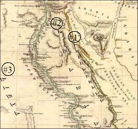
No.1: Troglodyte,
No. 2: Arabia,
No. 3: Libya
This map also places Arabia in the Sinai Peninsula and Saudi Arabia.
Map of 1831, by George Long (David Rumsey Historical Map Collection).
Chapter Two
Encampments of Shur, Etham, Marah, Elim, Red Sea, Wilderness of Sin, Dophkah, Alush, and: Rephidim.
Wilderness of Shur and Etham. After crossing the sea (flooded Delta), the children of Israel entered the Wilderness of Shur (Exodus 15:22) and the Wilderness of Etham (Numbers 33:8). It appears that one wilderness was encompassed by the other. Etham means “boundary of the sea”1 (where the annual flood came up to), and it follows that the “Wilderness” of Etham was the desert that bordered the sea. And the direction they headed at the start of their journey was toward the Gulf of Suez.
When the Israelites started their journey to Mount Sinai, they entered into Wady Tyh or “Valley of Wandering” (shown on the following map), and Jebel Ataka, or Mountain of “Deliverance,” which the Arabs2 say refers to Israel wandering in the desert and her miraculous deliverance. (It should be noted that not all Bible scholars are in agreement as to the meaning of the name Jebel Ataka.) These names for the valley and mountain are given in Arabic and would have come sometime after the Arabs’ conquest of Egypt in the 7th century AD, though the names were believed to have been passed down to them by the Egyptians.
There are a couple of proposed Exodus routes that have Israel entering the Valley of Wandering. But entering this valley really does not fit these routes, for instead of Israel wandering in this valley, they say Israel was still fleeing to the Red Sea from Pharaoh. Nor could these routes claim deliverance from the king of Egypt and his army till Israel was on the other side of the Gulf of Suez in the Sinai Peninsula. But entering this valley does work if Israel crossed the flooded Delta.
Israel entered the “Wilderness of Shur,” and the name Shur means wall3 and is found six times in the Bible. But it was only when the Israelites were leaving Egypt that it was called the “Wilderness” of Shur, as Etham was on both sides of the sea Israel crossed, but it was only called the “Wilderness” of Etham when they left Egypt. The other five times “Shur” is used in the Bible is when someone was heading toward Egypt. In Genesis 25:18, Shur is described as “before Egypt” and I Samuel 27:8, “as thou goest to Shur, even unto the land of Egypt.”
There are two possibilities as to what this “wall” (Shur) could be. One was a row of forts out on the desert protecting Egypt. This is what most believe was “as” or “like” a wall, and therefore they say it would have been the “Shur” the Bible refers to. There was, however, a wall built by a king of the Twelfth Dynasty, which was a fortified wall on the east side of the Delta with gates of entry. “He also fortified with a wall the side of Egypt which faces east, as a defense against inroads from Syria and Arabia; the wall extended through the desert from Pelusium to Heliopolis [following the east side of the Delta]…”4 (Diodorus, 1st century BC). Three times the Book of Jubilees5 (2nd century BC) mentions the “gates of Egypt,” which were on the east side of Egypt and therefore in this wall, and besides protecting the country, this shows the peninsula was not considered part of Egypt as it lay outside this wall to the east. I Samuel 15:7 says, “thou comest to Shur, that is over against Egypt.”
But did this wall stop at Heliopolis, which was at the apex of the Delta? Having a wall stop there would leave all of southern Egypt open to attack. But there was another wall that followed the Nile Valley. Kurdish historian and geographer Abulfeda (1273–1331 AD) said, “And he built before the land of Egypt, from one of its regions at the edge of Aswan [six-hundred miles to the south], to the other, a wall contiguous to this end.”6 Sir Wilkinson said, “That such a Wall was actually made by one of the Egyptian monarchs, we have positive proof from the vestiges which remain in different parts of the valley. It was not confined to Lower Egypt, or to the east of the Delta from Pelusium to Heliopolis, but continued to the Ethiopian frontier at Syene....”7 Historian Hugh Murray gave a description of this wall. “But as if this natural defense [the mountain ridges on the east of the Nile] had not been sufficient, the remains of an extensive wall, about twenty-four feet thick, formed of huge stones and running from north to south....”8
My motive in mentioning this is because others will say that Shur (wall) refers to a row of forts. They would have us believe that there were two walls, one that was a normal wall and one that was “as” a wall (row of forts). But it seems most likely that anyone coming to Egypt would have referred to the “real” wall when they said they were going toward Shur. Again, they have forced themselves to call a row of forts a wall, because they have Israel crossing the sea east of the real wall and therefore have to turn something else into a wall to fit their theory. As for those who hold to the Gulf of Aqaba as the crossing point for the children of Israel, they have no wall or row of forts they can point to as being Shur.
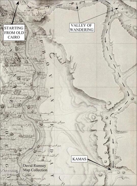
Marah
(possible)
“So Moses brought Israel from the Red sea, and they went out into the wilderness of Shur; and they went three days in the wilderness, and found no water. And when they came to Marah, they could not drink of the waters of Marah, for they were bitter: therefore the name of it was called Marah” (Exodus 15:22–23, also Numbers 33:8).
Meaning of name, Strong’s #4785 Marah = “bitter”
After crossing the sea the Bible tells us “they went three days” (Exodus 15:22) journey and then came to Marah. But if Israel had continued due east, in a short distance she would have run into the Mokattam Hills and of necessity would have turned there, and because Mount Sinai will be in the south, she would have gone that direction. Only five miles south and they would have come to “Torrah” (also “Toura”), by a mountain plateau that stands less than half a mile from the Nile. The plain there would have been flooded, forcing them to go east on the Wady Tyh or “Valley of Wandering.” (See last map, 1826, by Pierre Jacotin.)
The children of Israel would then have traveled about twelve miles to another wide valley (wider than the Nile) and turned south. Not only was this valley wide enough for Israel, but also it was the only way for such a multitude to have gone south, and it was on a known inland path through the desert. If Israel had not taken this valley when she did, she would have been forced to go east all the way to the Gulf of Suez. There is no other passage to the south that could have allowed such a multitude over the ridges or mountains. Israel traveled on this valley about twenty miles till they came to the “Fountine de Qamas,” as it is called on the 1826 French map, but it is spelled “Kamas” on the 1844 map. This French map called it a “Fountine” (fountain), but I found the terms “well” and “spring” sometimes used interchangeably on the maps. Normally, a well is dug and a spring comes to the surface, but some wells are spring fed and some springs are dug.
Reasons. Was the Bible referring to just one well when the Israelites came to the “waters of Marah”? I had imagined that Marah would be a large body of water, but the Bible only gives us the name of this encampment; it is Josephus who fills in the details. “They had indeed carried water with them…but when that was spent, they were obliged to draw water out of wells, with pain, by reason of the hardness of the soil. Moreover, what water they found was bitter, and not fit for drinking, and this in small quantities also; and as they thus traveled, they came late in the evening to a place called Marah, which had that name from the badness of its water, for Mar denotes bitterness....Now here was a well, which made them choose to stay in the place, which, although it were not sufficient to satisfy so great an army, did yet afford them some comfort, as found in such desert places....”9
Josephus informs us that they carried a supply of water with them (they had wagons Numbers 7:3), and apparently it would last for at least three days, for it was not until Marah that they have a water problem. He also tells us it was just one well (“a well”) and even if it had been good water, he says that it could not have supplied the needs of the multitudes that were in the camp. We learn from his account that they did not depend only on their encampments for water, but they also dug wells, though the soil was hard to dig in “they were obliged to draw water out of wells, with pain, by reason of the hardness of the soil.”
It is unfortunate that the first encampment after the sea crossing is marked “possible.” As I said in the preface, seven of the eighteen encampments are so listed. The distance (See Miles Per Day in Preface) and the route are not a problem, and because I know what follows with the other place names, Marah would have to be somewhere in this valley. The problem was the meaning of the name Kamas (Qamas), which neither translators nor Egyptians knew the meaning of, nor could I find the name on modern maps. I tried Greek, Latin, and ancient Egyptian, thinking the Arabs who named this place may have transliterated one of these languages, but found nothing. I tried several variations of Kamas, with Kh, Q, Gh, on the front of the word, also z for the ending, etc., but nothing worked. Needless to say, I was not happy with this and marked this place name as “possible.”
Strong’s #4785 gave “bitter” for the meaning of the Hebrew word Marah, similar to the Arabic word (murr, murrah, morra, amara, and many variations), which is what one would expect if the waters were still called bitter. Some have argued that it would no longer be named Marah (bitter) because Moses miraculously healed this water and therefore it would have remained sweet water. And this is a possibility, for when Elisha healed the spring of Jericho, we are told it remained good water (II Kings 2:21–22).
Some Bedouins told us of a well in the area where Kamas is marked on the map, and this was shown to my guide. The name of the well is “Sa’id” and means “happy,” and is drinkable according to the Bedouins, who also said that they did not know how it received this name. What would you call a “bitter” well that was miraculously healed?
Application. Even when following the Lord you will have times of trouble (John 16:33), but we have the Lord’s help. “And he cried unto the LORD; and the LORD shewed him a tree, which when he had cast into the waters, the waters were made sweet…” (Exodus 15:25).
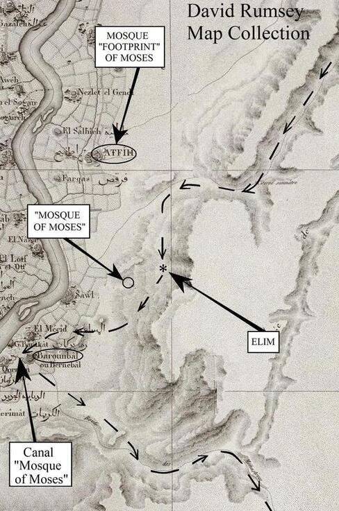
Elim
“And they came to Elim, where were twelve wells of water, and threescore and ten palm trees: and they encamped there by the waters” (Exodus 15:27).
Meaning of name, Strong’s #362 Elim = “palms”
Reasons. The distance from Kamas to Elim, our next station on the route, is seventeen miles. This is an important location, because it so rare to find a site out on the desert with this many wells. But was Elim a picturesque place? Did it have an abundance of water as is often taught? Are these things actually taught in the Bible or are we assuming them?
Josephus said, “And now removing from thence they came to Elim; which place looked well at a distance, for there was a grove of palm-trees; but when they came near to it, it appeared to be a bad place, for the palm-trees were no more than seventy; and they were ill-grown and creeping trees, by the want of water, for the country about was all parched, and no moisture sufficient to water them, and make them hopeful and useful, was derived to them from the fountains, which were in number twelve: they were rather a few moist places than springs, which not breaking out of the ground, nor running over, could not sufficiently water the trees. And when they dug into the sand, they met with no water; and if they took a few drops of it into their hands, they found it to be useless, on account of its mud. The trees were too weak to bear fruit, for want of being sufficiently cherished and enlivened by the water”10 (Josephus, also Legends of the Jews).
Well, this is not the Elim that is taught today, one that is made out to be a beautiful place with lots of water. The Bible did not say it was a beautiful location with abundance of water. Nor was it a picturesque place but had “ill-grown and creeping” palm trees, which “were too weak to bear fruit” and the wells “were rather a few moist places than springs.” But this is exactly what was found here on the southern route through the Eastern Desert.
On the last map, by Pierre Jacotin, 1826, you will see an arrow pointing to Elim, which is out on the desert. The valley the Israelites had been following through the desert had now turned toward the Nile River as seen on the map. The Bible said the next encampment after Elim was the Yam Suf (flooded Nile), so you would expect Elim to be close to some large body of water. When the Bible said, “and they encamped there by the waters” (Exodus 15:27), it may have been referring to the Yam Suf.
Bedouins who frequent this site call it Wady Al Rashrash “Valley of Sprinkling.” The information for this area came from the Bedouins through my translator Sameh, who is an Egyptian guide. One of the next two pictures is of an area where “wet sand” had grown some low palms, similar to what Josephus said, “ill-grown” because of the “want of water.”
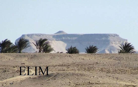
The Bible said there were seventy palm trees and twelve wells. I asked a man who lived about three miles away how many wells there were, and he said, “Between ten or twelve wet spots.” It is possible for the number of these wells to change as I was told they sometimes dry up in the late summer. The Bedouins who were with us said there were “twelve, plus one or minus one,” which they called “wet sand.” And they said there were only three places that had open water in them as one would expect to find at a well, but the rest were as Josephus said, “moist places.”
The Bedouins gave no number of how many palm trees there were. However, the reader has an advantage over the Bedouins in that he may look down on this location using one of the satellite websites, where one can count both the number of palm trees and the groupings of palm trees, where conceivably the water comes up through the ground. Sir Wilkinson said that though one could find small trees out on the desert with no apparent source of water, this was not so when speaking about the palm tree. “I never saw or heard of any palms but near water; though in many valleys of the primitive mountains there are innumerable seyale, tamarisk, and other trees, the palm we never found but at the watering-places themselves.”11 Strong’s gave the meaning of the word Elim as “palms.” I counted more than seventy palm trees along with twelve moist places, though it is hard to be sure when looking from the satellite view because some of the palm-tree groupings are not well defined, sometimes connecting to another group. I give here our web page which has the satellite view with the zoom in and out feature for Elim. www.SINAI-HOREB.com
The Bedouins gave no number of how many palm trees there were. However, the reader has an advantage over the Bedouins in that he may look down on this location using one of the satellite websites, where one can count both the number of palm trees and the groupings of palm trees, where conceivably the water comes up through the ground. Sir Wilkinson said that though one could find small trees out on the desert with no apparent source of water, this was not so when speaking about the palm tree. “I never saw or heard of any palms but near water; though in many valleys of the primitive mountains there are innumerable seyale, tamarisk, and other trees, the palm we never found but at the watering-places themselves.”11 Strong’s gave the meaning of the word Elim as “palms.” I counted more than seventy palm trees along with twelve moist places, though it is hard to be sure when looking from the satellite view because some of the palm-tree groupings are not well defined, sometimes connecting to another group. I give here our web page which has the satellite view with the zoom in and out feature for Elim. www.SINAI-HOREB.com
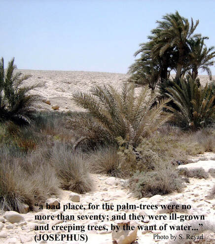
After three and a half millennia, since the time of Moses, no one is claiming there would still be exactly seventy palm trees, and no proposed site for Elim has this number. The best proposed site for Elim in the Sinai Peninsula is Wady Gharandel, but it only has a few wells. For those who place Israel as crossing at the Gulf of Aqaba, there is an impressive site with twelve picturesque wells made of stones and a lush palm orchard of some two hundred palm trees. But Josephus told us Elim was not a picturesque site with lots of water, and there is another major obstacle with this site: It lies in a narrow valley that in no way could support the multitude of Israelites who would have encamped there.
Tradition. There are three Muslim sites in a row that bear witness to Moses being in this area (see last map). In the city of Atfieh, about four miles north of Elim, there is a mosque said to have the “footprint” of the biblical Moses in a niche of the mosque. When we asked the people of Atfieh about this, they said they had heard of it being the footprint of Moses, but many thought it was of Mohamed (Mohamed never came to Egypt) and that it was now in the city of Bernebal. We tried to follow up on this, but at the city of Bernebal the man who watched over this stone with the footprint could not be located, and they called it “The footprint of the Prophet.”
This mosque, as well as the next two sites named after Moses, obviously did not exist in the days of the Exodus, but the traditions have been passed down and the names have stuck. As to how such a footprint could have been made in stone, I haven’t a clue. I am only trying to pass these traditions down as I come across them. The original source for the information about the “footprint of Moses”12 came from highly respected Muslim geographer Yaqut al-Rumi al Hamawi, born in 1179 AD.
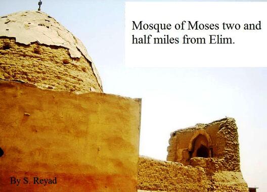
About two miles east of Zule is “Masjid Musa,” or the Mosque of Moses. It was built in the year 1121 AD; the date and the name are both written on the ruins of this building. Tradition says that Moses came here to be alone and pray in this place. I could find no other Mosque of Moses in Egypt, and the only other mosque in Egypt I know of that has any tradition about Moses is the Mosque of Ibn Tulun in Cairo, where it is believed that Moses at one time prayed. The next encampment of Israel will be by the city of Bernebal (“Burumbul” on today’s maps), which has a canal named after Moses, the “Tir`at al Masjid Mūsā Qiblīyah.” Here are three sites in a row with the tradition of Moses being there, and they are all on this Exodus route, and even right at the place where Israel came out of the desert from the valley. With the Elim of our route being in the order it is found in the Bible, following the only possible route for such a large multitude to have gone to the Eastern Desert and fitting the description given by Josephus, I say, it is a match. Nowhere else did I find twelve such “moist places”/wells in all the Eastern Desert (you would be fortunate to find two wells together), and these wells just happened to be where they should be.
Red Sea
“And they removed from Elim, and encamped by the Red Sea” (Numbers 33:10).
Meaning of name, Strong’s #3220 yam = “sea,” and gives for one of its meanings = “mighty river (Nile)”
Meaning of name, Strong’s #5488 suf = “reed, rush, water plant” (See Chapter Nine of out book The Quest for the Red Sea Crossing, for the explanation of the Yam Suf/Red Sea.)
Problem to solve. Why would the Israelites go to the Red Sea again, when they had just crossed it a few days before? Regardless of what body of water the “sea” referred to, salt water, fresh-water lake, or large river, they would of necessity been forced to change directions once they arrived, so why go there? This question would be valid regardless of which route one holds to.
On the last map it is plainly seen that Israel had no choice but to turn toward the river as the valley she followed forced this change of direction. But what logical reason is there for the other routes to have Israel go to the sea again? Those who believe Israel went to Saudi Arabia have Israel leaving the site they say is Elim and going back west several miles to arrive at the Gulf of Aqaba with no purpose, as this is salt water. Then they have Israel turn around again and go east to get to their proposed site of Mount Sinai.
Reasons. The name “Yam Suf” was the name of the flooded Nile, and Israel returned to it just after her last stop at Elim (with its twelve wells), which was only about seven miles away (see last map). The Israelites may have filled up with water at Yam Suf before going into the desert. This flooded river was also on the route they were following and, as was brought out, they were led there by the contour of the land. The other routes have a hard time explaining why Israel returned to the Red Sea, which most routes invariably make to be salt water.
Tradition. It is to the west of the city of Bernebal that we find the canal “Mosque of Moses,” the Tir`at al Masjid Mūsā Qiblīya, again pointing to Moses being there.
What helped me find these sites was realizing Israel followed the Old Route through the desert and hadn’t blazed a new trail, and therefore would have followed it all the way from Cairo. Because of the valley and contour the route Israel was on, I knew the only place she could have camped at for the Yam Suf was at Bernebal. It was also obvious that Elim with its twelve wells had to be in the area it was found in, or at least within five miles of it.
I picked up the phone and called Sameh, an Egyptian guide who had helped me in Egypt with the meaning of the place names. Sameh has a great personality, and besides speaking Arabic and English, he has a degree in French. I asked if he would go to where Elim was (or at that time where I thought it might be), and also if he would check on the locations I gave him for the Mosque by Elim. This worked well, and he was able to find these sites, although I later went with him to see these locations. I say this because knowing where a site was before we found it was based upon the Bible and the lay of the land, which I believe confirms we have the correct route.
Wilderness of Sin
(possible)
(Not to be confused with the “Wilderness of Zin,” which was at Kadesh)
“And they removed from the Red sea, and encamped in the wilderness of Sin” (Numbers 33:11).
Meaning of name, Strong’s #5512 Sin = “thorn” or “clay”
Problems. The children of Israel left the sea and went to a desert. A wilderness or desert implies a large area of land, not like Marah or Elim, which were only locations for wells. Even at their last stop at Bernebal, they were camped by the flooded river. Notice on the map that follows, that from their last encampment is a dotted line that leads to the wilderness, again following the lay of the land, which is a valley corridor that leads to the open desert.
The dotted line on the map goes by the “Natural Cisterns” and continues due south, but unfortunately the place name W. Aboureesh is written over it at this spot. There is another dotted line that comes down from the northeast and then turns to the west, also intersecting where the place name W. Aboureesh is written, but Israel was not on this other route. The route Israel was on passes by the “Natural Cisterns” and comes out the other side of the name W. Aboureesh and goes in an almost southerly direction for about forty more miles, till it bends back to the west. This is where we find the Wilderness of Sin. The problem is, there is only one encampment mentioned in this desert, and it was a distance of about seventy miles from the last encampment at Bernebal (the explanation will follow).
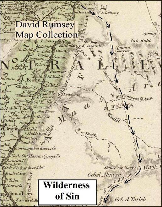
“And they took their journey from Elim, and all the congregation of the children of Israel came unto the wilderness of Sin, which is between Elim and Sinai, on the fifteenth day of the second month after their departing out of the land of Egypt” (Exodus 16:1).
The children of Israel left Egypt “on the fifteenth day of the first month...” (Numbers 33:3), but here in the Wilderness of Sin it was now “the fifteenth day of the second month.” A full month had gone by since they left Egypt, and only nine days were mentioned on their route. Josephus gave three days13 from leaving Egypt till Israel encamped by the Red Sea. We read it was three days till Marah (Numbers 33:8), with Elim and the Yam Suf both being a day’s march, then we are told she encamped in the Wilderness of Sin. Israel was obviously spending more than one day at some encampments and was stopping at locations that are not named, as was also brought out in the Preface under Miles Per Day. When the Israelites came to a desert, they gave at least one name for that area, even though it might have taken several days to pass through it. For unless there was some major event that happened at a site or the area was well known, there would not have been a need to give a name.
Supernatural events or natural causes? It was at the Wilderness of Sin that Israel received the quail (Exodus 16:13), and it was also in the Wilderness of Sin that God gave “manna” (Exodus 16:15); it was like a “seed, white; and the taste of it was like wafers made with honey” (Exodus 16:31). There are some who have gone to great lengths to explain that this was a natural phenomenon or to give a scientific explanation, saying that “even today” one can find this manna out in the desert! Really?
Perhaps they should go out in the desert and eat what they claim was this manna and see if they can find enough of it to live on as the children of Israel did. Israel ate manna for forty years until they reached the Promised Land, where the Bible said it “ceased” (Joshua 5:12). They could only gather enough for one day or it “bred worms, and stank” but “on the sixth day they gathered twice as much bread” because the next day they rested, but on the Sabbath day “it did not stink, neither was there any worm” (Exodus 16:20, 22, 24). On the seventh day there was no manna! “Six days ye shall gather it; but on the seventh day, which is the sabbath, in it there shall be none. And it came to pass, that there went out some of the people on the seventh day for to gather, and they found none” (Exodus 16:26–27).
God created the world; therefore, any miracles of the Bible are, to Him, the proverbial “drop in the bucket.” By making the miracles of the Bible a coincidence or some natural phenomena, it is at best a lack of faith or at worst explaining away His miracles. Are they “helping” God out of an “embarrassing” situation because the Bible talks about miracles? This is exactly why they are called miracles, because they cannot be explained by natural processes! Turning these miracles into a product of natural causes is sometimes done to make the Bible more palatable to an unbeliever, but I believe it has the opposite effect and would in most cases be thought of as silly! There are “Bible scholars” who do not believe the Bible! They do not rely on divine revelation but on human reasoning, and their articles are being printed in magazines and websites that pretend to have “biblical” archaeology. But they substitute natural causes for Divine miracles and ignore the clear teachings of the Bible and end up weakening the faith of some (Romans 16:17–18).
I am not implying that if someone disagree with me he does not believe the Bible; believers sometimes see things differently. I said in the preface it would be impossible to have everything right in this book, but that is different from the person who peppers his theories with a few verses from the Word of God, and where the Bible does not agree with one of his theories, he corrects the Bible, not his theory.
Application. We live in a time when man’s reason and science are elevated above the authority of God’s Word, but experts and scientist do not agree among themselves, and their opinions and theories constantly change. Miracles today are discarded, such as the virgin birth and the bodily resurrection, etc., and we no longer need God, but the Lord said, “in their affliction they will seek me early” (Hosea 5:15).
Forty years they were in the desert and for forty years they had bread. God has more power than we have faith. “Now unto him that is able to do exceeding abundantly above all that we ask or think…” (Ephesians 3:20).
How long they stayed at the Wilderness of Sin will become important, and some believed they stayed a full week at this location. In Exodus 16 they were told to collect manna for six days and then rest on the Sabbath, which they kept in verse 25 of this chapter. In Exodus 16:1, they arrived at the Wilderness of Sin and in the next chapter they left the Wilderness of Sin and some believe the six days of gathering manna and the Sabbath talked about in this chapter would have been accomplished there, but it is not required.
Exodus 17:1 says, “And all the congregation of the children of Israel journeyed from the wilderness of Sin, after their journeys, according to the commandment of the LORD, and pitched in Rephidim….” From reading only this passage, someone might believe the next encampment was Rephidim, but we know from another passage it was not. We do not always have all the information in one chapter about an event, and had it not been for Numbers 33, we would only have guesses as to whether there were any stops between the Wilderness of Sin and Rephidim. But we are told of two stops, Dophkah and Alush (Numbers 33:12–14). This is most likely the reason Exodus 17:1 says, “Israel journeyed from the wilderness of Sin, after their journeys...”--thus letting us know that there were other stops that were not named between the Wilderness of Sin and Rephidim. (Some have imagined that the phrase “after their journeys” refers to the Israelites breaking into small groups so they could traverse difficult terrain. But the same expression is used three times in Numbers 33:1–2, and this chapter gives Israel’s encampments in order to the Promised Land, with nothing mentioned about the need to break into small groups.)
One reason events are repeated in the Bible is precisely because they are not identical and to offer more information, and this is one reason why we have the four gospels, to have a complete picture of the life of Christ. The main purpose of Numbers 33 was to give the order of the encampments, but the book of Exodus concentrated on the events of the Exodus. Manna was provided for the first time in the Wilderness of Sin, and the explanation of it and the problems encountered are recorded in Exodus 16. But the full week described there, along with the Sabbath, does not mean it all happened in the Wilderness of Sin. In this same chapter, it said they ate manna for forty years (verse 35), but obviously that did not take place there. We are also told Aaron “laid” (past tense, verses 33–34) a pot of manna before the “Testimony”; this is a reference to the Ark of the Covenant and the Ten Commandments that were kept inside it (Exodus 25:16, Hebrews 9:4), but Israel did not have these until they came to Mount Sinai. All these things, the forty years of manna, the pot of manna before the “Testimony,” and the full cycle, or one week, of collecting manna, are recorded in Chapter 16 of Exodus to deal with them at one time, rather than breaking them up and giving only parts of the information at each encampment.
Reasons. The name of this wilderness was “Sin.” As to the meaning of the word, Strong’s #5512 gave “thorn” or “clay”; later it will be seen that the Wilderness of “Sin” means “clay.” In connection with this, there was one place on this route in the Eastern Desert where clay was found. In 1777, a man named Eyles Irwin made a trip through the center of the Eastern Desert. He was not exploring the desert but was avoiding the Nile River because of strife between two factions, and he thought it safer to go through the middle of the desert. He made this trip with some Bedouins and a caravan of a few camels. In his diary he noted, “The soil in many places is mixed with clay…” (A Series of Adventures (1780), 312). This clay was found just to the north of the encampment at Dophkah (see following map), and it was the only time he mentioned clay during his trip through the Eastern Desert, so I thought it a possibility for the Wilderness of Sin.
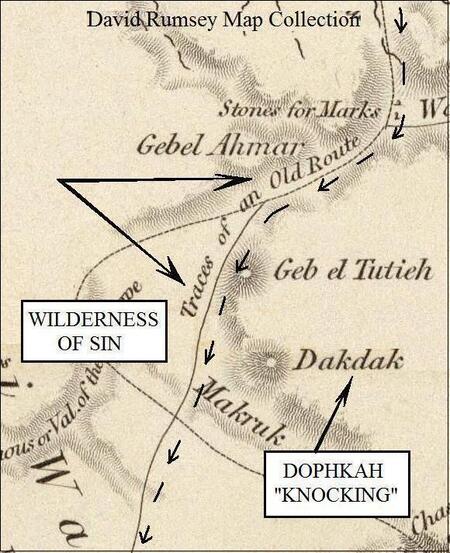
Dophkah
“And they took their journey out of the wilderness of Sin, and encamped in Dophkah.” (Numbers 33:12).
Meaning of name, Strong’s #1850 Dophkah = “knocking”
Reasons. The route Israel followed is the line on the map called “Traces of an Old Route,” and it is interesting that Israel followed this ancient route where the place names are being found. There is no need to move Israel ten miles to the west to find a place name, and then back thirty miles to the east to pick up another name, but Israel followed a logical path called the “Old Route.” This is not one of the ancient Roman roads known to have crossed the desert to stone quarries or mines. All the known Roman roads in this part of the Eastern Desert crossed from west to east, with the only north-to-south direction being on the Red Sea coast.
Continuing south on the “Traces of an Old Route,” one would come to the place name “Dakdak,” also spelled “Daqdaq” on the 1822 and 1843 maps. These last two maps also call it a “wady” (valley), and it is moved closer to the Old Route. “Daqdaq” is Arabic, and in The Arabic-English Vocabulary of the Colloquial Arabic of Egypt, it has for its first definition “daqdaq, to knock repeatedly.”14
This place name received the most comments from the Egyptians who translated for me. They found it hard to believe that anyone would give the name Dakdak to a place out on the desert and both asked, “Where did you get this map?” But I have found it on other maps of 1820, 1822 (two), 1825, 1832, 1843, 1851, as well as this 1844 map I am using, all from the David Rumsey collection.
The oddity of this place name only helps to confirm that Israel was on this route in the Eastern Desert. For in the Bible, we find Israel at an encampment named Dophkah, or “knocking.” It is on the path we have been following, and in the right order as found in the Bible. The other routes have a hard time with this site and give some amusing, if not misleading, information. Some place the site in different locations in the desert, not because they found the name but because “knocking” may describe the noise they heard from a copper mine, and a few said they could not find the meaning of the name. But there is no secret to the meaning of this name and many commentaries and concordances will give this information, including Strong’s Concordance, which is online.
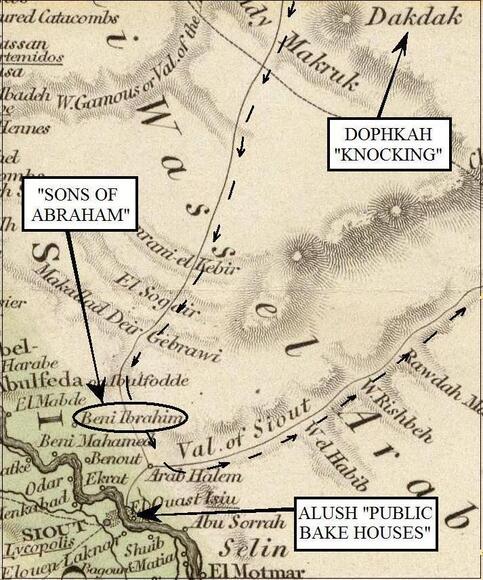
Alush
“And they departed from Dophkah, and encamped in Alush” (Numbers 33:13).
Meaning of name, Strong’s #442 Alush = “I will knead [make] bread”
Problem. A few teach that Alush (“I will knead bread”) was another name for the Wilderness of Sin, and that it refers to the manna God provided. But the Bible plainly said they “journey out of” and “departed from” the one encampment to arrive at the other. “And they took their journey out of the wilderness of Sin, and encamped in Dophkah. And they departed from Dophkah, and encamped in Alush” (Numbers 33:12-13). Israel already had bread, “manna,” from the time she was in the Wilderness of Sin, and what place in the desert could be known for kneading or making bread? And we find Israel returned to the Nile, which should have been back to its normal level after the Nile flooded.
Reasons. If one continues south on the “Traces of an Old Route” he would come to the city of Siout (Siut, Assuit, Asyut), which is on the bank of the Nile, with many smaller villages around this area. Siout was the capital of its nome (province) as well as the capital of middle Egypt.15 It was strategically located, not only being on the Nile, but also having two caravan routes coming in from the Libyan Desert and two from the Arabian Desert, one of which the children of Israel were on.
For Alush, the Talmud (3rd century AD) has a “crowd of men,” making bread and a crowd of men would point to a city or some sort of civilization, not the desert. And this is what you would expect from sailors on the river and caravan routes which would have been made up almost entirely of men.
English author and Egyptologist Amelia Edwards made an interesting comment about this city. “Now...our crew were to be allowed twenty-four hours for making and baking bread at Siût, Esneh, and Assuân…one of our most active and intelligent sailors, rushed off to hire the oven. For here, as at Esneh and Assuân, there are large flour-stores and public bake houses for the use of sailors on the river...who make and bake their bread in large lots….”15 Siout was one of three places in Egypt known for offering “public bake houses,” and in particular for “making and baking bread.”
So here is Alush, a place to “knead bread,” and as the Israelites already had manna, they were not headed here for this, so it follows that someone else is making the bread. The need for these public ovens was probably more in the pharaonic times, with such a strategic location for those who sailed the Nile and the caravan routes that crossed the desert. I do not believe Israel crossed the river in order to get to Asyut which was on the west side of the Nile. I believe these public ovens would have been on both sides of the river for the sailors and the caravan routes that came in from the east.
Israel had nothing to fear from the Egyptians as their army had already drowned. The site Israel will be encamped at is near the Nile and is connected to another route to the east, which Israel left from.
Tradition. On the Old Route, the children of Israel journeyed to Siout, and the first location they came to is called “Beni Ibrahim” or “Sons of Abraham” (circled on the map above). I found the name Ibrahim one more time on the Nile Valley, but “Sons of” Abraham was not found anywhere else in the Eastern Desert. This name is found on some maps (1822, 1843) on the ancient route itself that Israel traveled on, where it is called “Wady Beni Ibraham.” The Muslim religion, which in Egypt is about 90 percent of the population, holds Abraham of the Bible in high regard, and it is not unusual to find Egyptians with the name Abraham, but here it is “Sons of” Abraham. The ancient Egyptians were not “sons of Abraham,” for they existed before Abraham. Some modern Egyptians could claim being from Abraham, but the children of Israel are “Beni Ibrahim” or “Sons of Abraham.”
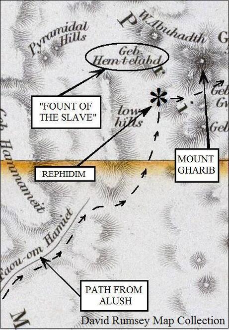
Rephidim
(possible)
“And they removed from Alush, and encamped at Rephidim, where was no water for the people to drink” (Numbers 33:14).
Meaning of name, Strong’s #7508 Rephidim = “rests,”
“stays,” or “resting places”
Problems. Israel left Alush by the eastern route and headed northeast. After leaving Dakdak, it would have been a shorter route for the Israelites to have turned and gone due east to reach Mount Horeb (Sinai), where they ended up. So why go to Alush? They may have needed the water from the Nile. They also kept to the Old Route, which was the easiest to follow, avoiding mountain ranges and harder terrain, which was essential for such a large multitude.
There was something else that guided the children of Israel from the start of their journey; the Bible said they were avoiding war (Exodus 13:17). And there was an enemy in this desert named the Amalekites, but staying on the Old Route would have helped them go around the enemy’s land. Moses knew this territory as he had lived here for several years after fleeing from Egypt, and he knew who the greatest threat was. But at this next stop of Rephidim, Israel was no longer able to avoid a fight as Amalek attacked her (I Samuel 15:2, Deuteronomy 25:17–18).
There is good reason to believe that the “country of the Amalekites” extended into the Eastern Desert of Egypt. “And the sons of Cush: Seba, and Havilah…” (Genesis 10:7, I Chronicles 1:9). Cush is south of Egypt and includes parts of Nubia, Sudan, and Ethiopia, Gesenius Lexicon defines Cush as “Ethiopia and Ethiopians.” The International Standard Bible Encyclopedia said, “The context of Genesis 10:7 [Havilah] thus favors situation on the Ethiopian shore….”16 Havilah was one of the sons of Cush, placing his descendants south of Egypt. And the Bible says, “Saul smote the Amalekites from Havilah until thou comest to Shur, that is over against Egypt” (I Samuel 15:7).
Others also lived in this area, and they were the descendants of Ishmael. “Ishmael…died; and was gathered unto his people. And they dwelt from Havilah unto Shur, that is before Egypt, as thou goest toward Assyria” (Genesis 25:17). Notice that the description of their location (“from Havilah unto Shur”) was the same as for the Amalekites, but adds, “as thou goest toward Assyria.” Assyria was north of Egypt and we are told the direction is “from” Havilah (by Ethiopia) unto Shur, which was defined by Josephus as the northeast corner of Egypt at Pelusium (Antiquities, VI, 7, 3), “as thou goest toward Assyria.” This fits perfectly, from the south in Ethiopia up to the Mediterranean (Pelusium) as one goes north to Assyria. But it would not make sense to say that Havilah was east of Egypt, as most believe, for how could one go from the east toward “Shur, that is before Egypt” (Pelusium, west) “as thou goest toward Assyria” (north)?
Also because of this, the descendants of Ishmael (though most believe them to be located elsewhere), at least at the time Josephus penned the above, were in the Eastern Desert of Egypt. This means Ishmaelites and Midianites were in close proximity one to the other, and this may explain why their names are at times used interchangeably (Genesis 37:28, Judges 8:22–26). They were closely related, being half-brothers, perhaps intermarrying, and living close together would make them appear as if they were the same people.
The events of Rephidim, which including an attack by Amalek (Amalekites), “smote the hindmost of thee, even all that were feeble behind thee…” (Deuteronomy 25:18). Some believe that Amalek was afraid of the cloudy pillar that led Israel, and because of this kept its distance from the main body. These stragglers (“feeble”) in the camp of Israel may have looked like an easy target to the Amalekites. Psalms 105:37 said, when the children of Israel started, there was not one “feeble” (Strong’s gives “to stumble, stagger, totter”), but after their long journey some became worn out and were called “feeble.” (A different Hebrew word, Gesenius’ gives “the weakened, the wearied.”)
A full-scale battle took place there with Joshua and the army of Israel winning the day (Exodus 17:8–18). There is a large valley (seven by twenty miles) just to the west of Mount Gharib where two large armies could have battled. (See the last map for the large valley between the “low hills” and our encampment for Rephidim.)
Several other things also happened here. Jethro, Moses’s father-in-law, joined* him here and told Moses to choose “able men” and make them “rulers of thousands” who could also help judge the people. Moses built an altar to the Lord called “Jehovahnissi”; Moses also named this encampment “Massah” (chiding) and “Meribah” (tempted), but when Israel left the site it was still called Rephidim.
(*This is the first time since the Exodus started that Jethro met with Moses, giving the impression that this was the closest Israel had yet come to Jethro’s land. I had said earlier that Mount Sinai was not in the land of Midian, but nor do I believe it was many days away as some have it. Moses had led the flock of Jethro to Mount Sinai, which on some routes would have made it a several-hundred-mile round trip for these sheep.)
Something else happened here at Rephidim. The final chapter of this book will be about Jebel Gharib being Mount Sinai. I want to “save the best for last,” but at Rephidim, Israel was quite close to Mount Horeb. “Behold, I will stand before thee there upon the rock in Horeb; and thou shalt smite the rock, and there shall come water out of it, that the people may drink” (Exodus 17:6). They were still encamped at Rephidim and Israel did not move her location in order to get this water, so she had to be close by (unless the stream of waters came to them). Rephidim was next to the mountain of God as Jethro meets Moses there (Exodus 18:5), and Legends of the Jews says, “With sacrifices and a feast was the arrival of Jethro celebrated, for after he had made the burnt offering not far from the bush of thorns that had been unscathed by fire....”17
The Gharib Mountain Range covers an area roughly six by nine miles, or over fifty square miles, with one prominent peak, Gebel/Mount Gharib. Our map makes it look like the site of Jebel Hem-t-elabd (circled on last map) is separated from Mount Gharib, but it is all part of this mountainous area. This name Jebel Hem-t-elabd, according to Sir Wilkinson, was “Themilt- el Abd, - ‘fount of the slave,’” 18 which may be a tradition of Moses striking the rock to get water, especially because it was right next to Mount Horeb (Mount Gharib. On the east side of Mount Gharib, modern maps have another watering place called “Bir Gharib.” Moses and the children of Israel were no longer slaves but would have been thought of that way by the people of the Eastern Desert.
Regrettably, I was not able to find the place name Rephidim (Strong’s #7508 gives “rests,” “stays,” “resting places,” and Gesenius’ gives “props,” “supports”). And I marked this encampment possible, but the Israelites were coming from the route that led out of Siout (Alush), which led right to this mountain, Mount Horeb. At this encampment, they are only a one day’s journey from the Wilderness of Sinai, which is on the east side of Mount Sinai; they would, therefore, have to be in the area of the “fount of the slave.”
ENDNOTES
1. Gesenius’ Lexicon, in which it states, “Jablonsky (Opuscc. ii. 157) regards it [Etham] as the Egyptian ‘boundary of the sea.’” The International Standard Bible Encyclopedia (1915), also said the same “boundary of the sea,” but added that it came from the Coptic “Atium.”
2. Sir John Gardner Wilkinson. Topography of Thebes, and general view of Egypt (1835), 322.
3. James Strong. Strong’s #7793.
4. Diodorus Siculus. I, 57.
5. The Book of Jubilees, The Death of Joseph, XLVI, 6, 7, 11.
6. H. Clay Trumbull D. D., Kadesh-barnea Its Importance and Probable Site (1884), 49.
7. Sir Wilkinson. Manners and Customs of the Ancient Egyptians (1837), Ch. II, 105.
8. Hugh Murray and John Leyden. Historical Account of Discoveries and Travels in Africa (1818), vol. II, 179–180.
9. Josephus. Antiquities, III, 1, 1.
10. Ibid. 1, 3. Also Louis Ginzberg. Legends of the Jews, The Awful Desert (1909).
11. Sir Wilkinson. Royal Geographical Society (1832), 31.
12. Yqiqut, Mucjam (also spelled Yaqut, Mujam). I, 311.
13. Josephus. Antiquities. II, 15, 1.
14. Socrates Spiro. The Arabic-English Vocabulary of the Colloquial Arabic of Egypt (1895).
15. Amelia Edwards. A Thousand Miles up the Nile (1891), Ch. VI, Minieh to Siut.
16. The International Standard Bible Encyclopedia (1915), section H.
17. Louis Ginzberg. Legends of the Jews (1909), vol. III, Jethro
18. Sir Wilkinson. Royal Geographical Society (1832), 39.
Chapter Three
Encampments of Wilderness of Sinai,
Taberah, Kibroth-hattaavah, Hazeroth,
Rithmah, Rimmon-parez, Libnah, and Rissah.
“And they departed from Rephidim, and pitched in the wilderness of Sinai” (Numbers 33:15).
Meaning of name, Strong’s #5514 Sinai = “thorny”
Gesenius’ Lexicon = “clayey, miry”
Wilderness of Sinai.
Some believe that the flocks and herds of Israel may have eaten the manna provided every morning out on the wilderness.1 Perhaps this is true, but Strong’s #4057 said the word “wilderness” (of Sinai) was suitable for “pasture” and Gesenius’ Lexicon gave it as “an uninhabited plain country, fit for feeding flocks….” This would also apply to the Wilderness of Sin, Wilderness of Shur, and Wilderness of Etham.
It took the Israelites thirty days of travel, including days of rest, from the start of the Exodus till they arrived somewhere in the Wilderness of Sin (Numbers 33:3, Exodus 16:1). They arrived in this Wilderness of Sin on the “fifteenth day of the second month” (Exodus 16:1) and “In the third month...came they into the wilderness of Sinai” (Exodus 19:1). There are conflicting theories about which day of the third month Israel arrived at the Sinai encampment. The Bible indicates this by saying it was “In the third month, when the children of Israel were gone forth out of the land of Egypt, the same day came they into the wilderness of Sinai.” This is interpreted by some to mean the first day of the third month, which would be fifteen days from the Wilderness of Sin, while others believe it to be the third day2 of the month, “the same day” as the month, which was the “third month,” which would be seventeen days from the Wilderness of Sin. Two days of travel time will need to be subtracted for Sabbaths,* and Israel may have been a couple of days at Rephidim, though one day could have been a Sabbath. This would have given the children of Israel either eleven or thirteen days (if they arrived on the third day of the month) of travel time to reach the Wilderness of Sinai. It is about 180 miles from where I place the Wilderness of Sin, by way of Alush, until the east side of Jebel Gharib (Jebel or Gabal is Arabic for mountain). At eleven days of travel time, that is sixteen miles a day, but if they had thirteen days as I believe, then it would be fourteen miles a day. *(Instructions for the Sabbath had been given at the Wilderness of Sin, but some believe they had kept the instructions from the encampment of Marah.)
The Multitude. Throughout this route, I have been talking about the “multitude” of the Israelites who made this journey. The Bible said their number was “about six hundred thousand on foot that were men, beside children” (Exodus 12:37). The men in this passage would be from twenty years old and up, and counting the women and children, we are talking about two million, maybe more!
(Deuteronomy 7:1 said, “seven nations greater and mightier than thou.” But this was all of them together not each one separately. And Deuteronomy 7:7 said, “ye were the fewest of all people.” But this was referring to Israel before she came to Egypt “ye were.”)
We are told that such a multitude would have been more than the population of Egypt at that time. Yes, and Pharaoh agreed! “And the children of Israel were fruitful, and increased abundantly, and multiplied, and waxed exceeding mighty; and the land was filled with them. Now there arose up a new king over Egypt, which knew not Joseph. And he said unto his people, Behold, the people of the children of Israel are more and mightier than we…” (Exodus 1:7–9). Some say that the Hebrew word translated “thousand” could be “clans” instead, so they say it was not 600,000 men, but six hundred clans, troops, or even households. But when the King of Egypt said, “the children of Israel are more and mightier than we…,” he obviously was not talking about 600 households. It is a question of whom we are going to trust. Do you trust God or some man, who will be judged by God?
Exodus 38:25–27 tells us that when the more than 600,000 men of twenty years old and upward (Exodus 30:14) were numbered, they each gave a half shekel of silver, and these were used to make one hundred silver sockets of one talent each. Given the accepted conversions of shekels and talents, it would have taken 600,000 half shekels to make 100 talents.3 And 600 “clans” would not have made even one talent or silver socket. Josephus, writing in the Greek language, said it was 600,000 men and the Targums, written in Aramaic, said there were 600,000 men.
It would have been an impressive site for the Midianites, Amalekites, and others who beheld this multitude, like a river of people wandering through the desert, the likes of which had never been seen. But Moses was far more impressed with something else. He told this multitude that had been encamped at the Wilderness of Sinai, “For ask now of the days that are past, which were before thee, since the day that God created man upon the earth, and ask from the one side of heaven unto the other, whether there hath been any such thing as this great thing is, or hath been heard like it? Did ever people hear the voice of God speaking out of the midst of the fire, as thou hast heard, and live?” (Deuteronomy 4:32–33).
Communication with two and an half million people was probably done similar to the way Ezra addressed Jerusalem, standing on a wooden platform while others stood on his right and left relaying the message to the people. The Bible said of these others who stood by that they helped communicate the message to the people, “they read in the book of the law of God” (Nehemiah 8:4 8). Moses had “rulers of thousands, and rulers of hundreds, rulers of fifties, and rulers of tens…” (Exodus 18:21). Besides being “judges,” they were also “rulers” in Israel; there would have been no need for them as rulers if Moses communicated to Israel without their help.
Israel also had “two trumpets of silver” used for “calling of the assembly, and for the journeying of the camps,” and for when they would “go to war.” There were different signals used for who was to be called and why. When both trumpets sounded, “all the assembly…but with one trumpet, then the princes, which are heads of the thousands of Israel, shall gather themselves unto thee” (Numbers 10:2–9).
Legends of the Jews said, “The camp was in the form of a square, twelve thousand cubits on each side.”3 Using an 18 inch cubit times 12,000 equals 18,000 feet or 3.4 miles on each side. This included a large area for the Tabernacle and the priests, and would make a camp of 11.5 square miles. The area needed for Israel to encamp would eliminate the traditional site of Mount Sinai, Jebel Musa, because there is no space near it for such a large multitude. Israel was not camped several miles away in some valley that would accommodate her multitude, but “before” Mount Sinai (Exodus 19:2). In 1761–1767, a Danish expedition came to the traditional site of Mount Sinai and they immediately realized it could not be the Mount Sinai of the Bible. Van Haven, a member of the expedition, said, “I have observed earlier that we could not possibly be at Mount Sinai. The monastery was situated in a narrow valley, which was not even large enough for a medium-sized army to be able to camp in, let alone the 600,000 men that Moses had with him….”4
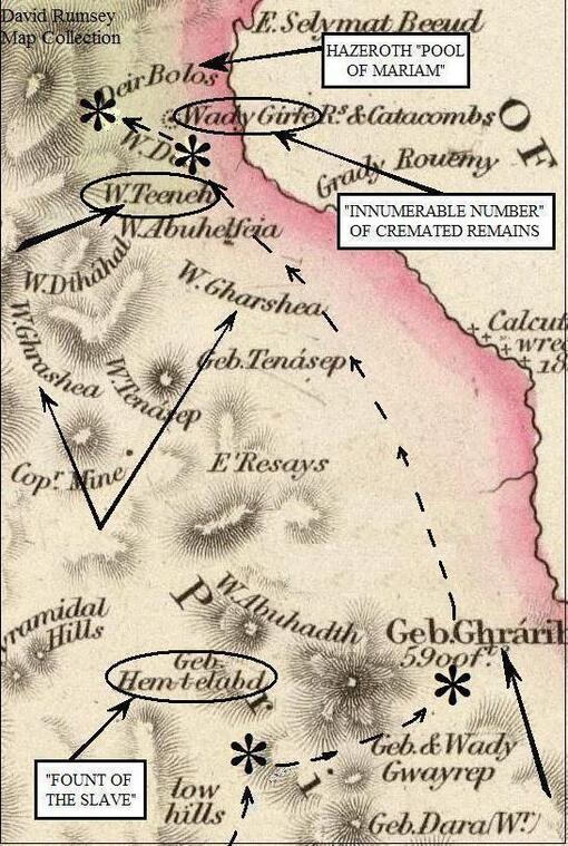
Reasons.
North of Mount Horeb (Mount Gharib, marked on the map with an arrow) is Wady Teeneh; I believe this represents the name Sinai. There are two other wadis named between Wady Teeneh and Jebel Gharib, but these are wadis within the Wilderness of Sinai. Arabic place names are known for taking a name of an area and placing it on one location as a mountain or wadi. On the map we are using, there is nothing in the Eastern Desert that is called a “desert” or “wilderness” (unless it be Wady Arabah); instead, the word “Wady” is used to describe both a valley and a wilderness. We are also told the Israelites had left the Wilderness of Sinai before they arrived at Taberah. “And the children of Israel took their journeys out of the wilderness of Sinai…” (Numbers 10:12). And the next place we find them is at Taberah (Numbers 11:3). Almost all of the proposed routes of the Exodus have the site of Taberah north of Mount Sinai. And when we discuss the location of Taberah, it will be found just to the north of Wady Teeneh. (This is based on Numbers 10:33 and the “three days” of travel from Mount Sinai.)
I would like to have found the name Wady Teeneh right by Mount Gharib, thereby showing its connection with Mount Sinai. But its position being north of Jebel Gharib, the direction Israel went, and at a wadi, which is a natural break or boundary line from one area to another, fits with Israel coming “out of the wilderness of Sinai.” Moving a place name from one location to another is known as “transference.” With the passing of time, and more commonly when a country has been conquered and names are changed to fit the new language, a name will become “detached” from where it was originally and placed where the new conqueror decides. The name Teeneh could have been placed anywhere in that area, or even deleted altogether.
Strong’s #5514 gave for Sinai “thorny,” while Gesenius’ Lexicon gave “clayey, miry.” Both Wilderness of Sin and Wilderness of Sinai are closely related in the Hebrew, and Strong’s transliterates Ciyn as “Sin” and Ciynay as “Sinai.” For the Etymology of the word Strong’s said, “Of uncertain derivation.” Dr. Andrew Fausset said, “From sin, ‘muddy,’ as Pelusium comes from flos ‘mud.’ So the Arab Teeneh from teen, ‘mud.’”5 (There is another Arabic word also spelled “teen,” which means figs but is pronounced differently).
The Arabic word “teen” which means mud or clay, is used for the ancient port city of Pelusium on the northeast corner of the Delta.6 Besides the “Wilderness of Sin,” there was also in the Bible a city named “Sin,” and both this city “Sin” and the wilderness “Sin” are the same Hebrew word. Bible scholars say the city of “Sin” was at Pelusium, and the Arabs place the name Teen at Pelusium, and both say it means mud or clay. Regardless of whether one agrees with these scholars’ placement of “Sin” at Pelusium, it is interesting that they see a connection between the Arabic “Teen” for clay and the Hebrew “Sin” for clay. There is not much difference between “clay” and “clayey”, like saying mud and muddy, and those who gave the Arabic names for these older maps would have been left to their own judgment as to whether to use Teen or Teeneh. I would have said that Teen was for Sin and Teeneh was for Sinai, but many are using these names interchangeably. On the older maps you will find Teen and Teeneh used interchangeably for the location of Pelusium. And online sites are giving “clayey” for the place name Sin. “A city in Egypt, called by the Greeks Pelusium, which means, as does also the Hebrew name, “clayey” or “muddy,” so called from the abundance of clay found there” (Easton’s Bible Dictionary, online under s). Arabic Teeneh would be the equivalent of the Hebrew Sinai (and even Teen as others are using it). Thus, Wady Teeneh is the equivalent of the “Wilderness of Sinai”! (More later in Chapter Six.)
(“And the children of Israel took their journeys out of the wilderness of Sinai; and the cloud rested in the wilderness of Paran” [Numbers 10:12]. The Kadesh encampment was also in the “wilderness of Paran” and will be discussed in Chapters Four and Five. There are different theories about when Israel reached Kadesh, and hopefully by first showing the route in the Eastern Desert will help locate it.)
Application. It was in the Wilderness of Sinai where Israel made the golden calf. And Moses said, “Who is on the LORD’s side? let him come unto me” (Exodus 32:26). Stand with God’s man. Do not stand with the crowd that is against God’s man. How do we know who is of the Lord? “Ye shall know them by their fruits. Do men gather grapes of thorns, or figs of thistles? Even so every good tree bringeth forth good fruit…” (Mathew 7:16–17). Who is building up the work of the Lord and winning souls to Christ (“good fruit”)? Who is causing trouble in the church, who is running down the pastor and causing contention (“Thorns” and “Thistles”)? “Wherefore by their fruits ye shall know them” (Mathew 7:20).
Encampments of (possible) Taberah and Kibroth-hattaavah
(Please see the last map for these encampments, marked just below “Wady Girfe.”)
“And he called the name of the place Taberah:because the fire of the LORD burnt among them” (Numbers 11:3).
Meaning of name, Strong’s #8404 Taberah = “burning”.
Problems. Were Taberah and Kibroth-hattaavah two different locations, as some believe? Deuteronomy 9:22 says, “And at Taberah, and at Massah, and at Kibroth-hattaavah, ye provoked the LORD to wrath.” The argument is, if Taberah and Kibroth-hattaavah describe the same place, then why separate them with Massah, which was a totally different event and time? But in Deuteronomy 9:22, as well as in the entire chapter, Moses was reminding the children of Israel of all the troubles they had caused. He told them of their “stubbornness”, twice He called them “rebellious”, twice “stiffnecked,” and three times he said how they “provoked the LORD.” The only other places that are mentioned in Deuteronomy 9 are: the Jordan River, which they had not yet crossed, and Horeb and Kadesh, again because of their failures. The purpose of Deuteronomy 9 was not to give the chronological order of events but to remind them of their failures, so they would not trust in themselves, but in God.
Massah was an event that had happened at Rephidim (Exodus 17:6–8) before either Taberah or Kibroth-hattaavah, yet it was named in the middle of these two because all three of these names described Israel’s failure. If I am to use the reasoning of those who say Taberah and Kibroth-hattaavah cannot be the same place because Massah is mentioned between them, then I would have to say that Massah happened after Taberah, because it is listed after Taberah. But, of course, it did not, and all know this. Taberah and Kibrothhattaavah are not two different locations but two different events that happened at the same place.
As to why it was the same location, in Numbers 10:12 the Israelites left Sinai, and in Numbers 11:1–3 we find them at Taberah, but it is not recorded that they left there. Numbers 11:4 begins to talk about the problem that arose at Kibrothhattaavah but does not say they had left Taberah or had arrived at Kibroth-hattaavah. Why? Because they were still at the same place. Taberah is not found in Numbers 33, where the list of all the other places Israel encamped are found. The account reads, “And they removed from the desert of Sinai, and pitched at Kibrothhattaavah” (Numbers 33:16). There is no record they came to or left from Taberah, but it is recoded they came to and left Kibroth-hattaavah (Numbers 33:16–17), because Taberah and Kibroth-hattaavah are at the same place. We are told the site of Kibroth-hattaavah was not the original name, but one given by Moses, and therefore he “changed” it from the previous name, and so says Legends of the Jews.7
In Numbers 11:1–3, we hear of Taberah (“burning”) for the first time and are told the name was given because God’s “anger was kindled; and the fire of the LORD burnt among them.” And in Numbers 11:4–34 was given the name Kibroth-hattaavah, meaning “graves of lust” (Strong’s #6914). “And he called the name of that place Kibrothhattaavah: because there they buried the people that lusted” (Numbers 11:34). The “mixt” multitude (believed to have been non-Hebrew slaves) who had left Egypt with Israel were the ones who led in this complaint (Numbers 11:4). But at Kibroth-hattaavah, the Bible does not actually say they were burned with fire, only that “the wrath of the LORD was kindled against the people, and the LORD smote the people with a very great plague.”
A “plague” in the Bible is often not a disease. Leviticus 16:21–26 mentions “plagues” of beasts, sword, and famine. Of the ten “plagues” (Joshua 24:5, Exodus 9:14) that fell on Egypt, only one was called a pestilence, while others were hail, fire, and rain. And there were other times God smote people with fire in the camp of Israel (Leviticus 10:1–2, Numbers 16:35).
In Psalms 78:15–31, there is a passage dealing with Kibroth-hattaavah. In verses 15 and 16 it talks about Rephidim, where waters came from the rock; in verses 17–20, the Israelites complained and asked “meat for their lust.” In verse 20 they said, “Behold, he smote the rock, that the waters gushed out, and the streams overflowed; can he give bread* also? can he provide flesh for his people?” They cried for “flesh,” which God provided by giving them quail, for the second time, at Kibroth-hattaavah, or the “Graves of Lust.” Then in verse 21 it says, “Therefore the LORD heard this, and was wroth: so a fire was kindled against Jacob….” This “fire” would have been at Kibroth-hattaavah after the fire at Taberah, which had happened earlier in the same location. Those who were buried at the “Graves of Lust” had been burned to death, and their urns were buried at Wady Girfe (more later on this site). The ashes of both Taberah and Kibroth-hattaavah would have been buried here as both times God’s fire burned among them.
*(They already had manna but had complained about it at Kibroth-hattaavah (Numbers 11:6). They made a distinction between manna and the bread they had eaten in Egypt. That is why in Numbers 21:5 they said they had “no bread… and our soul loatheth this light bread.” They were tired of the manna and so in Psalms 78:20 they said, “can he give bread also?”)
Reasons. Taberah and Kibroth-hattaavah are found on the map just south of the catacombs of Wady Girfe, and a few miles north of Wady Teeneh. This encampment was the closest of any station to the sea, except the Red Sea encampment after Elim. And there are two indications Israel was near the sea when at Kibroth-hattaavah. One was when Moses was confronted with the need of flesh for Israel to eat and said, “shall all the fish of the sea be gathered together for them, to suffice them?” (Numbers 11:22), and a wind “brought quails from the sea…” (Numbers 11:31). This was the second time quail had been provided to feed Israel—the other was at the Wilderness of Sin, but that was in the middle of the desert and nothing was mentioned there about a “sea.”
Numbers 11:31: “And there went forth a wind from the LORD, and brought quails from the sea, and let them fall by the camp, as it were a day’s journey on this side, and as it were a day’s journey on the other side, round about the camp….” The quail were round about the camp, but not a “day’s journey” on every side, but “a day’s journey on this side” and “on the other side.” Targum Jonathan (3rd century AD, Numbers 11) explains, “the quails fly from the Great Sea, and settle wherever there was place in the camp, as a day’s journey northward and southward.” This fits with the location of the site there. At this encampment, from the sea to the mountains is less than ten miles, with the Israelites somewhere in the middle, so the only way they could have collected quail a “day’s journey” would be on the north and south sides.
(Modern maps do not have either Wady Teeneh or the catacombs of Wady Girfe marked on them. As to why these names no longer exist on the maps, or why many names have been changed or added over the last few generations, I attribute to the influx of tourists and the discovery of oil. Oil is now pumped from many places on the west coast of the Gulf of Suez, and the beaches here are known as the Red Sea Riviera with many five-star hotels. In short, it is no longer a few Bedouins on camels, and with this new population came new names. Which is one reason it was necessary to look to these older maps in order to try and find place names given in the Bible. There are many names on these older maps that today are no longer put on maps.)
On the map, I had drawn the route of the children of Israel coming into the Wilderness of Sinai on the south side of Mount Gharib, and then had them encamping on the mountain’s east side. However, they could have come into this area from the north side of the mountain and then encamped there as they will be going due north when they leave. Israel had been at this encampment almost a year and was rested up, and with the rate of fifteen miles a day, this would place Israel just south of the Graves of Lust.
(Note: It is possible that the distances for traveling were from the location of the Ark of the Covenant and not necessarily the camp itself (Numbers 10:33). In most cases, this would not matter, but there are a few times where this would affect the location of the next encampment. The Ark was kept inside the Tabernacle except for traveling, and it should not be forgotten that the Tabernacle was not always placed in the center of the camp. Moses moved the Tabernacle “without the camp, afar off” [Exodus 33:7. Some believe this was Moses’s tent, not the tabernacle that held the Ark]. Targum Jonathan, on Exodus 33, said it was a “distance of two thousand cubits” or about three thousand feet from the camp. As was brought out before, the camp itself was 3.4 miles long on each side, and up till now I have only read guesses as to which side Moses moved the Tabernacle. In Numbers 11, where we have the account of the Graves of Lust, it appears the Tabernacle was still outside of the camp. Moses took the “elders of the people, and set them round about the tabernacle….But there remained two of the men in the camp” and they “went not out unto the tabernacle….”)

Caves or Catacombs? I will quote from Sir John Gardner Wilkinson, who explored them in 1823. “We met with nothing interesting along this flat shore till we arrived at the low hills of Wady Girfe, which lie between Jebel Kolzim and the sea....Near the ruins is a small knoll containing eighteen excavated chambers, besides, perhaps, many others, the entrances of which are no longer visible. We went into those where the doors were the least obstructed by the sand or decayed rock, and found them to be catacombs; they are well cut, and vary from about eighty to twenty four feet, by five; their height may be from six to eight feet. They are rounded at the upper end….Some of the chambers are double, communicating by a door.”8 Sir Wilkinson said, “eighteen excavated chambers, besides, perhaps, many others…” When I explored the catacombs, I counted thirty with the longest about 110 feet.
I had talked to my guide Sameh about the distance and direction from the monastery as given by Sir Wilkinson, and he found some Bedouins who thought they knew of the location of the catacombs. They were able to find them, and the Bedouins said they called this place Wadi El Khawaja, which Sameh interpreted as “Valley of the Foreigner.”
I had talked to my guide Sameh about the distance and direction from the monastery as given by Sir Wilkinson, and he found some Bedouins who thought they knew of the location of the catacombs. They were able to find them, and the Bedouins said they called this place Wadi El Khawaja, which Sameh interpreted as “Valley of the Foreigner.”
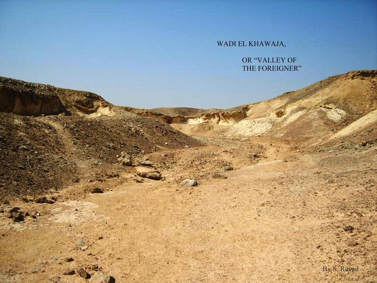
This is the only time in their forty years of wandering that the Bible mentions the Israelites burying their dead, except for Moses, Aaron and Miriam, because of who they were, but no other mass graves are mentioned, so it is not surprising that this would be more than a burial in the sand.
“We sought in vain for inscriptions or hieroglyphics; our curiosity was only rewarded by finding the scattered fragments of vases, bitumen, charcoal, and cloth. It is evident that the bodies were burnt, and the ashes, after the usual ceremony of bathing and wrapping them in these cloths,* were probably deposited in the vases, of which innumerable broken remains are seen in every direction; — they are earthenware, mostly red, and heart-shaped, with a mouth of about three inches in diameter, terminating at the base in a point; the materials and workmanship are good.”9
“We sought in vain for inscriptions or hieroglyphics; our curiosity was only rewarded by finding the scattered fragments of vases, bitumen, charcoal, and cloth. It is evident that the bodies were burnt, and the ashes, after the usual ceremony of bathing and wrapping them in these cloths,* were probably deposited in the vases, of which innumerable broken remains are seen in every direction; — they are earthenware, mostly red, and heart-shaped, with a mouth of about three inches in diameter, terminating at the base in a point; the materials and workmanship are good.”9
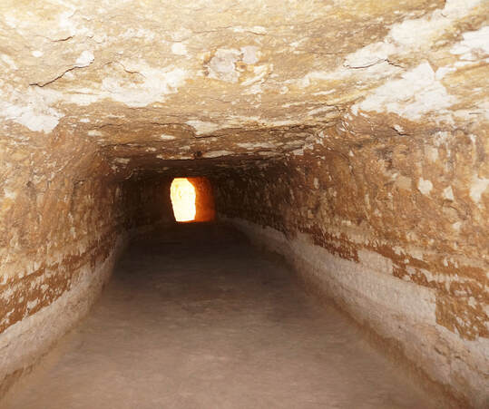
Did these Jewish slaves have the time and ability to make these? Yes, they stayed at Kibroth-hattaavah for at least thirty days (Numbers 11:19–20), and they had built the “cities, Pithom and Raamses” (Exodus 1:11). Israel also built the Tabernacle while at Mount Sinai and would have had tools to cut out these catacombs. (*Sir Wilkinson has a footnote about the cloth. “The cloth is found only in small pieces, and is very different from that in the mummy pits of the Egyptians.”10) “The Egyptians did not burn their dead; the other claimants are the Greeks and Romans…”11 (Sir Wilkinson). The ancient Egyptians, Arabs and Jews did not cremate their dead. But one day God’s “anger was kindled; and the fire of the LORD burnt among them.”
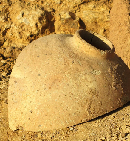
Wilkinson decided the ashes and vases were from either the Greeks or the Romans, but favored the Greeks because about eight miles southeast of Wady Girfe is a point on the Gulf of Suez named Grady Rouemy, which he believed was “signifying Greek.” He made a footnote about this, “Greek, in Arabic, is Yunani. The Arabs borrowed the name Rumi from the Greeks of Byzantium.”12 In the same passage Sir Wilkinson said that “Grady,” from Grady Rouemy, was Arabic for a plant in that area and that the Arabic language had a name for Greek which was “Yunani,” so why would the Arabs use the “Byzantium” name for “Greek” for the last half of this name?
There is no record of either the Greeks or Romans having a fort or city in this area. While in Egypt the Greeks and Romans usually did not cremate their dead, especially in the Eastern Desert, because of the scarcity of wood. An archaeologist told me, even at sites where Greeks and Romans were known to have lived in the Eastern Desert, they still have not found cremated remains. The ancient Greeks often put cremated remains in a ceramic vase with a foot or base and two small handles on the sides; they were also painted and usually inscribed with the name of the person and the date he died. But this was not what was found at Wady Girfe; the vases were not painted and had no handles and no bases. I believe the vases and ashes Sir Wilkinson found point to a mass funeral as the Graves of Lust were. For had this burial site been used for years, then certainly somebody would have started painting and decorating these vases as the Greek and Roman vases found in the catacombs of Alexandria.
Problem with date. Wady Girfe was excavated between 2011 and 2013 by a French and Egyptian archaeological team. They called the site Wadi el-Jarf and acknowledged that Sir Wilkinson had originally found the site. They, however, believed the manmade caves (they called them galleries) were used for boat storage for a harbor they found five kilometers away. The most impressive find was that of a Fourth Dynasty papyrus (the oldest ever found in Egypt) from the twenty-seventh year of the reign of King Khufu (Cheops), who is believed to have built the Great Pyramid!
But Sir Wilkinson called these manmade caves “catacombs,” and said “the bodies were burnt, and the ashes” had been deposited in the vases. It is true that Sir Wilkinson did not have the modern methods or the technology of today’s archaeologists, but he still would have known what ashes were! When I was first there in the fall of 2010 before the site was excavated, I picked up at random seven pieces of pottery, none with writing on them, and when at home I noticed that four of them had ashes on them, not from cooking, but gray ash. Sir Wilkinson said the ashes were wrapped in short strips of cloth and may not have been poured out till the jars were broken. That being so, not all the pottery would show signs of ashes on them.
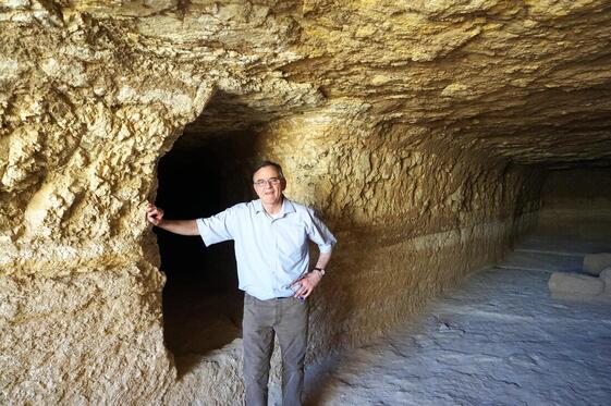
Were these man-made caves a “temporary” storage for vases and boats, and five kilometers away from the port? Only a few artifacts of boats were found there and no complete boat was found. Hard to believe the ancient Egyptians dug thirty caves to house boats when no complete boat was found. Sir Wilkinson said, “Some of the chambers are double, communicating by a door.” In the above picture I am standing by one of the doorways that connect to another cave about the same size, with no way in or out except by this passage. If this was for boat storage then the boats would have been small indeed to enter through this narrow passage.
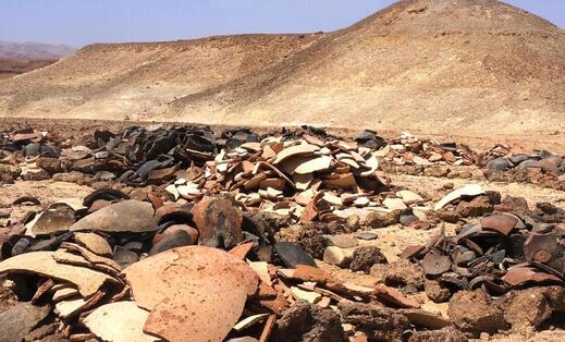
This picture was one of three locations at Wadi el-Jarf (Girfe) where the pottery was gathered by the archaeological team, plus those pieces still in the caves or on the ground.
There were “vases, of which innumerable broken remains are seen in every direction” (Sir Wilkinson). The archaeologists believed the large quantity of jars found at the site was for food and water storage, but no evidence was given. Nor did they mention that ashes could still be seen on much of the pottery.
This site, including the papyrus, jars, and wood fragments, is said to date around 2600 BC. The papyrus of the twenty-seventh year of King Khufu, and this king’s cartouche, found on some of the sealing blocks, were what was used to date this site. And mainstream chronology of the Fourth Dynasty would place King Khufu around 2600 BC. But no carbon dating was given; with today’s technologies like the Accelerator Mass Spectrometry (AMS), it is possible to date samples as small as a grain of rice. And it is easy to obtain carbon 14 dating for the wood fragments, papyrus, rope, and cloth that were found. I do not doubt the authenticity of the papyruses found at Wadi el-Jarf/Girfe, but would not recent technologies help better establish the chronologies of ancient Egypt and even determine when the Great Pyramid was built? There were over thirty dynasties in ancient Egypt (some overlapping), and some believe the dates of the chronologies are off by three hundred, six hundred, or even a thousand years. I do not know if they are off at all, but would not this be the perfect opportunity to prove them one way or the other, since the papyrus has the date on it of the twenty-seventh year of the reign of Khufu, who built the Great Pyramid.
These vases at Wady Girfe were not decorated or painted, and trying to date pottery by shape and size is futile as handmade vessels can run the whole spectrum of shapes and sizes with changes in style occurring for many reasons. The archaeologists did, however, find markings on some of the vessels and said these matched signs on some of the papyruses, which were then used to date the pottery. But the papyruses need to be dated! The papyrus of King Khufu, as well as the other papyrus fragments found there, are now at the Suez Museum. In 2013 I asked an Egyptian man who speaks Arabic to call there and ask for the results of any C14 test. The Suez Museum said there would not be any C14 test till March of 2014, but we called again in April and again in August 2014 and still no test.
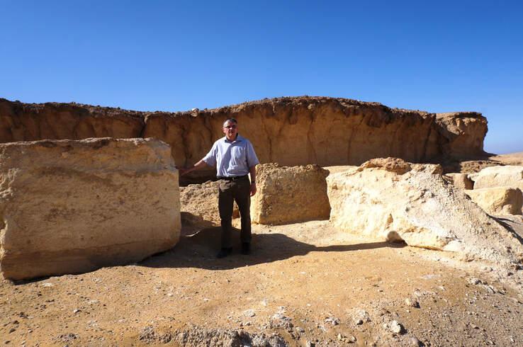
Author pictured with the huge blocks used to close the entrances to these man-made caves.
Reasonable questions and hopefully there are logical answers.
1. Why were these manmade caves sealed with large, quarried blocks that required several men and wooden skids to close the entrances? Hard to believe this was done for a few pieces of boats or temporary storage of jars. But on the other hand, if this site was used for burial, it would make sense.
2. Why did no one mention the ashes that Sir Wilkinson said were in the vases?
3. Why is there no carbon 14 dating for any of the papyruses, wood fragments, rope, and cloth?
Dating by AMS. I had the pottery dated using accelerator mass spectrometry (AMS). I had hoped AMS technicians might find some carbon material, such as a twig imbedded in the clay of the pottery and thus establish a radiocarbon date for that time period, but none was found. (AMS testing January 2, 2013, Beta Analytic Inc., Miami, Florida.)
Dating by Thermoluminescence. Thermoluminescence (TL) gives the approximate date by heating a sample with a laser. The luminescence the pieces give off can then be measured to give the date of its last firing (when it was made). All three laboratories the pieces were sent too were told the pieces were found in the Eastern Desert of Egypt. I kept all correspondence and documentation they sent me. The three laboratories the pieces were sent to was first, a laboratory in England, Oxford Authentication Ltd, Boston House, Grove Technology Park, Wantage England (November 11, 2010). Second, a laboratory in France, Ciram, Centre d’Innovation et de Recherche pour l’Analyse et le Marquage (December 16, 2010). And third, a laboratory in Belgium, Brussels Art Laboratory, Nuclear Section, Institut Superieur Industriel de Bruxelles (January 19, 2011).
All the laboratories gave test results of more than 1,000 years after the time of King Khufu. The oldest date given by the three laboratories, was the laboratory in France, l’Analyse et le Marquage. Which gave 3,230 years old or 1230 BC, with plus or minus 310 years, or about 10 percent margin of error, between 920 BC and 1530 BC.
Thermoluminescence is mostly used to determine if an auction piece or museum artifact is old, not some recently made fake and for this it is good. And I accept that Thermoluminescence dating is not as accurate as carbon 14, so why do archaeologists not test the carbon material they have with C14? Those who excavated Wadi el-Jarf should be commended for their work and findings! Still, the oldest date I received for the pottery was 1530 BC, and this was using the margin of error. Again this would be more than 1,000 years after the accepted time period of King Khufu and leaves one questioning. There may be logical responses to the questions I posed, so I will wait and see. But carbon 14 dating please!
However, there may be another possibility as to why the pottery dates do not line up with King Khufu’s reign. I received an email (April 15, 2013) from an archaeologist of the British Museum who had doubts about Sir Wilkinson’s findings, but still said, “The site and available vessels may have been reused.” Could the ashes have been added after the time of Khufu, and thus the site was reused by the children of Israel?
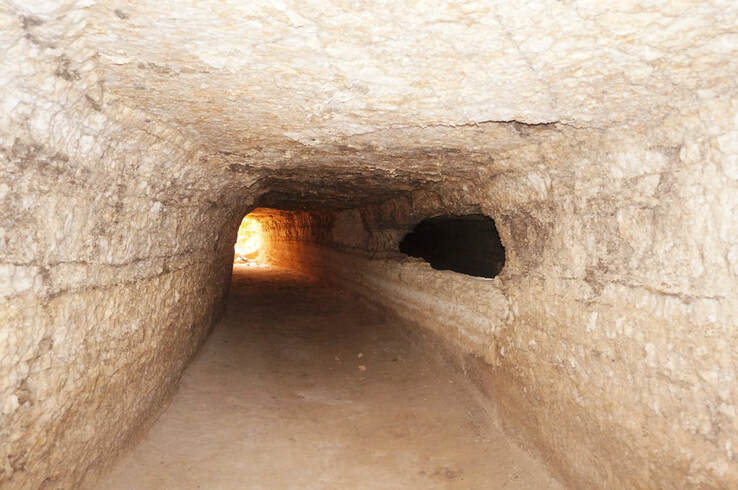
Application. Some years ago I read a sign out front of a church that said, “God is not angry with anyone.” Too bad they could not tell this to the people of the Graves of Lust, where God’s “fire” burnt among them. Nor is this only in the Hebrew Scriptures, “But with many of them God was not well pleased: for they were overthrown in the wilderness. Now these things were our examples, to the intent we should not lust after evil things, as they also lusted” (I Corinthians 10:1–6). “My son, despise not thou the chastening of the Lord, nor faint when thou art rebuked of him: For whom the Lord loveth he chasteneth, and scourgeth every son whom he receiveth” (Hebrews 12:5–6).
Hazeroth
“And they departed from Kibroth-hattaavah, and encamped at Hazeroth” (Numbers 33:17).
Meaning of name, Strong’s #2698 Hazeroth =
“settlement”
Reasons.
The children of Israel next encamped at Hazeroth, which I believe to be the “Deir Bolos” (Monastery of St. Paul). It was a short distance from the Graves of Lust, and Israel is encamped south of that; still, it should have only been about nine or ten miles for them to travel on a roundabout “circuitous road,”13 as described by Sir Wilkinson. The monastery was not there then. But it exists today for the same reason Hazeroth (“settlement” or “enclosure”) would have been there: because of its water supply. This may have been the reason Israel went there, to get water before continuing her journey. The main reason I believe this area to be the encampment of Hazeroth is not because the name fits or it is on the right path or in the right order but because of what the monks at the Monastery of St. Paul said.
Tradition.
The most outstanding thing that happened at Hazeroth was that Miriam (the sister of Moses) was struck with leprosy. This happened because she spoke against Moses, and God reminded her and Aaron that Moses was the only person in the entire earth that He spoke with directly. This is found in Numbers 12:1–16, where in verse 1 both Aaron and Miriam spoke against Moses, but Miriam’s name was given first, indicating that she led in this. The argument was about Moses marrying an Ethiopian woman, which God said nothing against.
Because of her speaking against Moses, she “became leprous, white as snow.” And “Miriam was shut out from the camp seven days: and the people journeyed not till Miriam was brought in again” (Numbers 12:15). When a leper was healed as Miriam was, before he or she could be allowed back into the camp, he not only had to be checked by a priest but had to go and “wash his clothes, also he shall wash his flesh in water, and he shall be clean” (Leviticus 14:9). And tradition says that Miriam, at the time of the Exodus, washed at the spring at this location, before it became the Monastery of St. Paul.
The last two pictures are at the Monastery of St. Paul. The monk in the picture is named Thomas, and we are standing right outside of the main gate of the monastery. I asked the monk if he had heard about the tradition of the children of Israel being there at the time of the Exodus and if he believed it? He said “yes” to both questions. I then asked him about the Arab tradition that Sir Wilkinson recorded, “Miriam, the sister of Moses, bathed in this spring at the time of the Exodus.”14 He said, “Yes, she had washed in a spring here,” and he added that it was known as the “Pool of Miriam.” I asked the monk how he knew these things and his answer was that they came from an 18th century manuscript that was kept there at the monastery, which had been copied from earlier manuscripts. What follows is a picture of the Pool of Miriam, but it has been drained and is awaiting repairs, and also a picture of the monastery.
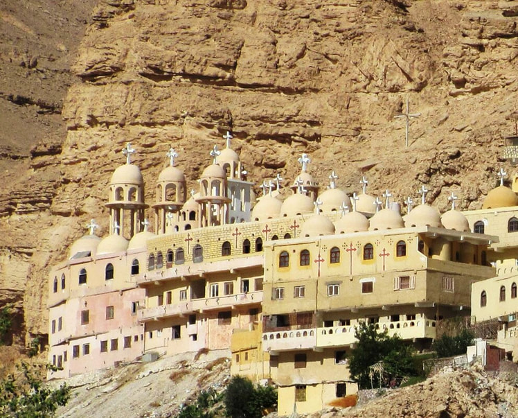
Monastery of St. Paul
Here we have the tradition for the Exodus in the Eastern Desert and the Monastery of St. Paul telling us that Miriam washed there, and this fits perfectly with the encampment of Hazeroth, which is found in the Bible right after the Graves of Lust.
This location of Hazeroth, which means “settlement,” shows that the Monastery of St. Paul, which was founded in the 4th century AD, would have been built on an ancient enclosure or settlement of some sort in order for this tradition to have been preserved. This Pool of Miriam is also found in the writings of Egyptian historians al-Maqrizi, 1441 AD, and Abu al-Makarim, 1171 AD.
The monks at the monastery made no mention of Numbers 12, where we find the place name Hazeroth and the account of Miriam, and they seemed not to realize that their monastery was built on the encampment of Hazeroth. Nor do they make any connection to the catacombs as being the Graves of Lust. And only some of the monks at the monastery knew of the catacombs and a few did not even know about the pool of Miriam at their own monastery. These catacombs are located about five miles east (as the crow flies) of the monastery and about a half mile north of the road that goes to the monastery.
Sir Wilkinson had mentioned a small town being in the same general location, at a little less than a mile north of the road to the monastery. The outline of stone houses can still be seen using one of the satellite websites, and one can count almost forty rooms. Even if each room was a house (highly unlikely), it would mean this town had less than forty houses in it, probably fewer. One of the monks thought the catacombs were from the Roman times (no proof was given), and that the town may have been a Roman fort. The Romans did build a number of forts in the Eastern Desert, but the most outstanding thing about a Roman fort was the outer wall that was used for defensive purposes. Yet this little town has no wall around it, and it cannot be a port as it was found three miles inland. This town had no water supply, not even a cistern, and Sir Wilkinson thought the water was brought from the monastery seven miles away (if following the road), making it a poor place for a permanent settlement. Sir Wilkinson never called it a port or a fort, but referred to it as a “village.” Sir Wilkinson had found other stone houses in the desert and thought they were made by the monks.15
It is obvious this village could not have supplied the cremated remains for the “innumerable” broken vases. Each vase would not have been placed in a separate space but would have been stacked one on top of the other; their numbers would have reached into the thousands! This number would only reflect how many vases there were, not how many “cremated” remains were in each vase. The vases were large enough to allow for the “ashes” of a number of cremated remains.
The last station was the “Graves of Lust,” which was the right distance from Mount Gharib, and the next station was Hazeroth, where the only person struck with leprosy was Miriam, and she was required by the Bible to wash both her clothes and herself before re-entering the camp. And here at the Monastery of St. Paul, we find a tradition about Israel being there at the time of the Exodus and that Miriam washed in a pool there! It is of interest that this tradition does not mention Moses or Joshua or Aaron or anyone else in the camp of Israel doing this, but only Miriam, the only one required to do this. I know of no other place in the world with such a tradition, and this one falls on the path we are following and in the right order.
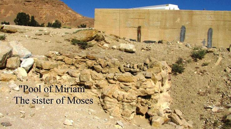
Application. After a leper was healed and washed himself (Leviticus 14:9), he then followed the rest of the ceremony given in that same chapter, which has spiritual significance. “[T]he law of the leper” (verse 2), “behold, if the plague of leprosy be healed in the leper” (verse 3), “take for him that is to be cleansed two birds alive and clean” (verse 4), “command that one of the birds be killed” (verse 5), “and shall let the living bird loose into the open field” (verse 7).
The leper is symbolic of all of mankind, “and death by sin; and so death passed upon all men, for that all have sinned” (Romans 5:12). The “two birds alive and clean” typify Christ without sin. The one that was killed is Christ dying for our debt of sin; the living bird let loose is His bodily resurrection.
The leper is symbolic of all of mankind, “and death by sin; and so death passed upon all men, for that all have sinned” (Romans 5:12). The “two birds alive and clean” typify Christ without sin. The one that was killed is Christ dying for our debt of sin; the living bird let loose is His bodily resurrection.
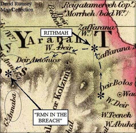
Rithmah
“And they departed from Hazeroth, and pitched in Rithmah” (Numbers 33:18).
Meaning of name, Strong’s #7575 Rithmah = “heath”
Reasons.
The meaning of “heath” (Rithmah) is a level wasteland with shrubs, broom, or genista flowers. Gesenius’ Lexicon only gave “genista,” which includes the common broom, a small plant with white, yellow, or purple flowers. A little over thirteen miles northeast of the Monastery of St. Paul is a point on the Gulf of Suez named Zafarana, which lies on the eastern end of Wady Arabah. Sir Wilkinson gave the translation “zafarana signifies saffron.”16 Saffron is a small plant whose flower is the same as the broom: white, yellow, or purple. In the days of Moses, such classifications as broom or genista were not used; instead, they called it “Rithmah.” At Zafarana we find the next encampment of Rithmah, in the right order, with the right flower, on the right path, and just a day’s travel from the Monastery of St. Paul (Hazeroth).
Perhaps one of the reasons these small plants were found here and became the name of this place was because of the almost-greenhouse effect of the area. “The shore is very flat, and the damp vapor which rises from the marshy soil must be exceedingly hurtful, and even dangerous in the hot season”17 (Sir Wilkinson). Today, there are some factories built there and many wind turbines.
Tradition. “The tradition of the Arabs fix the passage of the Red Sea at the eastern end of the Wadee el Arraba”18 (Sir Wilkinson and Claude Etienne Savary). The “the eastern end of the Wadee el Arraba” is where I have the encampment of Rithmah. Obviously, I do not agree the Israelites crossed the sea here, but the tradition of them being in this area is worth mentioning. It is believed by some the Arabs received this tradition from the Christians who lived in Egypt, and that may be so. I believe part of this tradition is correct, that the children of Israel were here, but not that they crossed at this point. Rather, they came from the south, passed Hazeroth, and entered this valley before they headed toward the Nile. The tradition of Miriam’s Pool being at the monastery is a problem for the Arab tradition, which says the Israelites crossed the sea at Wady Arabah. This would have made their journey to Hazeroth farther south, almost a thirty-mile round trip out of their way, not to mention the fact that Hazeroth was after the sea crossing.
Rimmon-parez
“And they departed from Rithmah, and pitched at Rimmon-parez” (Numbers 33:19).
Meaning of name, Strong’s #7428 Rimmon-parez = “pomegranate of the breach”
Reasons. The next site is about twenty-five miles west of Zafarana. Most likely, it required two days to arrive there. It was not possible for Israel to have gone due north from Zafarana because the Jebel Kalalla mountain range rises sharply from Wady Arabah and goes right to the Gulf of Suez. Israel would have followed the Kolzim Mountains, going in a westerly direction. She would have passed, or possibly encamped, at the location of the Monastery of Antony, labeled on the last map as “Deir Antonios,” again, built there because of its good water supply. There is a location on the map called Wady Annaba, which according to Sir Wilkinson, was twelve miles19 from the Monastery of Antony. I believe Wady Annaba is the Exodus encampment of Rimmon-parez.
The rarer the place name the better the confirmation it is the right site, and this name, “pomegranate of the breach,” is as rare as it gets! Thanks to Sir Wilkinson for a comment he made about the ravines of Jebel Annaba, a comment that he made of no other place on his trip through the Eastern Desert. But first, what is an “annaba”?
An annaba is an Arabic name for the “jujube fruit,”— yeah, I had never heard of it either! But it grows in Egypt and countries thereabout and is a dark-red fruit from a small thorn tree, really a bush, but it can reach a height of fifteen to twenty feet. There are few similarities between a pomegranate and a jujube, other than both are dark red. Taste and consistency are not the same, and the jujube is less than half the size of a pomegranate, sometimes referred to as a “red date.”
The word “Rimmon,” from the place name, can be translated pomegranate, but there is another possibility. The Hebrews and ancient Egyptians both spelled pomegranate with the same root “rmn”; remember, they are consonantal languages, with the vowels, which were added later, being conjecture. Amazingly, in Hebrew literature, the jujube fruit has the same consonantal letters as the pomegranate, and is named “rimin,” or “rmn!”20 Wady and Jebel Annaba are right together on the map, but in no other place on the map does the name occur! Another coincidence?
The other half of the place names is “parez,” or breach (Strong’s #7428), which can be used for a crack in a wall or a gorge in a mountain. “[O]ur enemies, heard that I had builded the wall, and that there was no breach left therein…” (Nehemiah 6:1). “[A]s a breach ready to fall, swelling out in a high wall...” (Isaiah 30:13), and “Ye have not gone up into the gaps…” (Same Hebrew word, Ezekiel 13:5). It is as a space between cliffs in a canyon, or a large break in a wall. Please read how Sir Wilkinson describes Jebel Annaba.
“At Jebel Annaba we stopped for water; there are two very good springs, three or four miles from the plain; near each of which is one old deserted house, probably built by the monks of the neighboring convent. The ravines are very fine and bold, and, judging from their depth, much water must fall there in the rainy season.”21 Jebel Annaba not only had “very good springs”, for Israel to drink from but also deep “ravines,” said to be “very fine and bold.” We could call it “Annaba (r-m-n) of the ravine” which was Rimmonparez for “pomegranate (r-m-n) of the breach.” The other routes do not have anything in their “breach”!
Libnah (possible)
“And they departed from Rimmon-parez, and pitched in Libnah” (Numbers 33:20).
Meaning of name, Strong’s #3841 Libnah = “pavement”
Reasons. Does Libnah mean “pavement,” as Strong’s has it, or “whiteness, transparency,” as given by Gesenius’ Lexicon? Strong’s also said it was “the same as #3839 for sort of whitish tree, perh. The storax:—poplar.” Many, if not the majority of those who give the meaning of this word, agree it was a tree that gave white gum, which out on the desert 3,500 years ago was more likely than a “paved” road. In all likelihood, the acacia tree is the best prospect in the desert for this white, milky gum, but of the many different varieties of acacia trees, only two produce white gum.
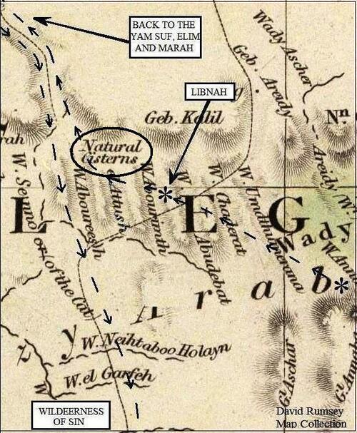
On modern maps is found the name Wadi Abu Siyal, which would be placed just north of Wady Abourimth on the 1844 map. Siyal is the type of acacia tree that gives a good quality white, milky gum. Sir Wilkinson said when traveling in this same area that “The flatness of the plain is only interrupted now and then by gentle ascents and descents; a few trees and low shrubs....”22 He did not name the trees found here, but Claude Etienne Savary, writing in 1787, gave a description of this area and, though he did not use the name Siyal, he did describe the tree, saying, “which is all barren land...[except]...the Acacia, whence arabic gum is obtained....”23 In 1725, Guillaume Cavelier, when describing the same area, said, “you cannot see anything else than a few wild Acacias....”24 I quoted from these different sources to show the only noticeable thing out in this part of the desert was the acacia tree, and it was the one that gave this white, milky gum.
In the Arabic language, this white gum from the Siyal tree is called “laban” (lbn), similar to the encampment name of “Libnah” (lbnh). And this area today has the name “Siyal” for this type of tree. It would have been a two-day journey for Israel from her last station at Jebel Annaba, and there is not much to name an encampment after in the open desert, so names are given for whatever stands out.
This gum was harvested from the acacia tree starting about June25 and Israel may have passed there during that time. It is on the same path we have been following, in the right order, and the Arabic name for this gum is “laban.” Though all this seems to fit and probably is the right location, it is also a possibility that Libnah may not be in this area.
The route Israel was on took them back to where they had entered the Eastern Desert. There was really only one way for this multitude to have left the Eastern (Arabian) Desert and that was to go back the way they came in. It will be explained later that the route picked up again on the north end of this north/south corridor. But where I have Libnah on the map, it is only ten miles from the valley that led back to the north of Egypt, and I thought it possible Libnah was on the north end of this corridor and not in the Eastern Desert.
Rissah (could not find)
“And they removed from Libnah, and pitched at Rissah” (Numbers 33:21).
Meaning of name, Strong’s #7446 = “ruins”
I spent a lot of time looking for this encampment, but I was not happy with anything I found. Because of this, it was the only one of the encampments I marked “could not find.” Right where the Israelites went back into the valley that led north, there is a wady named “Aboureesh” next to the “Natural Cisterns” labeled on the last map, which is about ten miles west from their last stop at Libnah. “Abou” (father of) is attached to the front of this place name but is not part of the name and normally would be separated from “reesh,” which in Arabic means “feather” and not “ruins,” as Strong’s has for Rissah. Because of the similarities between the names “Rissah” and “Reesh,” I had hoped they might be connected, but since Rissah means “ruins,” it would be expected to be near civilization, not out on the desert, so I believe it will be north of the route they came in on.
There are ruins all over Egypt, but the problem is trying to prove that certain ruins existed as far back as the time of the Exodus. If I had to guess, Rissah (ruins) might be one of two locations circled on an upcoming map. These two sites are next to each other and one is called “el Haid,” which in Arabic means “ruin.”26 The other site is named “Tel el-Kebir”; “Tel” is Arabic for mound or hill, which is where a city has been destroyed and covered over with sand, which, of course, would be ruins, and “Kebir” is the word great (“The Great Mound”). But I found no information at all on el Haid, and I do not know how long Tel el-Kebir has been in ruins. I have read that Tel el-Kebir was the city of Raamses, and I have read it was Pithom, and I have also read it was On. All three cities existed before the Exodus (Genesis 41:45 Exodus 1:11), and they would at least show that the site Tel el-Kebir would date back that far, but again, would it have been in ruins at that time? (Today, all three of these cities just named are placed in different locations.) At any rate, I was not able to figure it out, I “could not find” it.
ENDNOTES
1. Louis Ginzberg. Legends of the Jews (1909), vol. III, The Gathering of the Manna.
2. James Ussher. Ussher’s Chronology, 17th century, 12. In the Desert of Sinai, the Israelites camped opposite Horeb and stayed there almost a whole year. They left the wilderness of Sinai, on the second day of the second month, of the second year after coming out of the land of Egypt (Numbers 10:11–12). They came to Mount Horeb on the same day (third day) of the third month, after coming out of Egypt.
3. Exodus 38:25–27 tells us that when the over 600,000 men of 20 years old and upward (Exodus 30:14) were numbered, they each gave a half shekel of silver, and these were used to make 100 silver sockets of one talent each. In the back of your Bible you will usually find a section on weights and measures, giving a talent at 75 pounds and the half shekel equal to 0.2 ounce. Eighty half shekels times 0.2 ounce = 16 ounces or one pound, times 75 pounds to make one talent = 6,000 shekels, times 100 talents = 600,000.
4. Arabia Felix: The Danish Expedition of 1761–1767, by Thorkild Hansen.
5. Andrew Robert Fausset, M.A., D.D. Fausset’s Bible Dictionary (1878), under S.
6. John Murray. Handbook for Travelers in Egypt (1875), 269.
7. Ginzberg. Legends of the Jews (1909), vol. III, The Awful Desert..
8. Sir John Gardner Wilkinson. Royal Geographical Society (1832), 28–40 https://archive.org/stream/journalroyalgeo04britgoog/journalroyalgeo04britgoog_djvu.txt
9. Ibid.
10. Ibid.
11. Ibid.
12. Ibid.13. Ibid. 14. Ibid.
15. Ibid.
16. Herodotus. II, 8.
17. Ibid.
18. Herodotus. II, 8.
19. Ibid.
20. Mishna Demai, 1:1; Kilayim, 1:4, a tractate of the Talmud.
21. Sir Wilkinson. Royal Geographical Society (1832), 33.
22. Ibid.
23. Claude Etienne Savary. Letters on Egypt (1787), vol. I, 436.
24. Guillaume Cavelier. Nouveaux memoires des mission de la Compagnie de Jesus dans le Levant (1725), 133.
25. He said, “They told us the gum of this tree would be gathered in two more months…” He gave the date when he was told this as “April the 10th.” Sir John Gardner Wilkinson. Royal Geographical Society (1832), 28–40.
26. D. A. Cameron. Arabic-English Vocabulary For The
Use of English Students of Modern Egyptian (1892), 40.
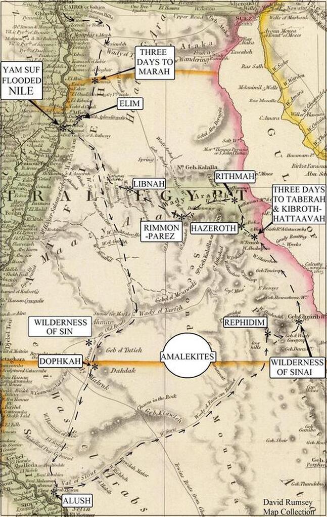
Chapter Four
“Eleven Days to Kadesh.”
“There are eleven days’ journey from Horeb by the way of mount Seir unto Kadesh-barnea” (Deuteronomy 1:2).
Kadesh-barnea. Israel stopped at Kadesh twice according to the following verses in the book of Numbers. In Numbers 13:25–28, the spies returned to Kadesh from searching the land of Canaan, and in the next chapter (Numbers 14:32–33), Israel was told she would wander in the wilderness forty years, then in Numbers 20:1 Israel, after her wanderings, returned to Kadesh, where Miriam died, Moses struck the rock that brought forth water, and messengers were sent to Edom seeking permission to go through its land. The Bible tells us it was thirty-eight years from the first time the Israelites were at Kadesh until that generation died (Deuteronomy 2:14).
In Numbers 33:1–49, which lists all the encampments where the children of Israel encamped, the station of Kadesh is only given one time (and later it will be explained why), but because of this, a few have thought that Kadesh in verse 36 was the first time they were there. But from Mount Horeb until Kadesh there were some twenty encampments. It is obvious that if it only took eleven days to get there (Deuteronomy 1:2), they would not have needed twenty encampments. Most believe Israel stopped twice at Kadesh, but few believe as I do, that there were two Kadeshes to the south of Israel.
The belief in two different Kadeshes is an old argument found in books more than a hundred years old; seldom can it be found in a newer book or article. But I did not come to this belief by old arguments but believed this before I knew others at one time held this belief. In Israel there was a Kadesh at the Sea of Galilee, “Kedesh of Galilee” (Joshua 20:7), which was also called “Kedeshnaphtali” (Judges 4:6). There was also a Kadesh (Qadesh) in Syria where Ramesses II fought the Hittite Empire. Kadesh was a common name and it should not be surprising to find two more sites with this name to the south of Israel.
The old argument for believing there were two locations with the name Kadesh was because Kadesh-barnea was in the wilderness of Paran, and Meribah-Kadesh was in another desert called the Wilderness of Zin. The argument against this was on the basis that both Kadeshes were given for the southern border of Israel, and because they seemed to be used interchangeably, they would be the same place.
The encampment of Kadesh-barnea has been located in some odd places, either several miles inside or outside of the border for Israel. But the Bible has Kadesh-barnea on the border of southern Israel (Numbers 34:4 and Joshua 15:3). Josephus echoed the same “and chose twelve spies, of the most eminent men, one out of each tribe, who, passing over all the land of Canaan from the borders of Egypt….” 1
In 1884, a book came out called Kadesh-Barnea its Importance and Probable Site, written by H. Clay Trumbul D.D.; it was 478 pages and all about Kadesh. Dr. Trumbul was a strong believer in only one Kadesh, and I got a kick out of his argument, and thought the reader might also. He started off by referring to a Mr. Lightfoot: “Indeed, on this point his argument from the Bible-text was and is unanswerable; and it would seem to be overwhelmingly conclusive. A school boy can understand it. In substance it is this: The gathering place of Israel after its thirty-eight years of wandering was ‘Kadesh;’ not called ‘Kadesh-barnea,’ but simply Kadesh. That was the ‘city’ Kadesh, on the uttermost borders of Edom, from which the messengers were sent to Edom’s king. That Kadesh was the place of murmuring for water; and in consequence it came to be called ‘Meribah,’ or ‘Strife,’ or ‘Meribah-Kadesh.’ Afterwards, Meribah-Kadesh is named as a central or pivotal point of the southern boundary of the Holy Land. But again it is declared that the pivotal or central point of the southern boundary of the Holy Land is ‘Kadesh-barnea;’ not Kadesh simply, but Kadesh-barnea. It is therefore clear that both ‘Kadesh’ and ‘Kadesh-barnea’ are identical with ‘Meribah-Kadesh’; and if proving them equal to the same thing does not prove them equal to each other, one of the familiar axioms of mathematics will have to be amended. The force of that argument has never been shaken, indeed it may be said never to have been directly assailed.”2 Sounds like an ironclad argument, does it not? We shall see.
Where the two Kadeshes were located will be discussed in the next chapter, but for now, Kadesh-barnea was the location of the first encampment at Kadesh and will be referred to as the “first Kadesh,” and Meribah, or “waters of strife in Kadesh,” was the second Kadesh encampment and will be referred to as the “second Kadesh.” Both locations are sometimes simply called Kadesh without adding Barnea or Meribah, but when this happens it is obvious in the passage which time period it is, the beginning or end of the forty years of wandering and therefore what location it refers to. I believe one of the reasons Barnea or Meribah was sometimes added to Kadesh was to distinguish the sites, so as not to confuse them.
Again, the argument for one Kadesh was that “Kadeshbarnea” and “waters of strife in Kadesh” (Meribah) were both given for the southern border of Israel and therefore must be the same place. It is true that there are two passages, one in Ezekiel 47 and the other in chapter 48, that give Meribah or “waters of strife in Kadesh” for the southern border of Israel. This appears to be used in place of Kadeshbarnea, which is also placed for the southern border of Israel and found in Numbers 34 and Joshua 15, but both the borders and the time periods are radically different. Numbers 34:4 puts the border of the children of Israel in the south and Kadesh-barnea is found there. Joshua 15:3 is about the border of Judah in the south, again with Kadesh-barnea. And both Ezekiel 47:19 (about Israel’s southern border) and 48:28 replace Kadesh-barnea with “the waters of strife in Kadesh.” But that is not all that is changed; both Ezekiel passages leave out the border towns Hazar-addar and Azmon, and both add Tamar. In the passages in Numbers and Joshua, the borders of the twelve tribes meander from one hill to another or to a stream or to a village. But not so for the passages in Ezekiel, where the borders for the twelve tribes are straight across from east to west (Ezekiel 48:24–24). But more than this, the tribe of Judah, which was in the south in both Numbers and Joshua, will move to the northern part in the Ezekiel passages, and Gad, which was up north, is found on the southern border!
The time line of Numbers and Joshua follows the lives of Moses and Joshua. But the Ezekiel passages refer to the future, and we are told they will take place when a river flows out from the sanctuary, and this river heals the sea to the east (Dead Sea); when trees from this river grow special leaves which will be used for medicine. (Ezekiel 47:1–29). Have any of these things ever happened? Not yet, but they all will. Have the borders, as described in the Ezekiel passages, ever been straight across from east to west? Never! But they will; it is prophetic. And those who used these passages to try and prove there is only one Kadesh, when both the borders and time periods are different, have obviously not proved “them equal to the same thing” and have done a worse job than those who try to compare apples with oranges.
So why are there two Kadeshes?
1. There are four times the Bible connects “wilderness of Paran” to Kadesh-barnea, which was the first Kadesh Israel encamped at, “unto the wilderness of Paran, to Kadesh” (Numbers 10:12, 12:16, 13:3, 26). But there are five times the “wilderness of Zin” is connected to Meribah in Kadesh, which was the second one she came to, “the water of Meribah in Kadesh in the wilderness of Zin” (Numbers 27:14 [two times], 33:36, 34:3, and Deuteronomy 32:51).
The Meribah of Kadesh was in the “wilderness of Zin,” but never does the Bible say that Kadesh-barnea was in, or a part of, the Wilderness of Zin. Conversely, Meribah of Kadesh is never said to be in, or a part of, the “Wilderness of Paran.” The name Wilderness of Paran was still being used after the name Wilderness of Zin is first given (the name had not changed) but at a different location, just as the name Wilderness of Zin continued to be used in spite of the name Wilderness of Paran, because they are two different locations.
2. The Bible never mentions Edom when Israel camped at the first Kadesh (Kadesh-barnea); it only mentions Edom at the second Kadesh (the water of Meribah). There are three times at the first Kadesh that the Amalekites (Amalek) and Canaanites (Numbers 14:25, 43, 45) are mentioned, but nothing is said of them at the second Kadesh.
It is true that the Amalekites were descendants of Esau (Edom) through his grandson, but the Amalekites were a separate race from the Edomites. God had told Israel not to war with Edom. “Meddle not with them…” (Deuteronomy 2: 4–5), but of the Amalekites “the LORD hath sworn that the LORD will have war with Amalek from generation to generation” (Exodus 17:16). They could not possibly be the same people! Edom is mentioned five times at the second Kadesh (Numbers 20:14, 18, 20, 21, 23), but never at the first Kadesh.
The name Kadesh-barnea is listed ten times in the Bible and seven times it is obviously the first Kadesh, and there are also two times where it is given as a border location. There is one time, in Joshua 10:41, where the name Kadesh-barnea is found, and it would be difficult to prove or disprove it was the first Kadesh except for one thing: It is said to be somewhere by Goshen, and this is where we will find the first Kadesh in the next chapter.
3. At the second Kadesh, the children of Israel sought permission from Edom to go through its land to have a more direct route to the Promised Land, but at the first Kadesh, they sought permission from no one but just sent spies in. At the first Kadesh, they did not enter the Promised Land because of a lack of faith, but at the second Kadesh, they did not enter the Promised Land because of a lack of permission. Why did they not seek permission from Edom at the first Kadesh? Because Edom was not there; it was not the same place as the second Kadesh!
4. The first Kadesh had water; in fact, it had a spring named “En-mishpat.”* But at the second Kadesh, Moses needed to work a miracle so Israel could have water (Numbers 20:9–11). The second Kadesh is called a “city” (Numbers 20:16); some would argue the word translated as city only means a lookout post, but whatever it means, it is never said to be at Kadesh-barnea.
(*In Genesis 14:5–7, there were four kings who united together to fight against their enemies. “And they returned, and came to En-mishpat, [Strong’s gives “spring of judgment”] which is Kadesh, and smote all the country of the Amalekites....” These kings needed water for their armies so they came to Kadesh, which had a spring, which meant they were at the first one, because there was a water problem at the second Kadesh. Also, we find they were battling the Amalekites here, which happened at the first Kadesh.)
5. The encampments on the way to and from the second Kadesh were different from those of the first! In Numbers 33:33–43, there were four encampments on the route to Meribah-Kadesh, “Hor-hagidgad,” “Jotbathah,” “Ebronah,” “Ezion-geber,” and then the Israelites “pitched in the wilderness of Zin, which is Kadesh.” After they left this second Kadesh, they camped at “mount Hor,” “Zalmonah,” “Punon,” and “Oboth.” The encampments for the second Kadesh were not found at the first Kadesh.
Notice the encampment given just before the second Kadesh is “Ezion-geber,” and when the children of Israel were not granted permission by Edom, they went back the way they came and again passed by “Ezion-geber” (Deuteronomy 2:8). This shows there was only one route available for them to enter and leave this second Kadesh. One would expect “Eziongeber” to be found at Kadeshbarnea as well as Meribah-Kadesh, if they were the same Kadesh.
In 1866, after a much-heated debate about Kadeshbarnea, a statement was made by British geographer Trelawney Saunders, who spoke of its location as “one of the most hotly contested sites in biblical investigation, and the settlement of which is much to be desired.”3 Many square pegs were forced into round holes in order to make everything work with one Kadesh.
Eleven days for whom? The verse in Deuteronomy that tells us it took eleven days to reach Kadesh-barnea has been much debated. The problem is, how many miles a day could such a large multitude travel with children, elderly, and herds of cattle? One can find distances from five miles a day to over a hundred miles a day, with supporting reasons given as to why each is the right one. Others tell us the sheep and cattle could only go five to six miles a day when grazing, or the counterargument that wagon trains of the old west, unless hindered by forest, could average twelve to sixteen miles a day, including all the animals, and on it goes. One person jokingly said, “It just depends on how many miles a day that you need!” This shows the real problem; there is no agreement, nor should we expect one in the future if we continue to tackle the problem the same way. I was perfectly willing to defend my position of fourteen miles a day average except for one thing: It does not work with the distance to Kadesh-barnea! There is a fundamental problem we have created, which is, the verse never said it took Israel eleven days to arrive at Kadesh-barnea!
“There are eleven days’ journey from Horeb by the way of mount Seir unto Kadesh-barnea” (Deuteronomy 1:2).
It says nothing about the children of Israel, nothing about their cows or how big a multitude they had or grandma, etc. It is talking about the average distance traveled per day by the average person. The verse does not give a distance of how many miles it was, but of how many days it took, and we know from history the average distance a person could travel per day. That is why the eleven days to Kadesh cannot be referring to the nation of Israel, because not only is there no agreement today, but also there never was and there never will be. In effect, this eleven-day information would be useless unless it was what the average person of their day thought of when discussing distances. But almost everyone today is putting the entire nation of Israel into the equation and there is no agreement as to how far she could have traveled in one day.
It could be argued that the context requires the eleven days to be in reference to Israel, but Deuteronomy 1:1–5 is all preparatory to the address that Moses would give to the children of Israel. It gives us an idea of their location and time period and other information that sets the stage for his message to the next generation, who would enter the Promised Land. It is the opinion of many Bible commentaries4 that verse 2 of this chapter, which tells us it was an “eleven days’ journey,” was given to show the reader that Israel was never far from the Promised Land, but because the first generation rebelled, they could not enter in. This fits with the message that follows as it is a reminder of their parents’ failures during the forty years of wandering in hopes the new generation would not make the same mistakes.
How many miles a day did an average person travel? Herodotus (440 BC) gives nineteen miles per day on foot and Diodorus (1st century BC) gives twenty miles per day.5 (The conversion was made from their ancient Greek mile to our English mile.) These were not exact measurements but varied depending on the type of terrain and other circumstances, yet they were the average. In Chapter One, it was explained that the eleven days were not consecutive and we do not need to take one day off for the Sabbath, because the eleven days referred to the actual time of travel, not the time for rest or repairs. At twenty miles per day, it would be 220 miles from Mount Horeb to Kadesh-barnea.
“And he [Elijah] arose, and did eat and drink, and went in the strength of that meat forty days and forty nights unto Horeb the mount of God” (I Kings 19:8). Why would Elijah have needed forty days to get to Horeb? When he departed for Horeb, he was already a day’s journey south of Beersheba (I Kings 19:3–4), and it was only eleven days from Horeb to Kadesh-barnea, which I believe was near Beersheba. I had originally thought the forty days were for the round trip, including going to Damascus, where he ended up, but the verse does not read this way. He simply was not in a hurry to get there, and it was the same for the Israelites, who use forty days from Mount Sinai till they left the encampment of Hazeroth but had only traveled five days.
ENDNOTES
1. Josephus. Antiquities, III, 14, 2.
2. H. Clay Trumbull. Kadesh-barnea Its Importance and Probable Site, (1884), 200–201.
3. Ibid. 27.
4. John Wesley; Matthew Henry Concise; John Gill; Jamieson, Fausset & Brown.
5. Herodotus, Terpsichore, l, 5, c. 53. Diodorus Siculus. Bibliotheca, l, 2, 92. John Gill Bible Commentary, on Jonah 3:3.
Chapter Five
Encampments of Kadesh-barnea, Beer-sheba, Paran, Kehelathah, plus Mount Seir and the southwest border of Israel.
How far west did the southern border of Israel go? I will need to reverse the order of the place names as listed in the title of this chapter, “the last shall be first.” There is no agreement on how far west the southern border of Israel was. Some believe it reached a branch of the Nile River, while others say it terminated at Wadi el Arish. (Wadi el Arish is located on the Mediterranean Sea about seventy-five miles east of Pelusium.) And because Kadesh-barnea is found on the southern border of Israel, it is important where this ancient border was. I have been translating the name “wady” (wadi) as valley, but a better definition would be a seasonal creek. Because of the lack of rain in the desert, these wadis are usually dry; many go years without any water in them. But the Bible said Israel’s border extended to the river of Egypt.
The children of Israel did not decide for themselves what their border should be, or only use the ancient borders of either the Canaanites or the Egyptians, but the placement of their borders came directly from God. “In the same day the LORD made a covenant with Abram, saying, Unto thy seed have I given this land, from the river of Egypt unto the great river, the river Euphrates” (Genesis 15:18, Numbers 34:4–5, Joshua 15:4 and 47, I Kings 8:65, II Kings 24:7, and Ezekiel 47:19). Everyone knows where the Euphrates is, but there has been much debate about “the river of Egypt.” Jewish sources give for this the eastern branch of the Nile, which is called the Pelusian (Pelusiac) branch. This is why only the Euphrates was called the “great” river and not the Nile for it was not referring to the main body of the Nile but only to one of its branches, which used to be seven branches (Isaiah 11:15). To use two rivers in parallel, from one to the other, would work well for boundary lines, but if only one is a river and the other a “wady” (a dry riverbed that only flows in the rainy season) it is out of place. Both Targum Jerusalem and Targum Jonathan say, “I give this land, from Nilos of Mizraim [Egypt].” Both Isaiah 23:3 and Jeremiah 2:18 refer to a branch of the Nile, not a dry wadi, and they call this Nile river branch “Sihor,” which was the border of Egypt according to Joshua 13:3 and I Chronicles 13:5. This was the name King David used when gathering “all” Israel, “So David gathered all Israel together, from Shihor of Egypt even unto the entering of Hamath…” (I Chronicles 13:5).
When the Bible said the boundaries of Israel went to the Red Sea (Exodus 23:31), was it talking about the Gulf of Suez or the Gulf of Aqaba? “And king Solomon made a navy of ships in Ezion-geber, which is beside Eloth, on the shore of the Red sea, in the land of Edom” (I Kings 9:26, II Chronicles 8:17). Ezion-geber was on the Gulf of Aqaba, but we are told this was in the “land of Edom.” Regardless of how Solomon came to use this port, it was not Israel’s land. This leaves the Gulf of Suez. Many believe its ancient head extended up to the Bitter Lakes (discussed later), and this would be about the same distance to the land of Palestine as the Gulf of Aqaba. The extended Gulf of Suez would also be much closer to the Pelusian branch of the Nile, and this gulf would be a more logical border than stretching it all the way over to the Gulf of Aqaba. My purpose is to establish the ancient boundary of Israel so as to locate these encampments mentioned in the Bible, not to extend Israel’s border. In the present state of things in the Middle East, it is doubtful that anyone is expecting Israel to control these ancient borders until the Lord Himself returns.
In Chapter Two, it was explained that “Shur” was the wall next to the East Delta. “And David and his men went up, and invaded the Geshurites, and the Gezrites, and the Amalekites: for those nations were of old the inhabitants of the land, as thou goest to Shur, even unto the land of Egypt” (I Samuel 27:8). “And Saul smote the Amalekites from Havilah until thou comest to Shur, that is over against Egypt” (I Samuel 15:7). It was also explained that Shur was on the eastern arm of the Nile Delta, which was called the Pelusian branch. “But when Saul had conquered all these Amalekites that reached from Pelusium of Egypt…”1 (Josephus). These two verses plus what Josephus said reveal that Shur was “from Pelusium,” “against” or “unto the land” of Egypt, making it synonymous with the border of Egypt and therefore by the eastern branch of the Nile. This could not be said about Wadi el Arish.
Kadesh-barnea
“[A]nd we came to Kadesh-barnea” (Deuteronomy 1:19).
Meaning of name, Strong’s #6947 Kadesh-barnea = “holy” for the word Kadesh and the second part of the name, barnea, is “field” (Strong’s #1251).
Surprisingly, this name was given by the Egyptians.
Problem. Since Israel not only went twice to Kadesh, and there were two Kadeshes (discussed in the last Chapter), why was Kadesh only mentioned one time in the list of place names found in Numbers 33:1–37? Answer: There was another name put in its place, just as Massah was used for Rephidim and Meribah was used for the second Kadesh (Deuteronomy 33:8).
Numbers 13:3 and 26 told us that Kadesh was in the “wilderness of Paran.” In Numbers 12:16, we are told, “And afterward the people removed from Hazeroth, [where Miriam washed] and pitched in the wilderness of Paran.” So if Kadesh was in Paran, and after Israel left Hazeroth they came to the Wilderness of Paran, many believe the next station, which was Rithmah, would be Kadesh. I gave Zaffarana for Rithmah, and the site I have for Kadesh-barnea is more logical than Rithmah and I have at least one ancient source for it.
The path the Israelites followed after leaving Hazeroth took them to where they had been, to Elim and to Marah, and then they journeyed north to Kadesh. They had entered this desert on the only path for such a group to travel and needed to exit the same way. Because of this, when they reached the valley that led back to the Nile, there was no need to rename the places they had already camped at, as the Yam Suf, Elim, and Marah; their route, instead, will have Israel exit at Old Cairo, where the multitude had crossed through the sea, and it was sixty miles from there to Kadesh-barnea. No encampments are listed (except Rissah and possibly Libnah) between Cairo and Kadesh-barnea, even though it was sixty miles and a four-day journey. As discussed before, there was no need to name every encampment unless something happened there, or the site already had a name.
The site of Kadesh will be the station of Kehelathah (Numbers 33:22), which according to Strong’s #6954 means “assembly.” Many believe this was the assembly of Korah (Numbers 16:19–29) that withstood Moses and Aaron. I do not want to teach error; I do not want to find just any spot that could work and then move on to the next, and I was having a hard time with the location of Rissah. The site of Kadesh-barnea that I found had a ruined city (or village) that existed in the days of Moses, so I could have used it for Rissah, because its name means “ruins.” But for anyone who might try and move some of these sites around, I want to explain why I chose Kehelathah for Kadesh-barnea. I realized that Kehelathah was much more likely to be at Kadesh than Rissah. It seemed to me unlikely that Moses would have described Kadesh as a place of ruins (Rissah), but it was possible he would have referred to it as Kehelathah, “assembly,” showing the Israelites rebellion when they rose up to withstand Moses. As Moses had done in giving the names Massah (“temptation”) to Rephidim, and Meribah (“strife”) for the second Kadesh, (Deuteronomy 33:8). And as I said, there is an ancient Hebrew text that says Kehelathah was Kadesh-barnea (more later).
The events of Kadesh. “And they journeyed from Rissah, and pitched in Kehelathah.” At Kadesh-barnea, Israel sent the twelve spies to “search out the land.” They go to the land of Canaan, then after forty days return back to the camp of Israel. They told the Israelites the land was a great place, but there were fenced cities and giants they would have to fight. Israel lacked the courage to go in because she lacked faith in God, even after all the miracles they had seen. Joshua and Caleb showed their leadership by trying to encourage the multitude to trust in the Lord, but Israel would not listen, and the inheritance that could have been theirs was lost. They fought a battle they were told not to fight, Moses did not go with them, and, of course, they lost the battle. They had been scattered by this defeat (Deuteronomy 1:44) and later regrouped at Kadesh. And I believe Korah’s rebellion took place here (discussed later). The ground clave under the tents of those in Korah’s rebellion who had led in this and “swallowed them up.” Also Aaron’s rod budded as a sign against the rebellious. There are more events that took place here, but most of them were disappointing.
The Israelites spent more time here at Kadesh-barnea than at any other location, with the exception of the Sinai encampment. I do not believe they spent years here as some do, for after they refused to go forward, God had wanted them to leave the very next day (Numbers 14:25). But because of the battle and the rebellions that took place, “many days” (Deuteronomy 1:44 – 46) were spent there. However, God wanted them to leave right away not to keep them there for years. Some have Israel living at Kadeshbarnea for nineteen years. But the time when she “came from Kadesh-barnea, until we were come over the brook Zered, was thirty and eight years…” (Deuteronomy 2:14). This was not the time from when they left Sinai or the banks of the Yam Suf, but when they “came from Kadesh-barnea”. They could not have spent half of the thirty-eight years at Kadesh-barnea, as some have thought, for these years began after they left Kadesh-barnea. Josephus said they left Kadesh-barnea right away so as not to be attacked by their enemy. “But when Moses saw how deeply they were affected with this defeat, and being afraid lest the enemies should grow insolent upon this victory, and should be desirous of gaining still greater glory, and should attack them, he resolved that it was proper to withdraw the army into the wilderness to a further distance from the Canaanites….”2
There have been over a half-dozen sites proposed for Kadesh and I do not wish to try and disprove any of them, as one of them may well be the second Kadesh, but I believe we have found the site of Kadesh-barnea. It is not hard to understand how we could find it when one considers that others have forced themselves to search in the wrong place, because of where they have placed both the Red Sea crossing and Mount Sinai. “If you start in the wrong place you will go to the wrong place.” I felt like I was the first person at a gold mine picking up all the nuggets that were lying out in the open. It was fun!
Application
A. One day while the Children of Israel were complaining, God said to Moses He was going to kill them all. Moses prayed and changed the mind of God. Never underestimate the power of prayer! “Now if thou shalt kill all this people as one man, then the nations which have heard the fame of thee will speak, saying, Because the LORD was not able to bring this people into the land which he sware unto them, therefore he hath slain them in the wilderness” (Numbers 14:15–16) God also gets blamed for things He never did. People would say “the LORD was not able….” God was able and willing; they just would not trust Him.
B. “While it is said, Today if ye will hear his voice, harden not your hearts, as in the provocation. For some, when they had heard, did provoke: howbeit not all that came out of Egypt by Moses” (Hebrews 3:14–16).
C. When the Israelites lacked the courage to go into the Promise Land, God told them He would send them back into the wilderness until their generation died off, and then try it once more when their children were grown (Numbers 14:20–29, Deuteronomy 1:23–40). I believe this to be the saddest event in the Bible. Two and a half million people missed out on God’s best for their lives, including some good men and women, because they listened to an evil report about the land God had promised them and then turned back into the wilderness. The world is full of people who will tell you, “It can’t be done!”
Reasons. German Egyptologist Heinrich Brugsch said the old name for the city of Heroopolis was Qes (Kes).3 The city of Heroopolis (Hero, Ero) is located east of the Delta and will be shown on one of the upcoming map, and this is where we will find Kadesh-barnea.
This name Kes is believed to be an abbreviated form of Goshen, which has been found with the spelling of “Gesem” and “Kesem.”4 The name Kes is a possibility for Goshen, and it has also been found in other areas of the Delta, but was Heroopolis inside the land of Goshen? In the last century, some have put the land of Goshen as far east as Heroopolis, but a lady named Etheria (also called Silvia and Egeria), writing in 385 AD, has Goshen in the Delta not out at Heroopolis. In her book the Pilgrimage of Etheria, she tells about her trip to Egypt. (And to Mount Sinai, which she had been told was in the southern Sinai Peninsula.) She had traveled from the Gulf of Suez and was on her way to the land of Goshen but had stopped at Heroopolis before she came to Goshen and said, “Hero; it is situated at the sixteenth milestone from the land of Goshen....”6 But if Heinrich Brugsch was right and Kes is the old name of Heroopolis, then at least for this city of Hero (Heroopolis), it could not stand for Goshen, because Etheria said it was sixteen miles outside the land of Goshen.
It is also possible that the name Kes is a shortened form of Kadesh. The abbreviation of names was an ancient practice also found in the Bible, as the city of “Ijeaba-rim” is found with the spelling of “Iim” (Numbers 33:44–45), or even Jerusalem as “Salem” (Psalms 76:2). The spelling of the name of Kadesh has been found without the letter d. The Egyptian Amarna tablets (1350–1335 BC), when referring to another Kadesh that was in the country of Syria, sometimes have the spelling as “Qissa,” making “Qes” or “Kes” a possibility for Kadesh.
“And Abraham journeyed from thence toward the south country, and dwelled between Kadesh and Shur, and sojourned in Gerar” (Genesis 20:1). At that time Abraham lived in the area of three place names, Kadesh, Shur, and Gerar. Shur was next to the Delta and with Kadesh at Heroopolis, Abraham would have been close to Egypt. The other place name in the above verse was Gerar, and only a few miles southeast of Pelusium was the ancient city of “Gerrha.” Strabo (1st century AD, Geography, XVI 2:33 placed Gerrha in the area just described at modern-day El-Mahamdiya).
The classical writers (ancient Greek and Roman writers) repeat a story by the Egyptians, and though I do not know if it was true, my interest is in the place name they gave, which was “Holy Field” (Kadesh-barnea). There was a certain king named Pheros from the Twelfth Dynasty, who had rounded up a number of women whom he deemed unfaithful to their husbands and condemned them to death. Herodotus (440 BC) gives us the account told to him by the priests of Egypt: “he took all the women whom he had tried, except the one who had made him see again, and gathered them into one town, the one which is now called ‘Red Clay’: having concentrated them together there, he burnt them and the town.7 Diodorus (1st century BC), when giving the same account, said the Egyptians had a special name for this location. “All the other women he burned alive in a certain village to which the Egyptians because of this incident gave the name Holy Field.”8 This city that was burned was not Heliopolis as I have read, for after this event the king dedicated “two monolithic obelisks” to the “god in Heliopolis.”9
The father of King Pheros was Sesostris and there is debate about both of these kings. Some believe King Sesostris was mythical, although the Egyptian priest Manetho (3rd century BC), who Egyptologists highly respect, places this king in the Twelfth Dynasty. Some also believe the name Pheros to be a derivation of the title pharaoh. I do not know if this is true, but only acknowledge that such viewpoints exist.
Danish geographer Conrad Malte-Brun, in the book Universal Geography, said, “Hero or Heros (Heroopolis), is a city of Egypt called ‘Haimos’ (blood), because Typhon being struck with a thunderbolt, stained the ground with his blood.” He goes on to say, “But Herodotus tells us of a place called Erythre-Bolos, that is, ‘Red Clay.’ Now Typhon was called by the Egyptians Rosh, or the red, and the words ‘red earth,’ or ‘earth of Typhon’ were in their language translated into Cherosh....The true name of the city, Cherosh, preserved in the Itineraries [surveys of the Roman Empire], has thus been transformed by the Greeks into Heroopolis, or ‘the city of heroes.’”10 He explains that “Red Clay” of Herodotus, which Diodorus said was “Holy Field,” was located at the city of Heroopolis.
The name “Holy Field” is the same name as Kadesh (“holy”) and barnea (“field”). Heroopolis was built centuries after the Exodus, but before the Exodus there was a town there and King Pheros gathered together an unknown number of condemned women and burned them and this city together, which besides being called “Red Earth,” the Egyptians also called it the name “Holy Field.”
There is another clue about this name in Genesis 14:7, where is found the first mention of the name Kadesh. “And they returned, and came to En-mishpat, which is Kadesh….” The Scriptures tell us of two names for this site, both Kadesh and En-mishpat, but En-mishpat is later dropped, as it is never again found in the Bible. En-mishpat was given earlier as “spring of Judgment,” but I have yet to read a satisfactory explanation as to how the site received such a name. I continue to read that it was called a well of “judgment” because Moses was judged there for striking the rock, and “holy field” (Kadesh-barnea) because of the Tabernacle and Ark of the Covenant.
But these names (En-mishpat and Kadesh-barnea) already existed almost four hundred years before Moses (Genesis 14:7). Would not the spring of “judgment” be connected with the condemned women whose blood was spilled there when they were burned to death at this site?
On the following 1844 map can be found two locations for Heroopolis. Both locations have a question mark and arrows pointing to them, the correct one is in the north, just to the west of Lake Temsah. Positive identity of the site was made by Swiss Egyptologist Edouard Naville, where he found two inscriptions with the name “Ero” (Heroopolis).12
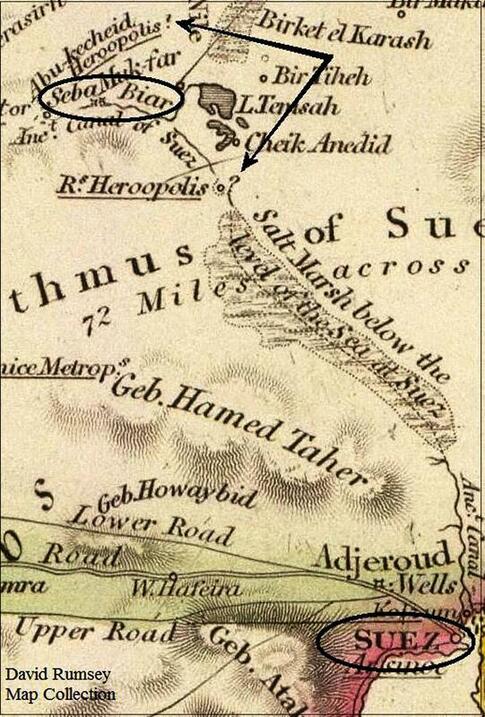
The location of Kadesh at the site where Heroopolis was later built works well for a station to exit out of and into Lower Egypt. On the last map notice the “salt marsh,” which is said to be below the level of the sea and is between Lake Timsah and the Gulf of Suez. As given earlier many scholars believe the Bitter Lakes, including Lake Temsah, were at one time connected to the Gulf of Suez, and not just by a canal, but from the Gulf of Suez stretching farther inland. During that time period for someone to exit Egypt to the east, he would need to be at least as far north as Heroopolis.
The battle Israel lost at Kadesh-barnea was against the Amorites. They were told not to fight them. “Go not up, neither fight; for I am not among you…” (Deuteronomy 1:42). But they “went presumptuously up into the hill. And the Amorites, which dwelt in that mountain, came out against you, and chased you, as bees do...” (Deuteronomy 1:43–44). The word “hill” and “mountain” in these last two verses is the same Hebrew word. There are some hills to the east of the Isthmus of Suez, but on the map they are hard to notice; also, south and east of Lake Timsah there is Jebel Miriam, a ridge of low mountains.14
Beer-sheba. There is an expression found seven times in the Bible, “And all Israel from Dan even to Beer-sheba....” (I Samuel 3:20—this represents all the territory of Israel.) Dan was in the north of Israel and Beer-sheba was in the extreme south, “and they went out to the south of Judah, even to Beersheba” (II Samuel 24:7). As Beer-sheba was linked with the extreme most point of Israel, it would be expected to be on the southern border of Israel where Kadesh-barnea was (Numbers 34:4, Joshua 15:3).
There is an old argument about the possibility of two Beer-shebas. Abraham first gave the name “Beer-sheba” (Genesis 21:31), and then years later in Genesis 26:32–33 it is said, “And he [Isaac] called it Shebah: therefore the name of the city is Beer-sheba unto this day.” There are some Bible scholars who believe that Isaac was only reaffirming what his father had done. The city of Beer-sheba that is in southern Israel today may have been called by this name in ancient times. But the one used in the expression “And all Israel from Dan even to Beer-sheba...” would have been at the border of Israel. The Beer-sheba of today is inside the ancient southern border of Israel, from twenty to forty miles inside, depending on whose ancient border one goes by.
The scholars give two possible meanings for the name Beer-sheba; one is “seven sells” and the other is “well of the oath.” An oath was made at Beer-sheba, but the scholars say that though the word “sheba” in the Hebrew is similar to the word oath, it is not the same word and should be translated the cardinal number seven.
The Bible points to Beer-sheba being near Egypt. Hagar, who originally came from Egypt, would have been expected to return there. And when she fled from Sarai, Abram’s wife, she went toward Egypt as she was found “by the fountain in the way to Shur” (Genesis 16:7). And later, when Abraham sent her out, she departed with Ishmael and “wandered in the wilderness [not the city] of Beer-sheba” (Genesis 21:14). She appeared to be living next to Egypt as she took for her son “a wife out of the land of Egypt” (Genesis 21:21). And it has already been brought out that the descendants of Ishmael (Hagar’s son) lived in the Eastern Desert of Egypt. On the last map right by Heroopolis is circled “Seba Biar,” which is Arabic for “Seven Wells”. In Hebrew, adjectives can appear after nouns, thus Beer for well and sheba for seven, or “wells seven” for Beer-sheba. But Arabic can have adjectives before nouns, or Seba Biar. And we find Seba Biar right on the border (where I believe it should be) near “Holy Field” (Kadesh-barnea).
Rekem
There is a belief that a place named “Rekem” was the name the Arabians gave to Kadesh. “Rekem, who was of the same name with a city, the chief and capital of all Arabia, which is still now so called by the whole Arabian nation, Arecem, from the name of the king that built it; but is by the Greeks called - Petra” (Josephus. Antiquities, IV, 4, 7). Josephus said that Petra, which was between Israel and the Gulf of Aqaba, was at one time called “Arecem” (Rekem). The three Targums are fairly consistent in associating “Rekem” or “Rekem Giah” with Kadeshbarnea, and “contentious waters in Rekem” or “waters of strife, which is Requam” with the second Kadesh. Were there two locations with the name Rekem?
“Lake of Heropolis; the lake is now Birket-et-Timsah ‘the lake of the crocodile,’ and is supposed to mark the ancient head of the gulf. The canal that connected this with the Nile was of Pharaonic origin. It was anciently known as the ‘Fossa Regum’ and the ‘canal of Hero’”15 (Smiths Bible Dictionary). Heroopolis is right on the “canal of Hero” which “was anciently known as the “Fossa Regum.” These names keep “popping up.” Kadesh-barnea (Holy Field, which was located at Heroopolis), Rekem (Regum), and Beer-sheba (Seba Biar) are all very close together.
Paran
Meaning of name, Strong’s #6290 Paran = “place of caverns”
The name is found twelve times in the Bible, six times as the “wilderness of Paran,” three times only as “Paran,” two times “mount Paran,” and one time “El-paran.” It would appear there were at least three different places named Paran, one a “wilderness,” one a “mount.” and one a city. “And they arose out of Midian, and came to Paran: and they took men with them out of Paran, and they came to Egypt…” (I Kings 11:18). Though it is still possible the name “Paran” could refer to either the mountain or wilderness, at least in this last verse it is more probable that it refers to a city, as they took “men with them out of Paran.” It was unlikely they would have found men in the desert or the mountain. Josephus mentions a Paran when talking about “Great Idumea...and at the valley called Paran, he enlarged many of the caves….”16 This is believed to be the ancient fortress city of Petra by Edom and, at the least, a city with many people.
We know that Kadesh-barnea and the Wilderness of Paran were together, “unto the wilderness of Paran, to Kadesh” (Numbers 13:26). What follows is given only as a possibility, but it seems to work with the name Paran being the name, or one of the names, for this country, where the Midianites, Ishmaelites and Amalekites lived.* I do not want to be confusing on this, as I already said one Paran was a wilderness, one a mountain, and one a city. It was the Greeks who gave the name “Troglodytes” (“cave dwellers”) to this country, which was hundreds of years after the Exodus of Israel. The Hebrews would have given some name for this country, would not Paran, “place of caverns” fit?
*(Amalekites was one of the people groups who lived in Paran, but not the Amorites. In Deuteronomy 1:19, after they had left Mount Horeb, it said, “we went through all that great and terrible wilderness, which ye saw by the way of the mountain of the Amorites, as the LORD our God commanded us; and we came to Kadesh-barnea.” This verse does not say they went through or by the “mountain of the Amorites,” but that they went “by the way” of the mountain of the Amorites. For this verse Gesenius’ Lexicon gives for the meaning of “by the way” the idea of going “toward” the mountain of the Amorites. That is why in the next verse, after they came to Kadesh-barnea, it says, “Ye are come unto the mountain of the Amorites.” They had not arrived at the Amorites’ territory till they arrived at Kadesh-barnea.)
There were many caves in the mountains on both sides of Wady Arabah (just north of Hazeroth, or Miriam’s pool), and this area could be included in the Wilderness of Paran, with the word Paran meaning “place of caverns.” “You see a great number of deep caves on the Kolzim, Keleil and Askar Mountains”17 (Fleuriau d’Armenonville, 1725). These mountains with “a great number” of caves are on the north and south sides of Wady Arabah (where Rithmah and Rimmon-parez were found). If these mountains would be part of the “mount Paran” range, then the “wilderness of Paran” could have taken its name from the surrounding mountains, which is where we would expect to find this wilderness as it follows Hazeroth (where Miriam’s pool was). “And afterward the people removed from Hazeroth, and pitched in the wilderness of Paran” (Numbers 12:16).
The Midianites were only one of many different people groups living among the Troglodytes (“cave dwellers”). The Bible speaks of a people named Horites who lived in two locations (more on this later) and in the time of Moses, the Troglodytes people were called the Horites, also meaning “cave dweller” (Strong’s 2752). Gesenius’ Lexicon gives for the meaning of El-Paran, El for “mighty one,” and Paran for “abounding in caverns.” El-Paran would certainly be a fitting name for the land of the Horites (“cave dwellers”). This would explain why we were told to look for the Wilderness of Paran right after Hazeroth, but again find the Wilderness of Paran at Kadesh. Remember it was an eleven-day journey from Horeb to Kadesh-barnea, with a four-day journey till Hazeroth, requiring several more days of journey from Hazeroth to Kadesh. Even the routes that say Rithmah was Kadesh-barnea still acknowledge there were several stops between Hazeroth and Kadesh-barnea. The Wilderness of Paran would have covered a large area, again lending itself as the name of the land. In Genesis 21:21, we are told that Ishmael “dwelt in the wilderness of Paran…” and it was brought out before that at that time he lived in the Eastern Desert of Egypt. (See Chapter Two.)
In Deuteronomy 33:2, Sinai, Seir, and Paran are either close together or show a south-to-north direction. “The LORD came from Sinai, and rose up from Seir unto them; he shined forth from mount Paran, and he came with ten thousands of saints: from his right hand went a fiery law for them.” With Israel headed north from Mount Sinai and then by Mount Seir (discussed later), the verse said the next mountain was Paran. It is possible in this context that Mount Seir and Mount Paran were both names for this area, like Mount Seir was sometimes used as the name for Edom. The parallel passage for this is found in Habakkuk 3:3–7 “God came from Teman, and the Holy One from mount Paran. Selah….and burning coals went forth at his feet….I saw the tents of Cushan in affliction: and the curtains of the land of Midian did tremble.” It is interesting that this passage of the Exodus mentions the affliction of Cushan and the trembling Midians, showing their proximity to the Exodus route.
The song of Deborah found in Judges 5:1–5, which talks of Mount Sinai, not only says it was close to Seir but also names “Edom”. “LORD, when thou wentest out of Seir, when thou marchedst out of the field of Edom….” The name Edom means “red,” and the ancient Egyptians called the desert, including the entire Eastern Desert, the “red land” (field of Edom).
Kehelathah
“And they journeyed from Rissah, and pitched in Kehelathah” (Numbers 33:22).
Meaning of name, Strong’s #6954 Kehelathah = “assembly”
Problem. I did not find the name, but I did find the location by finding Kadesh-barnea, because Jewish sources say Kehelathah was at Kadesh. Names given to describe an area may last through the years as the land is likely to remain the same. Place names that existed before Israel came to the location may also last. But I believe names given by Israel that describe an attitude of rebellion were not as likely to survive, especially when given in a country outside of Israel, for the inhabitants of that country are not as likely to keep in remembrance an event of foreigners, such as Massah for “Temptation,” Meribah for “Strife,” or as in this, the “Assembly.”
Reasons. Targum Jonathan (3rd century AD) said, “thence to Kebelath [Kehelathah], where Korach and his companions banded together against Mosheh and Aharon….”18 Legends of the Jews said, “Korah’s rebellion took place during Israel’s sojourn in Kadesh-Barnea, whence, a short time before, the spies had been sent out.”19 These two quotes show that Kehelathah was where Korah’s rebellion took place and that this happened at Kadesh-barnea. This “assembly” (Kehelathah) refers to Numbers 16:19, where “Korah gathered all the congregation against them [Moses and Aaron]….”
This is why many articles and commentaries have been written about the encampment of Kehelathah taking place at Kadesh-barnea, for that was the most logical time for the rebellion to have happened. The Israelites had been discouraged by their defeat and the fact they were condemned to wander aimlessly in the desert till their generation died off. They could neither have gone to the land of Canaan nor back to Egypt but had to live in the wilderness. They did not want to accept this, and so we are told it was at “Kebelath, where Korach” withstood Moses and that “Korah’s rebellion took place during Israel’s sojourn in Kadesh-Barnea….”
Two mountains named Seir! One was in Edom and the other was near Mount Horeb. Esau lived in the country of Edom, called the land of Seir or Mount Seir. Most believe that the name Seir came from a people called “Horims,” because they were called “sons of Seir the Horites” (Genesis 36:20), and that the places where they lived received the name Seir, either “mount Seir” or the “land of Seir.” When God gave this land to Esau, it appeared to have been already named Seir *“I have given mount Seir unto Esau for a possession” (Deuteronomy 2:5). But we find the Horites also lived in another location before they were in the land of Seir in Edom.
Now because the name Horite “cave dweller” was used in the Bible before the Greek name Troglodytes, also “cave dwellers”, some have thought that perhaps the country of Troglodytes was in Edom where the Horites once lived. But when Josephus talked about Moses being in the nation of Troglodytes, the Horites had already been chased out of Edom. “As he did to the children of Esau, which dwelt in Seir, when he destroyed the Horims [Horites] from before them; and they succeeded them, and dwelt in their stead even unto this day…” (Deuteronomy 2:22). Esau and his descendants had lived in Edom since Genesis 32:3 and 36:8, before Israel came to Egypt.
*(“Meddle not with them; for I will not give you of their land, no, not so much as a foot breadth; because I have given mount Seir unto Esau for a possession” [Deuteronomy 2:5]. Some have a problem here as it is believed Israel, on her wilderness journey, traveled across the land at the northern end of the Gulf of Aqaba, which was also the Territory of Edom/Esau [I Kings 9:26, II Chronicles 8:17]. Edom’s stronghold was the mountains, which they would not allow the Israelites to cross, but God said he would not give them even a “foot breath” of Edom’s land. And God did not give them any of that land, but Israel paid to cross it [Deuteronomy 2:27–29]. There has also been an attempt by some to place Mount Sinai in Edom, but Israel stayed at Mount Sinai for eleven months, again, Sinai in Edom does not work with “I will not give you of their land, no, not so much as a foot breadth”.)
In the Bible it is clear that Seir was in two different locations! Deuteronomy 2:1, speaking of Israel says, “we compassed mount Seir many days”; at that time Israel was going around in circles waiting for her forty years to be up. The word “compassed” in this verse is the same word used where Joshua is said to have “compassed” the walls of Jericho seven days. But when Israel’s time was finished at Mount Seir, she was given new orders. “Ye have compassed this mountain long enough: turn you northward” (Deuteronomy 2:3). The Israelites were done encircling “mount Seir” and now headed north toward the Promised Land. Then the next verse says, “And command thou the people, saying, Ye are to pass through the coast of your brethren the children of Esau, which dwell in Seir (verse 4). But for several years they had already been at “mount Seir” (verse 1) and now they are going to another Seir, which is also called “mount Seir” (verse 5). It has already been explained what happened here, that they had asked permission to go through Edom but were refused, so they had to turn back and go through rough terrain before they headed north. But why ask the Edomites for permission to go through their country of Seir if Israel had been going around (“compassed”) it for years? So there were two locations named Mount Seir as the Bible said (Deuteronomy 2:1, 5). During the wanderings of the children of Israel, they were not close by Edom or “partially” encompassing Edom’s Mount Seir, as most believe, but were at another “mount Seir” many miles away.
In Genesis 14:5–7, where we have been before, we found four kings and their armies headed up by King Chedorlaomer, and they are doing battle with “the Rephaims in Ashteroth Karnaim, and the Zuzims in Ham, and the Emims in Shaveh Kiriathaim, And the Horites in their mount Seir, unto El-paran, which is by the wilderness. And they returned, and came to En-mishpat, which is Kadesh, and smote all the country of the Amalekites….” Chedorlaomer and his army make war against the king of Sodom and those fighting with him, and Chedorlaomer’s group wins two battles (Genesis 14:1–10), and at least one of these battles is believed to have taken place by the Dead Sea. Perhaps so, but Chedorlaomer’s army would have left Kadesh by this time, and to try and make all the place names given in Genesis 14:5–7 be near the Dead Sea, as some do, is hard to believe.
Chedorlaomer had fought with the “Zuzims in Ham,” and the vowel pointing on the Hebrew word “Ham” in Genesis 14:5 is different than the other times the name Ham is given in Scriptures. Thus we are told it is not the “Ham” of Egypt (Psalm 78:51, 105:23, 27, 106:22), even though it is still transliterated the same in English as the “Ham” of Egypt. It has already been shown that “the Horites in their mount Seir” (who King Chedorlaomer fought) was one of two places named “Mount Seir” (Deuteronomy 2:1, 5). And according to Josephus, the Amalekites (who King Chedorlaomer fought, Genesis 14:5–7) extended up to Pelusium in Egypt. The Rephaims, Kiriathaim (“im” is a plural ending) and El-paran, look similar to places or names of people found in or near Egypt.
Mount Seir
Meaning of name, Strong’s #8165 Seir = “hairy” or
“shaggy.”
In the children of Israel’s forty years of wandering, they spent more time going around (“compassed”) this mountain than at any other location. But it is not even listed in Numbers 33 (nor is Mount Sinai for the same reason) because they had not actually encamped on Mount Seir, only around it. Its sole purpose was to waste time “wandering” (Deuteronomy 1:46–2:1).
Reasons. Mount Seir is named between Horeb and Kadeshbarnea when the eleven days of travel time was given. So when the children of Israel left Kadesh, they turned back toward Mount Horeb on their way to Mount Seir. When the Bible was written, there were no chapter or verse divisions and Deuteronomy 1:46–2:1 were all together. (The chapters and verse numbers were added later to help us find verses in the Bible.) One can see from this passage that there are no encampments given between Kadesh-barnea and Mount Seir. There are a number of stops, but no encampments are named. The Israelites were going back toward Mount Sinai, and the encampments have already been named so there was no need to give them again.
Because of Israel’s failure at Kadesh-barnea, she had been given new orders with a new direction. “Then we turned, and took our journey into the wilderness by the way of the Red sea…” (Deuteronomy 2:1). The Nile and the Delta should have been at flood stage when they “turned” and went in the direction of the Yam Suf. When at Kadesh-barnea, the spies had been sent into the Promised Land, which was “the time of the firstripe grapes” (Numbers 13:20), which is the month of August,20 and the floodwaters of the Delta do not peak till the month of October and still require several weeks to subside after that. They were not loitering around, but as Josephus said, they moved out right away. Israel returned to the Eastern Desert and from there she “compassed” Mount Seir.
It will be explained in this section that Mount Seir was in the way geographically, so that it was not possible to proceed in a straight line between Horeb and Kadesh, but to reach Kadesh Israel had to travel from “Horeb by the way of mount Seir unto Kadesh-barnea” (Deuteronomy 1:2). The point I am making is that Mount Seir was centrally located between Horeb and Kadesh-barnea, in the middle of the Eastern Desert, so when traveling between Mount Horeb and Kadesh-barnea, it would have been necessary to go by or get around Mount Seir.
Gesenius’ Lexicon calls the Horite “a troglodyte,” “cave dweller.” Moses called people living in the Eastern Desert Horites and the Greeks called them Troglodytes. Archaeologist Wall, when speaking about the Eastern Desert of Egypt said, “The flat country along the shore seems to have been formerly denominated Hor’ or ‘Horeth’….the residence of the ‘Horites’ or ‘Troglodytes.’”21 And because the name Seir came from the Horites (Genesis 36:20, 29–30), we would expect to find the name Seir in this area of Troglodytes. On the 1844 map, just to the west of Wady Annaba, is “Jebel Aschar,” which I am proposing for Mount Seir. This is the Mount Seir that was between Jebel Gharib (Horeb) and Kadesh-barnea in the eleven days’ journey. Because of where Jebel Aschar (Mount Seir) is situated, it was not possible to go in a straight line from Horeb to Kadesh and that is why it is “by the way of mount Seir.” (By the way, when it says “by-the-way” of Mount Seir, this “way” does not have to be a highway, as some have imagined. Strong’s #1870 gives “way, road, distance, journey, manner,” and any one of these is a possible meaning of the word, including the first one, which was given as “way.”)
When I sought for the meaning of Jebel “Aschar.” most translators could not give an answer. One said he thought it might mean soldier, and it could mean this. I found the Arabic word for soldier was spelled “askar” or “askarī,” and it would have been easy to write down ch for the k. It is also possible it could be the Arabic “shaar” (hair), which is the meaning of Seir, Strong’s 8165 gave for Seir = “hairy” or “shaggy”. Especially when one sees how the name is spelled on other maps. The spelling for this same mountain is given as “Shaire” or “Shera” on the maps for 1854, 1893, 1895, 1910, and 1922. (All from the David Rumsey Map Collection.) In 1871, Bible commentary Jamieson, Fausset & Brown called the Mount Seir in Edom “Jebel Shera,” the same spelling as on the maps just mentioned for the Eastern Desert. The Red Sea coast city of El Gouna, which is eighty miles south of Jebel Gharib, was originally called Abu Schaar. This spelling of “Schaar” is found on many maps (including some modern maps), and it is not disputed that this name means “hair.”
The Arabic definite article “al” sometimes gets attached to names, and the letter l is silent before the s. Notice the A on the front of Jebel A-schar (1844 map) has been dropped and the ch is changed to h and becomes Shaire/Shera for the maps for 1854, 1893, 1895, and 1910. This is closer to the spelling of “shaar” (hair) than the traditional Seir or Mount Seir that is north of the Gulf of Aqaba; also, the traditional Seir or Mount Seir is found fewer times on these older maps than the one in the Eastern Desert. The traditional Mount Seir is given as Scherah on the 1853 map and Schera on the 1875 map (David Rumsey Map Collection). I am not disputing the location of the traditional Mount Seir, for there were two mountains named this. I only wanted to show that the spelling for the traditional Mount Seir (“Scherah”) is not as close to the Arabic “shaar” (hair) as “shera” is in the Eastern Desert.
On the 1844 map, there was another route, shown by a dotted line, which came down from the north through the center of the desert. This route is known as Irwin’s Route, which we have mentioned before. He made this trip in 1777 with a caravan of less than twenty camels. It was possible for caravan members, being so few, to take the route they did, but it would have been a real problem for Israel to have crossed the same rough terrain and to have gone through the narrow ravines that Irwin did. But the 11 days to Kadesh will follow at least part of this route.
Jebel Aschar is in the right location, being in the middle of the desert. And to have traveled from Mount Gharib (Horeb) to Holy Field (Kadesh-barnea), it would have been necessary to go by this mountain. Regardless of which way one left Jebel Gharib, whether south first and then west at Zafarana as the children of Israel did, which was when they passed by Jebel Shera, or the route from the west side of Horeb, it still would have been necessary to go by the way of Jebel Aschar/Shera (Mount Seir). Once at Jebel Aschar/Shera, a person could have gone south all the way to “Holy Field” (Kadesh-barnea) without any detours. The Ataka mountain had a break in it of about ten miles wide, which almost lined up between Holy Field and Mount Shera, only requiring a few degrees off due north to have reached Heroopolis.
As explained earlier in Chapter Four, the eleven days of travel to Kadesh were neither consecutive days nor the time it would have taken a nation to travel, but they reflect the normal time an average adult would have traveled, about twenty miles per day or 220 miles for eleven days. And it is about 220 miles from Mount Gharib via Mount Shera to Heroopolis (Holy Field). I have worked this out on both old and modern-day maps and the route fits; if anything, on some maps it took less than twenty miles a day.22
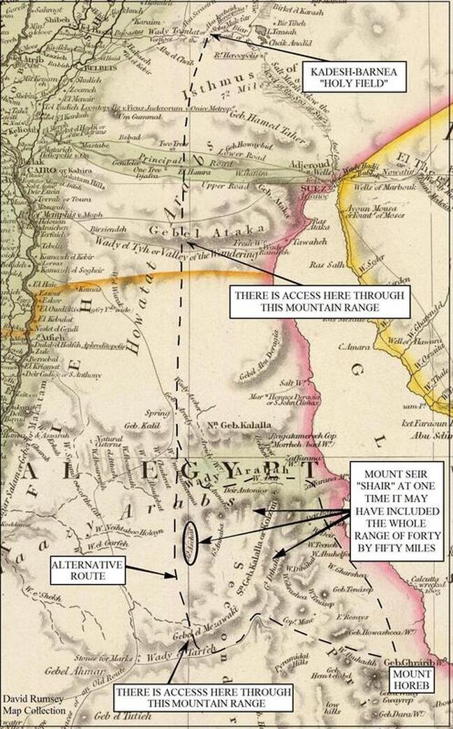
Application
A. At Mount Seir there was no purpose, only “wandering” around and waiting for time to expire. Deuteronomy 2:1 became the life verse of the children of Israel: “and we compassed mount Seir many days.” In one verse we have a life in vain, as the sigh of Simon, “we have toiled all the night, and have taken nothing…” (Luke 5:5). Are you wandering around?
B. Israel had been “sent to her room,” and after thirty-eight years it was time to come out and try it again, and this time she succeeded. “And the LORD spake unto me, saying, Ye have compassed this mountain long enough: turn you northward” (Deuteronomy 2:2–3). The children of Israel had to learn their lesson the hard way, and they finally had enough faith to trust the Lord and made it all the way to the Promised Land. Once there, they still had battles (it was not heaven), but God gave the victory and it was much better than the desert. But with a little faith it could have happened thirty-eight years earlier!
If you believe you can serve God when you feel like it, then you may find yourself as Israel, going in circles for the best years of your life. “I am come that they might have life, and that they might have it more abundantly” (John 10:10).
ENDNOTES
1. Josephus. Antiquities, VI, 7, 3.
2. Ibid. IV, 1, 3.
3. Heinrich Brugsch. Geography, I, 254.
4. Edouard Naville. The Store-City of Pithom and the Route of the Exodus (1903), 10.
6. Etheria. The Pilgrimage of Etheria (385 AD), 15.
7. Herodotus. II, 111, 3.
8. Diodorus Siculus. Library of History, I, 59.
9. Ibid. I, 59.
10. Conrad Malte-Brun. Universal Geography (1825), 53.
11. Ibid.
12. Edouard Naville. The Store-City of Pithom and the Route of the Exodus (1903), 25.
13. Dr. William Smith. Smiths Bible Dictionary, under R, Red Sea point #3, Ancient limits. Also Edouard Naville. The Store-City of Pithom and the Route of the Exodus (1903), 7–8.
14. Edouard Naville. The Store-City of Pithom and the Route of the Exodus (1903), 25.
15. Dr. William Smith. Smiths Bible Dictionary, under R, Red Sea point #3, Ancient limits.
16. Josephus. Antiquities, IV, 9, 4.
17. Thomas Charles Fleuriau d’Armenonville. Nouveaux memoires des mission de la Compagnie de Jesus dans le (1725), 137.
18. Targum Jonathan. Numbers 33:?
19. Louis Ginzberg. Legends of the Jews (1909), vol. III, The Waters of Meribah..
20. Jamieson, Fausset & Brown, Bible Commentary, Numbers 13:20
21. Historical account of discoveries and travels in Africa (1817), vol. II, by Hugh Murray, John Leyden, (Dr. Wall), 181.
22. The maps with zoom-in, zoom-out controls did not always seem to be consistent in their distance given. It was possible on the same map when using the zoom feature to end up needing twelve days while other times only ten, but it usually worked out to eleven days at a little less than twenty miles a day.
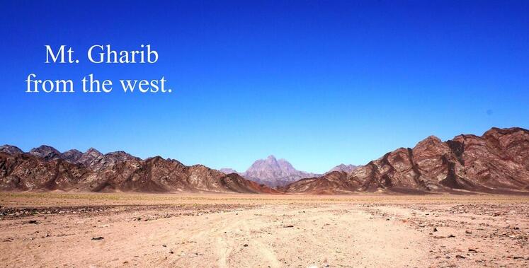
Chapter Six
Mountain of God
Mount Sinai, Mount Horeb
Meaning of name, Strong’s #5514 Sinai = “thorny” Gesenius’ Lexicon Sinai = “clayey,” “miry.”
Meaning of name, Strong’s #2722 Horeb = “desert” Gesenius’ Lexicon Horeb = “dry,” “desert.”
Questions. “Would not the real Mount Sinai have signs of being burnt, and are the Bible scholars right who claim Mount Sinai was an active volcano?” Some also claim that the cloudy pillar by day and column of fire by night was just a volcanic ash plume, and that it never moved. “And it came to pass, as Moses entered into the tabernacle, the cloudy pillar descended, and stood at the door of the tabernacle, and the LORD talked with Moses” (Exodus 33:9). That does not sound like any volcanic ash plume to me. Also, “the pillar of the cloud went from before their face, and stood behind them: And it came between the camp of the Egyptians and the camp of Israel…” (Exodus 14:19–20, Numbers 9:15–23). I feel ridiculous even trying to explain this, but because some believe it I am trying to respond to all points.
“And mount Sinai was altogether on a smoke, because the LORD descended upon it in fire: and the smoke thereof ascended as the smoke of a furnace, and the whole mount quaked greatly. And when the voice of the trumpet sounded long, and waxed louder and louder, Moses spake, and God answered him by a voice. And the LORD came down upon mount Sinai, on the top of the mount: and the LORD called Moses up to the top of the mount; and Moses went up” (Exodus 19:18–20). The reason Mount Sinai was all aflame was “because the LORD descended upon it in fire….” This was a supernatural act of God and is why Moses could climb up to the top and not be hurt. Of course, climbing up to the top of an active volcano would give one a very short life!
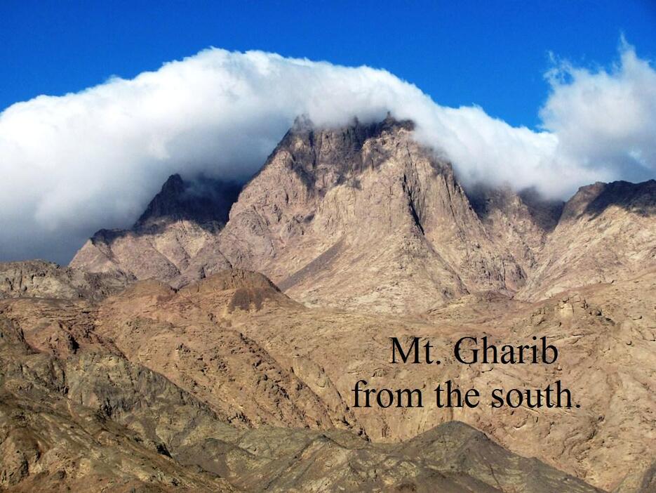
Aristobulus (Jewish Alexandrian philosopher, 3rd–2nd century BC) said, “For though the places were all ablaze, the fire did not actually consume any of the things which grew upon that mountain: but the herbage of all remained untouched by fire…” (Praeparatio Evangelica, VIII, 10). There should be no signs of a burnt mountain, any more than there was a sign of a burnt bush that God’s fire engulfed but did not consume (Exodus 3:2–3). There are dozens of mountains in the Eastern Desert that are darker in color than the surrounding mountains and some of them were volcanoes, and some of them were not.
As to the idea that Mount Sinai was an active volcano, this is what is called “biblical” archaeology today, but it needs to be taken out of this category and placed on the shelf with evolution and the world-is-flat theory. The Bible teaches the world is round Isaiah 40:22. Verses that say unto the “end of the earth” are only figures of speech, which every generation and language has. We say “shooting star,” but if a star that is a sun shot past our Earth we would all be toast. Even newspapers say “sunrise/sunset,” but the sun has never done either, as the world rotates. When Christ comes back the Bible says it will be both “day” and “night” at the same time. This is only possible if the earth is a globe (Luke 17:31, 34).
Should we find the twelve pillars that Moses made? “And Moses wrote all the words of the LORD, and rose up early in the morning, and builded an altar under the hill, and twelve pillars, according to the twelve tribes of Israel” (Exodus 24:4). Even though Moses most likely had help with these, the fact that he rose “early in the morning” to accomplish this would (at least to me) point to it being a one day’s job, not enough time to have left behind rounded tooled columns. The word in the Hebrew that is most often translated “pillar,” according to Strong’s, is #5982 but this is not the Hebrew word that is used here in Exodus 24:4, which Strong’s gives as #4676 “pillar, mastaba, stump.” Strong’s said it “occurs 32 times,” and nineteen times it is translated “images” or idols, which of course Moses would not have made, and twelve times it is translated “pillar/pillars,” Of these, at least eight times it was only one stone, and done in one day, obviously not rounded tooled columns. “And Jacob rose up early in the morning, and took the stone that he had put for his pillows, and set it up for a pillar, and poured oil upon the top of it” (Genesis 28:18, Genesis 31:45).
Moses made the altar and the “twelve pillars” at the same time, and we are plainly told God wanted no tooled altar, because manmade objects would make it “polluted.” “An altar of earth...And if thou wilt make me an altar of stone, thou shalt not build it of hewn stone: for if thou lift up thy tool upon it, thou hast polluted it” (Exodus 20:24–25). For the Tabernacle and its vessels, God wanted things made beautiful, but not in this natural setting, and it follows that if God did not want stones for the altar to be tooled then He would not want stones for the pillars to be.
Should we expect to find the “sapphire” stones that Moses and the seventy elders of Israel saw on Mount Sinai? “And they saw the God of Israel: and there was under his feet as it were a paved work of a sapphire stone, and as it were the body of heaven in his clearness” (Exodus 24:10). The sapphire stone was associated with heaven, God, and his throne; when God and His throne left, then the sapphire stones left (Ezekiel 1:26, 10:1).
Was Mount Sinai really the “mountain of God” (Exodus
3:1) or did He have to share it with occult deities? It is commonly taught that the name Sinai came from a Babylonian moon god named Sin, and some of the proposed sites for Mount Sinai were places of worship for pagan gods. “And he said, Draw not nigh hither: put off thy shoes from off thy feet, for the place whereon thou standest is holy ground” (Exodus 3:5). Not even Moses was allowed to wear his shoes when he was on “holy” ground. This word “holy” means “apartness, holiness, sacredness, separateness” (Strong’s #6944). It means something that is set apart for God’s purpose. But some would have us believe God’s Mountain was a place of occult worship and covered in pagan symbols.
Josephus, when talking about the area around the Holy Mountain, said, “the best for pasturage, the herbage being there good; and it had not been before fed upon, because of the opinion men had that God dwelt there, the shepherds not daring to ascend up to it...how bold he [Moses] had been in venturing to come into a place whither no man had ever come before, because the place was divine; and advised him to remove a great way off from the flame….”1 With this said, and the part about Moses not using tools even when building an altar to God, lest Moses “polluted it,” would Moses then have chiseled “graffiti” (petroglyphs) on Mount Sinai as the heathen were known to do at their places of worship? I would not expect to find any from Moses or from those who lived in this area, as Josephus said, “the shepherds not daring to ascend up to it.” (Two inscriptions, one by a pharaoh of Egypt and one by a Queen of Egypt have been found there, more later.) Today, man could not make “the mountain of God” any holier by building shrines, monasteries, or snack bars for tourists; it was already holy even before Moses and the children of Israel came there. Would it not be wise to leave it alone in its natural setting?
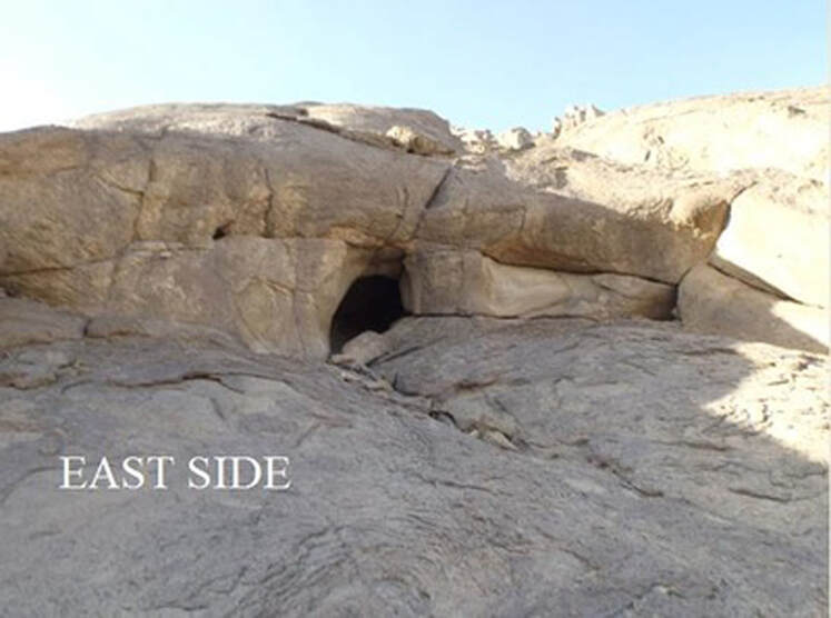
Would it be wrong to climb this mountain? Others have, and all proposed sites for Mount Sinai have been scaled several times. It is called “the mountain of God” (Exodus 3:1) and at least a part of it was said to be “holy ground” (Exodus 3:5), but the city of Jerusalem is the “city of God” (Psalms 87:3) and also on a “holy mountain” (Daniel 9:16), with people walking all over it. Should we make pilgrimages there? Elijah and the Apostle Paul went to Mount Sinai (discussed later), but I do not believe it will make anyone holier. When Elijah came to Mount Sinai, he stayed in a cave, but God twice asked him, “What doest thou here, Elijah?” Then He sent Elijah back to serve Him by ministering to others and telling them what God had said.
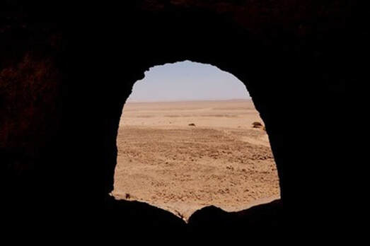
Inside picture of last cave on east side of Jabal Gharib.
I am glad we were able to go there; we spent a day on the northwest side of the mountain and two days on the south, east, and northeast sides. We also drove around it and encamped one night on the east side of the mountain. We climbed up a few hundred feet on the south shoulder, southeast and northeast side of Jebel Gharib. Anyone who wants to make a trip there should bring lots of water, a Bedouin guide, and a four-wheel-drive vehicle is a must! There is no road to the mountain, but you can see both camel paths and tracks of four-wheel-drive vehicles there. We entered from the south side and left on the north side. Though one can drive right next to the mountain on the east side, he cannot enter from the east, as it is a restricted area.
I am glad we were able to go there; we spent a day on the northwest side of the mountain and two days on the south, east, and northeast sides. We also drove around it and encamped one night on the east side of the mountain. We climbed up a few hundred feet on the south shoulder, southeast and northeast side of Jebel Gharib. Anyone who wants to make a trip there should bring lots of water, a Bedouin guide, and a four-wheel-drive vehicle is a must! There is no road to the mountain, but you can see both camel paths and tracks of four-wheel-drive vehicles there. We entered from the south side and left on the north side. Though one can drive right next to the mountain on the east side, he cannot enter from the east, as it is a restricted area.
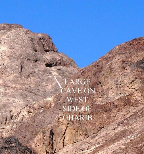
Why two names for the same mountain? Gesenius’ Lexicon said that Mount Sinai was only one part of Mount Horeb, and that “Horeb seems to have been a general name for a whole mountain of which Sinai was a particular summit.” I said before that the Gharib mountain range covers an area of over fifty square miles and has one very prominent peak, which I believe would have been “Sinai.” That is why in the Bible Sinai and Horeb are basically used interchangeably, except where it refers to the Wilderness of Sinai. Horeb is never called a wilderness but there was a “wilderness” of Sinai, and it is found thirteen times in the Bible.
Should we find water erosion marks from the rock that Moses struck at Horeb (Exodus 17:6)? I do not see how water erosion marks can be used as evidence that one has the right spring of Moses. Water erosion marks can be found all over the desert! In the Eastern Desert of Egypt it seldom rains, but when it does it pours. These flash floods are what cause the wadis in the desert and they are found around every mountain. At Mount Gharib there are some large wadis, especially on the south and east sides. Water erosion marks can also be found in the granite gullies of Mount Gharib (last picture), as they could at any mountain in the area.
Should we find water erosion marks from the rock that Moses struck at Horeb (Exodus 17:6)? I do not see how water erosion marks can be used as evidence that one has the right spring of Moses. Water erosion marks can be found all over the desert! In the Eastern Desert of Egypt it seldom rains, but when it does it pours. These flash floods are what cause the wadis in the desert and they are found around every mountain. At Mount Gharib there are some large wadis, especially on the south and east sides. Water erosion marks can also be found in the granite gullies of Mount Gharib (last picture), as they could at any mountain in the area.
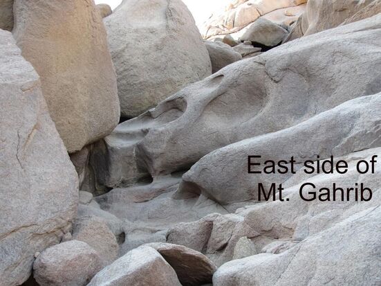
At the Gharib Mountain Range there is the “Fount of the Salve” (Hem-t-elabd, Wilkinson translation), and this may preserve the event described in Exodus, but to point to water erosion marks is not evidence. Nor is a picture of a large, split rock. Legends of the Jews (vol. III, Miriam’s Well) makes the rock out to be something small. The Bible does not tell us how large the rock was, and split rocks can be found anywhere.
The lay of the land on the east of Mount Gharib, where the children of Israel probably encamped, has a gentle slope of a few degrees. It is made up of sand and gravel from the wadis and run off from the mountain, which have built up over the centuries. There were two or three wadis where flash floods have cut through these deposits to a depth of over twenty feet, leaving the impression that the deposits from these runoffs were at least this thickness.
The lay of the land on the east of Mount Gharib, where the children of Israel probably encamped, has a gentle slope of a few degrees. It is made up of sand and gravel from the wadis and run off from the mountain, which have built up over the centuries. There were two or three wadis where flash floods have cut through these deposits to a depth of over twenty feet, leaving the impression that the deposits from these runoffs were at least this thickness.
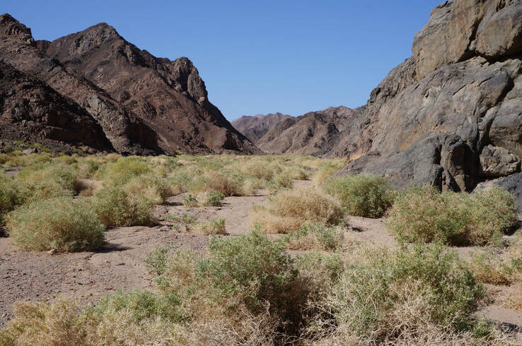
The Eastern Desert used to have more foliage.
Sir Wilkinson said, “there must be in places similar reservoirs of water in the granite, which, being compact, could retain it [water] for a great length of time when not exposed to evaporation. I cannot otherwise account for the quantity of trees, the luxuriant appearance of their foliage, and the greenness of the herbage, which in the vallies of the secondary mountains are always parched up or, at best, display but little signs of life.”10 There is more greenery on the west side of the mountain, but the east side had few trees and little herbage. As bad as the deserts were in the days of Moses, it is agreed that the present state of the deserts of Egypt is worse.11
Meaning of the name Gharib. Names change over the centuries and none of the mountains that claim the title of Mount Sinai today are called “Jebel Sinai.” Many of the place names I gave in this book were not original names but new ones the conquerors had given in their languages, but often preserving the original meaning in the new name. There are many old maps that have Mount Gharib with two names, the one it has today and “Agrib,” meaning camel’s hump, referring to the distinctive peak of the mountain.
The Apostle Paul said, “For this Agar is mount Sinai in Arabia…” (Galatians 4:24–25). Paul was making an “allegory” in the preceding verse between Mount Sinai and Hagar, but he also may have been telling us the name that Mount Sinai was called in the Arabia of his day. (And many Bible commentaries agreed with this.) The name Hagar means “the stranger”; it also means “flight” in the sense of leaving one country to go to another4 (Easton’s Bible Dictionary). The name Gharib means “strange,” as in foreign. Paul had been to Arabia (Galatians 1:17) and knew the name the Arabians gave this mountain, and he said, “Agar is mount Sinai in Arabia.” Gharib is not how Hagar is spelled in the Arabic language, even though both have similar meanings. Though Paul was still calling it Sinai in the 1st century, it appears that those of his day who spoke the language of the Eastern Desert, where the mountain was located, may not have. Perhaps as the languages changed with the new conquerors, so did the name, and it became Gharib.
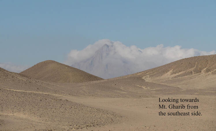
The port city of Ras Gharib, on the Red Sea coast (about 25 miles from Mt. Gharib), also bears this name “strange” as the mountain does. And if the name “strange” did not come from Hagar, then such a peculiar name would have been given for some reason. The following are given only as possibilities. The name may have come from Moses. “And she bare him a son, and he called his name Gershom: for he said, I have been a stranger in a strange land” (Exodus 2:22). When Moses named a place, as he did on the Exodus route, it most often became its name. “Strange” was the name he gave the land; the mountain was already called Sinai, but later generations could have called the mountain Gharib also. There is also the strange glow of Mount Gharib, discussed later. (The Wilderness of Sinai may have received its name from the mountain as Acts 7:30 says, “the wilderness of mount Sina”.)
Reasons
Backside of the desert. Mount Gharib sits on the west side of the desert, sixteen miles from the Gulf of Suez. Exodus 3:1 says that Moses “led the flock to the backside of the desert, and came to the mountain of God, even to Horeb.” For “backside of the desert” Gesenius’ Lexicon gives “to the west of the desert,” and this is the standard interpretation (see also Numbers 3:38).
Would it hurt your eyes to look at Mount Sinai? Sounds like a strange question, but Josephus said of Mount Sinai, “indeed, it cannot be looked at without pain of the eyes” (Antiquities III, 5, 1). Some people believe this was because it was a steep or high mountain, as Josephus said, “Mount Sinai, which is the highest of all the mountains that are in that country and is not only very difficult to be ascended by men, on account of its vast altitude, but because of the sharpness of its precipices also; nay, indeed, it cannot be looked at without pain of the eyes.” Much of my life I have been around mountains; I was raised in the Sierra Nevada Mountains, and for the last twenty-seven years I have lived at the foot of the beautiful Bucegi Mountains in the heart of Romania. And it does not hurt your eyes to look at a high or steep mountain. But when you are near any mountain and looking toward the summit, and if the sun is high in the sky, then yes, it will hurt your eyes, but that is because of the sun, not the mountain. Josephus was giving three reasons why it was hard to climb. First, it was high; second, it was steep; and third, it was hard to look upon.
The classical writers talk of such a mountain. Diodorus (1st century BC) said, “first of all we shall take the right side, the coast of which is inhabited by tribes of the Trogodytes as far inland as the desert. In the course of the journey, then, from the city of Arsinoê along the right mainland, in many places numerous streams, which have a bitter salty taste, drop from the cliffs into the sea. And after a man has passed these waters, above a great plain there towers a mountain whose colour is like ruddle and blinds the sight of any who gaze steadfastly upon it for some time. Moreover, at the edge of the skirts of the mountain there lies a harbour, known as Aphroditê’s Harbour, which has a winding entrance” (Diodorus, History, III, 39, 1). Because he said at “the skirts of the mountain” was Aphrodite’s Harbour, which was believed to be the port of Myos Hormos, people have looked for the mountain “whose colour is like ruddle” at this ancient port, which archaeologists said was situated about seventy miles south of Mount Gharib. And they have given the location for this mountain (Actually, they had four possible locations for this mountain.) within close proximity to the ancient harbor of Myos Hormos. But at the beginning of this century, the archaeologists moved the location of Myos Hormos more than a hundred miles farther south. Now they will have to move their guesses as to where this red-colored mountain was also. However, this came from Diodorus, who never saw this mountain. He got his information from the sailors who had been on the Red Sea and from sitting in the Alexandrian library and pulling books (scrolls) off the shelf. “I refer to the Arabian Gulf [Red Sea] drawing in part upon the royal records preserved in Alexandria, and in part upon what we have learned from men who have seen it with their own eyes” (Diodorus, 1st century BC, History, III, 38, 1).
Reading these ancient writers, it is easy to have the impression that all these ports, springs, and mountains were close together, but they were not. Strabo (1st century AD, Greek geographer) said, “As one sails from the City of Heroes along the Troglodytic country, one comes to a city Philotera, which was named after the sister of the second Ptolemy, having been founded by Satyrus, who had been sent for the purpose of investigating the Troglodytic country and the hunting of elephants. Then to another city, Arsinoê. Then to springs of hot water, salty and bitter, which flow down a high rock and empty into the sea. There is a plain near these springs a mountain, which is of a red color like minimum. Then one comes to Myus Harbour, which is also called Aphrodite’s Harbour….” (Strabo, Geography, XVI, 4, 5). Strabo most likely received his information from a geographer named Artemidorus (1st century BC), as he quotes from him in this same paragraph; unfortunately, the works of Artemidorus are now lost to us except where he is quoted by others. Notice that Strabo, who gives the same order of the sites as Diodorus, said this mountain was “near” the hot springs (Ain Sukhna), not Myos Hormos, but these hot springs are a hundred miles north of Mount Gharib.
In both accounts of Diodorus and Strabo, the mountain was said to be in a plain. Mount Gharib sits in the middle of an eighty by fifteen-mile desert, and is by far the most notable mountain in that whole area. Diodorus added that in this “great plain there towers a mountain” (the one that “blinds the sight”); this would fit Mount Gharib. Both Diodorus and Strabo said it was as a bright rust-colored mountain, “colour is like ruddle” (red iron ore), and “a red colour like minium” (red lead). However, most ancient geographers do not mention this blinding rust-colored mountain. During the time I was at Mount Gharib, including driving around it once, I only noticed this bright red color one time in a shaded area, seen in the following picture and this picture is not enhanced. But it depends on the angle of the sun and how clear the sky is. In 1937, an archaeologist named G.W. Murray climbed Mount Gharib and said, “All the massif…is composed of a beautiful red granite, which glows at sunrise and sunset like a red-hot iron.”2 So this bright color could only be seen in the morning and evening. And often there are sandstorms that cover the mountain in dust. Also, it is possible Mount Sinai may have been named after the appearance of red clay, “clayey” (Sinai). It is interesting that Josephus said that Mount Sinai, which he located near the country of Troglodytes, would hurt your eyes to look upon, and Diodorus also said that sailors off the coast of Troglodytes saw a mountain that hurt their eyes. I cannot remember anyone ever saying that about a mountain before.
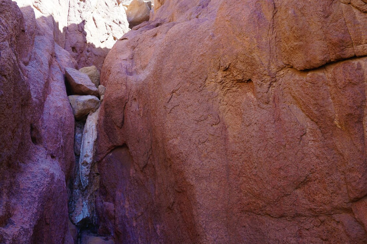
The eleven days to Kadesh-barnea (Chapter Four) fits with Jebel Gharib being Horeb. Jebel Shaire (Mount Seir) is situated in such a position that one has to go by it in order to travel to “Holy Field” by Heroopolis. There are also the rare place names of the encampments of Israel, some found nowhere else in Egypt, and falling in the right order. Couple this with the route we followed that led us up to and away from Mount Gharib, and all this points to this mountain being Mount Sinai.
“Mount Horeb.” The Arabic name Gharib is similar to the pronunciation of Mount “Horeb.” The Hebrew word Horeb with Kh in place of H, as given by Strong’s pronunciation (“Khoreb”), could sound like the Arabic word Gharib. The spelling of Ghrarib on the 1844 map with the extra r is rare; it is most often Gharib and is sometimes spelled Chareb or Kharib on the following maps of 1829, 1844, 1848, 1875, and 1892 (David Rumsey Map Collection).
At the start of this search, I believed I was the only one who had ever considered the possibility that Jebel Gharib was Mount Horeb (Sinai). But Sir Wilkinson said, “I will not pretend to decide whether this name [Gharib] is derived from, or bears any relation to, Hor, Horeth, Horeb, or the Horebites, mentioned by a modern author as that of the country of the Troglodytes....”3 I was unable to find out who the “modern author” was. It would have been helpful to know the arguments, both for and against. It is evident he lost the debate as everyone is looking for Mount Horeb/Sinai east of the Isthmus of Suez. This belief probably died out because all believed Israel made the sea crossing from the Gulf of Suez, or north or it, or even farther east at the Gulf of Aqaba, and therefore Israel would not have turned back to the Eastern Desert of Egypt. At any rate, as stated by Sir Wilkinson, people at one time debated the possibility that Gharib/Charib for Chrb was “derived from…Horeb,” Strong’s transliteration of Horeb was “Choreb” for Chrb.
Both Philo and Josephus said it was the tallest mountain in the area. “For, having gone up into the highest and most sacred mountain in that district in accordance with the divine commands, a mountain which was very difficult of access and very hard to ascend…”5 (Philo). “[T]aking his station at the mountain called Sinai, he drove his flocks thither to feed them. Now this is the highest of all the mountains thereabout...”6 (Josephus).
They did not say it was the highest in the country but “in that district” and “thereabout.” Jebel Shaib al Banat is higher than Jebel Gharib, but it is ninety miles away to the south. What Josephus and Philo said would eliminate the traditional Mount Sinai of Mount Musa at 7,497 feet, for right by it is Mount Catherine at 8,625 feet. Another contender for Mount Sinai is Jebel Khashm et-Tarif, which is in the Negev Desert of the Sinai Peninsula, but it is barely a hill, being only a few hundred feet high. There is a passage in Legends of the Jews about a conversation “between mountains” that are arguing over which one should have the honor to be chosen as the one that God would descend upon. But the biggest mountains were rejected because they were too “proud,” and so the honor went to Mount Sinai, because it was portrayed as the smallest of mountains and therefore more “humble.” At any rate, Josephus and Philo did not get their information from talking mountains.
The last picture is of Mount Gharib from the southeast side. It has an elevation of 5,479 feet, but because the desert floor is only a few hundred feet above sea level, the mountain appears much taller. In many places, it rises at more than a forty-five degree angle and some areas look almost vertical. Mount Sinai, as described by Philo, was “very difficult of access and very hard to ascend.” Sir Wilkinson climbed Mount Gharib in 1823 and said, “During our stay here we ascended the mountain, which, from its steepness, and the frequent occurrence of ravines, is rather a fatiguing undertaking.”7 Another contender for Mount Sinai is Mount Lawz in Saudi Arabia, which is the highest mountain in its area, but it does not have the sharp ascent of Jebel Gharib. It has been argued that Moses at eighty years of age could not have climbed a steep high mountain, but the Bible said, “when he died: his eye was not dim, nor his natural force abated” (Deuteronomy 34:7).
A pharaoh of Egypt came to Mount Gharib! In December of 2013, an Egyptian man, Mr. Hosam Mosa, found a Greek inscription at Jebel Gharib. This discovery was a full two years after my book Exodus was published and from which this present book came from. When Mr. Hosam told me of the inscription he found, I did not expect much. Sir Wilkinson had not mentioned any inscription by Mount Ghraib. The only Greek writing he mentioned on his trek through the Eastern Desert was a few letters scratched on rocks at watering holes between Mount Ghraib and the Monastery of St. Paul.
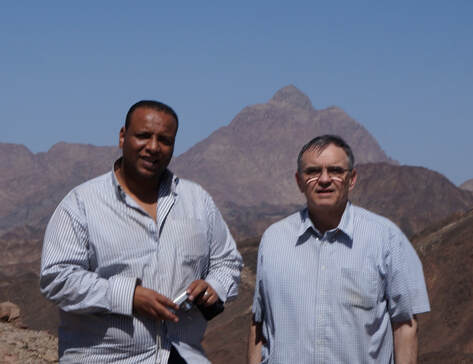
Our Bedouin guide drove us around Mount Gharib and I shot some pictures from the west side. Then Mr. Hosam took me to see the writing he had found. I was surprised by the inscription for two reasons. First, it was right next to the mountain (less than a hundred feet) on a large boulder situated where Jebel Gharib starts its abrupt and steep climb upward, positioned on the southeast side not far from a creek gully. Second, it was not a few scratches but a real inscription (31 letters). It was obviously old and he had to point it out to me twice before I began to make out the letters. As will be seen, the pharaoh who had this inscription made would not have stayed long at Mount Gharib. He did not have the time to make a finished stone with the engraving that he did later, so he used the rough surface of a granite boulder.
If someone thinks such inscriptions are found all over the Egyptian desert, he is mistaken. Over 99 percent of Egyptian inscriptions were found in the Delta and Nile Valley. Wadi Hammamat, about a hundred and fifty miles south of Mount Gharib, has two-hundred inscriptions but outside of that location they are rare and even more rare to find the name of a Pharaoh. Pictures will follow, first from a distance and later close-ups. The first picture will have the area of the inscription highlighted by a white rectangle.
If someone thinks such inscriptions are found all over the Egyptian desert, he is mistaken. Over 99 percent of Egyptian inscriptions were found in the Delta and Nile Valley. Wadi Hammamat, about a hundred and fifty miles south of Mount Gharib, has two-hundred inscriptions but outside of that location they are rare and even more rare to find the name of a Pharaoh. Pictures will follow, first from a distance and later close-ups. The first picture will have the area of the inscription highlighted by a white rectangle.
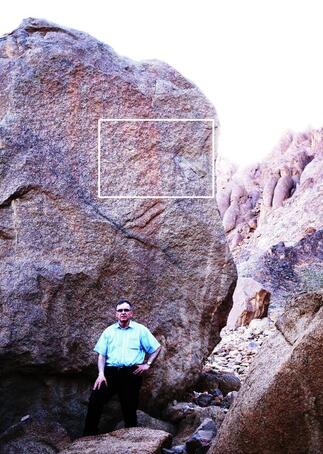
The inscription is on a red granite boulder, about twenty-five feet high. The letters are in capitals about eight- to ten-inches tall, engraved in three lines, with the bottom line around six feet over my head.
The picture to the right is a close-up of over half the inscription. What follows are each of the three lines with the Greek printed below. |
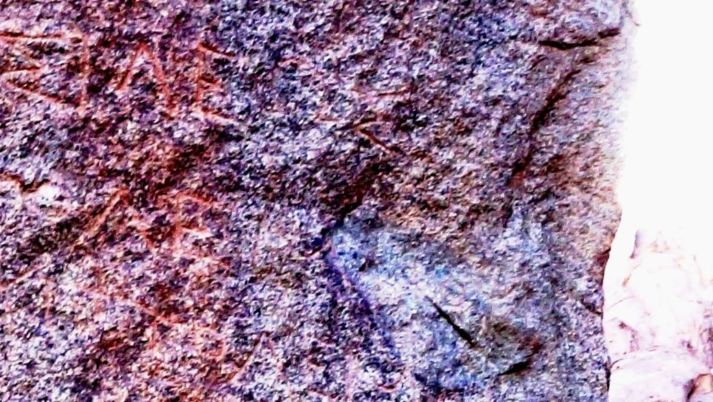
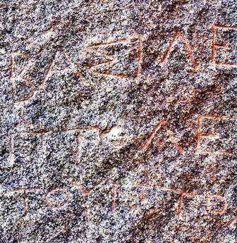
|

|
ΒΑΣΙΛΕΩΣ |
ΠΤΟΛΕΜΑΙΟΥ
ΤΟΥ ΠΤΟΛΕΜΑΙΟΥ
The first line is ΒΑΣΙΛΕΩΣ, “KING”; the second line ΠΤΟΛΕΜΑΙΟΥ, “PTOLEMAIOU”; and the third line reads, ΤΟΥ ΠΤΟΛΕΜΑΙΟΥ, “SON (of) PTOLEMAIOU.” “King Ptolemy Son of Ptolemy” was the title and name of the second king in the Ptolemaic Dynasty. In the book The House of Ptolemy by E. R. Bevan, when speaking about the second Ptolemy said, “He was known to his contemporaries simply as ‘Ptolemy the son of Ptolemy’” (III, page 56).
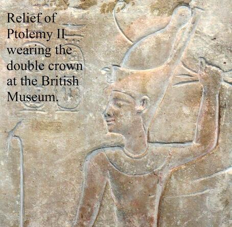
Alexander the Great had conquered Egypt in 332 BC, and after his death his kingdom was dived among his four generals, with Ptolemy I Soter taking Egypt. There were several Ptolemies in this dynasty, which lasted almost three hundred years, with the last one ruled by the famous Queen Cleopatra. The second Ptolemy was the one who left his inscription at Mount Gharib. He is also known as Ptolemy II and Ptolemy Philadelphus. He reigned in Egypt from *285 BC to 246 BC, which means this inscription is at least 2,260 years old. *(This is counting the joint reign of over two years with his father.)
In May, 2016, was found yet another Greek inscription about 50 feet north of the first inscription. It has the distinction of being written upside down. At least that is how it was found on another huge boulder. Apparently, an earthquake had caused it to roll down the steep incline of the mountain and it landed on its top. The above picture is with the Greek letters right side up. Written in three lines, “Arsinoès theas phila delphou” or “Arsinoe the goddess, the sibling-loving”. This was the title of Ptolemy II’s second wife who he married sometime between 280 and 272 BC. These two inscriptions, that of Ptolemy II and his Queen, are the only two inscriptions known at Mount Gharib.
http://www.tyndalehouse.com/egypt/ptolemies/arsinoe_ii_fr.htm
I started studying Ptolemy II and found he was by far the richest and most prolific builder of all the Ptolemies in his dynasty, some believe of all of them put together. He had a taste for the bizarre and imported huge snakes and elephants from Africa. He was depicted in pharaonic clothes but never spoke Egyptian, and never met a “god” whose idol he did not worship. He killed his two half brothers8 and married his full sister (her inscription is above), something repugnant to even the ancient Greeks. And he ended up proclaiming his sister/wife and himself gods. (Other than that, he was a nice guy, Ha Ha!) He did, however, have three big pluses: He ruled Egypt well, he was unbelievably rich (an understatement), and one would have to go back to the time of Joseph to find a king of Egypt who favored the nation of Israel more than he did.
Would you like to help put a puzzle together? What was Ptolemy Philadelphus and his sister queen doing at Mount Gharib? He wanted others to know he was there; he left his title and name engraved in granite. There had to be a reason he went to such an out-of-the-way place.
In 1882, Swiss Egyptologist Edouard Naville excavated a site east of the Nile Delta that he believed was the biblical city of Pithom. He found, among other things, a stele he said was “the largest and most important monument discovered” at the site. He called it “the great inscription of Ptolemy Philadelphus,” the same king who engraved his name at Mount Gharib. “The tablet has a height of four feet three inches, and a width of three feet two inches. It is now preserved in the Museum at Cairo.”9 The main criticism of this stele was the poor quality of the engraving in certain lines. But the area of interest for our search, which is the main place name “Prstt,” had no problem with the engraving, however there is an argument over its interpretation.
Edouard Naville said the stele was “intended to be an important historical record of certain acts of the second Ptolemy.”9 And the stele has four different dates given of events that took place under the rule of Ptolemy II. At the end of line 6, “In the sixth year…”; line 15, “The twelfth year…”; line 16, “In the year 16…”; and line 27, “The twenty-first year….” This is the type of register that we should look to find out what he did, where, when, and why. I will give the interpretation of lines 11 and 12, our area of interest, which was worked on by archaeologist Edouard Naville and German Egyptologist Heinrich K. Brugsch (author of several important works on Egypt and hieroglyphics).
“…His Majesty [Ptolemy II Philadelphus]
Line 11. – went to Teshiit at the entrance of the South. He reached the land of Persia, and found the gods of Egypt, all of them. His Majesty brought them to Egypt. They came with King Ptolemaeus to Khemtit, and they protected(?) His Majesty going to Egypt. They were received by the inhabitants of Egypt, full of joy at the arrival of these gods. After these things His Majesty was exalted, because he brought back.”
Line12. – “the gods of Egypt. It pleased all of them to come with His Majesty, in order to confer honours upon him. Tum will increase his reign to an eternal duration.”
There are three problem place names in line 11: “Teshiit,” “Persia,” and “Khemtit,” with the main problem being “Persia.” Persia was the focus of the text and the only name mentioned where something happened: Ptolemy II “found the gods of Egypt.” There is no battle mentioned and scholars are puzzled as to how he could have entered a foreign country and raided its temples to recover the idols of Egypt without a war.* These idols were apparently stolen earlier by, archeologists believe, a country powerful enough to have entered Egypt and to have grabbed her idols. Again, the heart of the text said, “He [Ptolemy II] reached the land of Persia, and found the gods of Egypt, all of them. His Majesty brought them to Egypt.” But there has been a long debate over whether he went to Persia or not. *(Ptolemy II could not have gone to either Persia or Palestine without fighting a war, but he would not have been expected to fight a battle in the Eastern Desert.)
The problem was the place name Prstt (transliteration of the hieroglyphs). Most of the scholars believe it to be either Persia or Palestine. The other two names, Teshiit and Khemtit, are usually not mentioned as they are not sure where they are located, and they will concentrate their efforts on the place name Prstt as it was the main focus. There are many other places named on this Pithom Stele, and those who interpret it are all basically in agreement, except the names in line 11. Does it not seem strange that this one line with three place names has produced only two questions marks and an argument?
The Scholars are looking in the wrong places! And when they comment on the interpretation of the rest of this stele, they are kind one toward another, that is, except on this one line, line 11, and then the “atmosphere” definitely changes and they become sharp in their criticism. I will share a couple of examples here; Dr. Joachim Friedrich Quack, a scholar of distinction and director of Heidelberg University’s Institute of Egyptology, said, “Personally, I think the equation with Palestine is highly dubious, to say the least.”10 And classical scholar W. W. Tarn and Fellow of the British Academy, said in regards to it being Persia, “this is out of the question…the idea that Ptolemy II circumnavigated Arabia is absurd.”11 I gave this sampling of the arguments so the reader will catch the tone of the discussion, and more importantly, to see that there is not an agreement, even by the best of scholars on this one line and all three of these place names. As you no doubt have guessed, I do not agree with any of them on the locations they gave for line 11. But I admittedly have a big piece to the puzzle they did not have, Ptolemy’s inscription at Mt Gharib. This helped with the location and later where Ptolemy got his wealth.
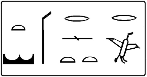
“ Prstt” or “Prs”
How can the scholars read the same Egyptian hieroglyphics and one group say the name was Palestine and the other Persia? The hieroglyphics pictured above are read from right to left and the transliteration of the hieroglyphs into Roman or Latin letters is Prstt. The mouth sign in the upper right-hand corner is not part of the place name. Under that is the bird in flight, which is p3, then the next sign to the left and above is again the mouth sign, and here it is the consonant r. Then under that the “door bolt,” which looks like a string with a knot tied in the middle, and has an s sound. Then under that are two half circles, “loafs,” which are the double tt. One loaf is normally sounded out as t, and the double tt almost always has no sound and is used like a *determinative to tell us that it is a foreign land. Then moving to the left again is the so called “throw-stick,” which is a determinative without phonetic value and tells us the name is of a foreign country or person. Then to the left another loaf, or t. And last, under that is a sign that looks like a crown, which is also a determinative without phonetic value, and tells us it is a desert or foreign country. Two archaeologists assured me that both determinatives (throw-stick and crown) are for the place name Prstt. *(Determinatives are not pronounced but describe the idea or give a description of the word.)
Again the double tt has no sound and is usually dropped from the word, unless in the rare occasion when it is to be sounded out. Therefore, you will find the reading of this place name as Prstt or Prs. Egyptian hieroglyphics are a consonantal language, with the vowels being conjecture, and so there are possible different spellings. Also, the r in Egyptian hieroglyphics was weak, and is often translated as an l. This is why some have Prstt as Plst, and with the vowels added, Palestine. Even though there is still no n as required for the name Palestine. Or some drop the double tt to become Prs, which with the vowels could be Persia. But though Ptolemy II did fight a battle in Palestine, he did not fight any in Persia, nor did the Babylonians or any neighboring nation of Persia record such. And in this Pithom Stele, Ptolemy is leading the expedition, not sending some troops there.
So, what has been said is that both names, Palestine and Persia, have problems. Prstt will not give the n sound for Palestine, and Prs will not work with Persia because Ptolemy fought no known battle there. But both sides have a much bigger problem.
Hey guys, my compass is pointing in another direction! In line 11 of the Pithom Stele, where we find the three place names, Teshiit, Prstt, and Khemtit, Ptolemy II said he went to the “South.” And this will rarely be used by one side or the other as Persia is east and Palestine is north, not south. (See map below.) If the directions were not important, they would not have been given.
Sometimes these scholars have Ptolemy II going south in a ship, but they end up having him turn north in the Arabian Gulf. They have painted themselves into a corner by not following the directions! The archaeologists will say that they have found Prstt in other hieroglyphics that would work for Palestine or Persia. But that is the reason the stele said he went “south,” so as not to confuse it with another place. The reason the scholars do not place the name in the south is because they could not find there the name Prstt, but it is there. And though I am not a scholar, I can read those who are, and support for where I place Prstt comes from what they have said.
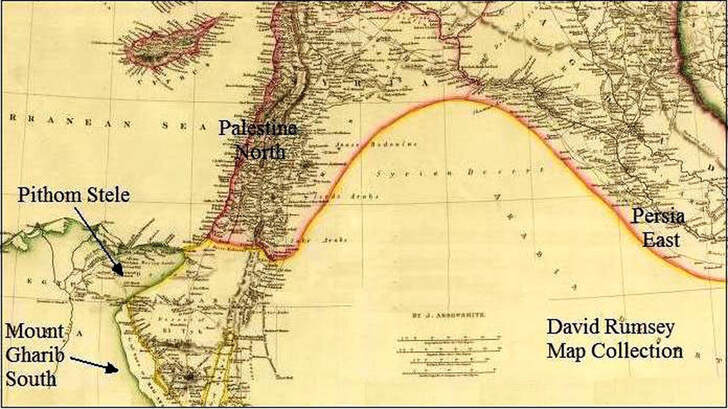
“His Majesty went to Teshiit at the entrance of the South.”
It will be helpful to see how the Egyptians used the four cardinal points of the compass. The city of Pithom, where the Pithom Stele was found, was often described in hieroglyphs as the city “which is at the Eastern door.”12 The city of Thebes was the largest city in southern Egypt and was sometimes referred to simply as “the Southern city.”13 And because of the geography of Egypt, the “entrance of the South” would be Wadi Hammamat. Both Wadi Hammamat and “the southern city” (Thebes) are close to the 26 parallel.
It will be helpful to see how the Egyptians used the four cardinal points of the compass. The city of Pithom, where the Pithom Stele was found, was often described in hieroglyphs as the city “which is at the Eastern door.”12 The city of Thebes was the largest city in southern Egypt and was sometimes referred to simply as “the Southern city.”13 And because of the geography of Egypt, the “entrance of the South” would be Wadi Hammamat. Both Wadi Hammamat and “the southern city” (Thebes) are close to the 26 parallel.

In southern Egypt, the Nile River makes a bend to the east for several miles (see following map) up to the ancient city of Coptus before it turns west toward Thebes. Here at Coptus was the shortest route from the Nile to the Red Sea; this route went directly east for about one hundred miles to the ancient port city of Quseir. The route was used by caravans and those who worked the gold mines of the Eastern Desert. Wadi Hammamat was in the middle of this natural corridor through the eastern mountains of Egypt and was sometimes called the “Southern Narrow Doorway.”14
Edouard Naville and Heinrich Karl Brugsch, both of whom translated this stele, gave the reading as “south,” though Brugsch thought it was at the “end” of the south while Naville believed it was at the “entrance” of the south. I mention this because some scholars today say it should not read south at all. What follows are the hieroglyphs.
Harbor of King Khufu The remains an ancient 4,500-year-old Egyptian harbor was discovered by an Egyptian and French archaeological team in 2013. It is located about 40 miles north of Gebel Gharib and could have been used by Ptolemy II.
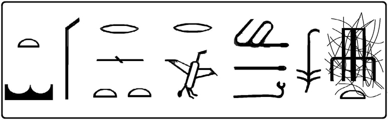

Again, reading from right to left, the first engraved sign was of poor quality, shown by the semi scratch lines. The next sign to the left is “south.”15
Line 11, “His Majesty went to Teshiit at the entrance of the South. He reached the land of Persia [Prstt], and found the gods of Egypt, all of them. His Majesty brought them to Egypt. They came with King Ptolemaeus to Khemtit, and they protected His Majesty going to Egypt.”
Ptolemy II had a large navy and would have taken ships to the “entrance of the South” (Wadi Hammamat), where he and his mercenary Greek army would have disembarked at the ancient port of Al-Quseir (believed to be Myos Hormos) and gone north searching (explained later) for Prstt. When it said, “He reached the land of Persia” (Prstt), where he found all the idols, he then changed direction. He did not go past Prstt but only went as far as, “reached” this location. He then would have got back into one of his ships and continued in his original direction, south to Khemtit. The stele said he brought the gods with him (“They came with King Ptolemaeus to Khemtit”); for the duration of the trip, these idols were hauled around to “protect” the king. After arriving at Khemtit, and perhaps surveying the area and looking for elephants, he turned toward home, “going to Egypt.”
One of the names in line 11 that is seldom explained by the scholars was “Khemtit,” but the same name is found farther down in the stele. Line 22, which reads, “He navigated towards the coast of the Red Sea; he arrived at Khemtit.” This section is not the same expedition as found on line 11, nor is it the same year, but it would have been “year 16” (line 16). This was an expedition by the “general of His Majesty,” who in the next line (23) says, “He built a great city to the king with the illustrious name of the king, the lord of Egypt, Ptolemy.” This was the city of Ptolemais that Ptolemy II had built in his name for the hunting of elephants, which were captured and shipped back to Egypt for his army. This city, who built it, and where it was located is well known in history. It was on the Erythraean coast, between Ethiopia and the Red Sea. This, of course, is also south, and where it said, “He navigated towards the coast of the Red Sea he arrived at Khemtit,” this would be the coast of Troglodytes. The scholars probably did not mention any of this as it would have been another reminder that Prstt was in the “south.” Therefore, it is no secret where the place name Khemtit in line 11 was as the same place name was given in line 22 which is undisputed that it was in the south. It is true there was a slight difference for the hieroglyphics for Khemtit in line 11 and the Khemtit of line 22, but the difference was so slight that Edouard Naville could not spell it any different in English. And the scholars willingly accept the spelling variants between Kes/Gesem, or Qissa/Qes, or Troglodytes/Trogodite, or Medjay––Mday, Mazoi, and Mejay.
Diodorus (1st century BC) said, “For from earliest times until Ptolemy who was called Philadelphus, not only did no Greeks ever cross over into Ethiopia, but none ascended even as far as the boundaries of Egypt…but after this king had made an expedition into Ethiopia with an army of Greeks, being the first to do so, the facts about that country from that time forth have been more accurately learned” (Diodorus, I, 37). This above quote of Diodorus is not talking about the general of Ptolemy II who went to Ethiopia to build a city, but it says that Philadelphus himself went to Ethiopia. Which is what I have been saying.
The stele tells us that the other place name Teshiit was “at the entrance of the South,” or Wadi Hammamat. And “Teshiit” was given with the determinative for a “desert or foreign country” (the Eastern Desert was not part of ancient Egypt). Line 4 of the stele said, “he who averts the Tesheru (the nomads of the Arabian desert) by his intelligence.” The parenthesis in this line was put there by Edouard Naville, and he explains that the Tesheru were “nomads,” and he added that they lived in the “Arabian” desert.
Notice the similarities between the nomads called Tesheru and the desert or land of Teshiit. The Tesheru were not a particular tribe; the name was a derogatory term for all the different nomads of the desert, as some have used the word savages for the different jungle tribes. Egyptologist Wallis Budge said, “Tesh-t, the red land, i.e., the desert. teshu (tesheru), the “red” fiends, associates of Set.” (An Egyptian Hieroglyphic Dictionary, p. 889) The main difference was that the Tesheru were the “nomads” and Teshiit was their land, having the determinative for desert or foreign country. In the Pithom Stele in line 4, it talks about Ptolemy II who “averts the Tesheru,” the nomads, and in line 11, “His Majesty went to Teshiit.”
“Prstt,” the meaning and location. Mount Sinai was in the “wilderness of “Sinai” (Exodus 19:1–11), and to find the one would mean that you have found the other. I will briefly refresh what was said in Chapter Three about the name Sinai. I gave the name Wady Teeneh for Wilderness of Sinai, and though this name was some thirty-five miles north of Mount Gharib, it was the same desert plain that extended to this mountain. And this name Teeneh is only found one time in all the Eastern Desert.
Wilderness of Sin and Wilderness of Sinai are closely related. Strong’s transliterates the Hebrew “Ciyn” as Sin and “Ciynay” as Sinai. Gesenius’ Lexicon gave Sinai as “clayey, miry,” and Sin means “clay.” The difference between clay and clayey would be similar to the difference between mud and muddy. And at the Egyptian city of Pelusium, where the Arabic name Teen (clay) is placed on the maps, the scholars will place the Hebrew word Sin (clay). These Arabic words (Teen, Teeneh) seem more closely related than their corresponding Hebrew words (Sin, Sinai), for on the older maps the Arabic words Teen and Teeneh are used interchangeably for the location of Pelusium. From how these words are used, either Teeneh or Teen could be used as the equivalent of Sinai.
It was Ptolemy II who went to this Eastern Desert location and left his name there, so he would have used his Greek language (he did not speak Egyptian) to tell the scribe who made the Pithom Stele the name for this desert (“The Wilderness of Clay”). As the scholars believe the names Persia and Palestine were transliterated in the Pithom Stele. And the name for clay in Greek was pēlos (πηλός, Strong’s G4081, “clay”. Where the name Sinai appears in the Greek New Testament, it was the Hebrew word transcribed in Greek letters and not a Greek word with the equivalent meaning.)
There was no l in Egyptian hieroglyphics and was normally given in place of the Egyptian r. That is why many scholars believed Prstt was Palestine, substituting the r for the l. Therefore, the Greek word pēlos would be prs (without the vowels) in Egyptian hieroglyphs.
And interestingly the Greek word pēlos is the same word for the Greek-named city of Pelusium (ium was a common ending). So for the name of the same town, the Hebrew was Sin, the Arabic was Teen, and the Greek was Pēlos; in this context for a location they are interchangeable. And as given before by Easton’s Bible Dictionary, “called by the Greeks Pelusium, which means, as does also the Hebrew name, ‘clayey’ or ‘muddy,’ so called from the abundance of clay found there.” For the last nine years I have been studying place names in Egypt and nothing has fit so well.
Wady Teeneh, of our 1844 map, would work for the Wilderness of Sinai, which would be the Wilderness of Pēlos (prs), the desert Ptolemy II went to. And the determinative for Prs was for either a country or desert, “Wilderness of Sinai.”
Because the scholars do not agree as to where Prstt was, it should not be expected they would agree with me, especially since most do not believe in the account of the Exodus. But then they should answer the following: (1) What was Ptolemy II doing in this desert in front of Mount Gharib? (2) If the Pithom Stele is not describing Ptolemy’s expedition to this desert, where his name is inscribed, then where is it recorded in Egyptian records? (3) Because the Pithom Stele said Prs was by the “entrance of the South,” and Ptolemy II went to Khemtit in the south, and Diodorus said Ptolemy II went to Ethiopia in the south, and Ptolemy Philadelphus’s inscription was found in the south, therefore, where in the south can the place name Prs be found? In the south, please!
What were the gods of Egypt doing in the Sinai Desert? “His Majesty [Ptolemy II Philadelphus] went to Teshiit [the country of the nomads] at the entrance of the South [Wadi Hammamat]. He reached the land of Prstt [desert of Pēlos], and found the gods of Egypt, all of them. His Majesty brought them to Egypt.” When Israel came out of Egypt, not all of Egypt came out of her. None of the judgments of God on the Egyptians were on the land of Goshen where Israel was, including when God executed judgment on the gods of Egypt, and the Israelites also had the idols of Egypt. And when they left on their Exodus journey, they brought the idols of Egypt with them.
Ezekiel 20:7–11 says, “Then said I unto them, Cast ye away every man the abominations of his eyes, and defile not yourselves with the idols of Egypt: I am the LORD your God. But they rebelled against me, and would not hearken unto me: they did not every man cast away the abominations of their eyes, neither did they forsake the idols of Egypt: then I said, I will pour out my fury upon them to accomplish my anger against them in the midst of the land of Egypt. But I wrought for my name’s sake, that it should not be polluted before the heathen, among whom they were, in whose sight I made myself known unto them, in bringing them forth out of the land of Egypt. Wherefore I caused them to go forth out of the land of Egypt, and brought them into the wilderness. And I gave them my statutes, and shewed them my judgments….” They brought the idols of Egypt with them! And those in other countries knew about this. In Gill’s Exposition of the Bible, Exodus 11:5, he quotes from Justin16 (Roman historian, 3rd century AD) “Moses, being the leader of the exile Israelites, stole away the sacred things of the Egyptians, i.e. their gods.”
One can read online sites that say Israel was purged of these idols after she crossed the Red Sea. Yes, but when and where after she crossed the sea? These online sites get this information from an old Hebrew text called Exodus Rabbah, Beshalch, section XXIV. But those I found who could read Hebrew could not read it, because it has ancient Aramaic words mixed in.
I received help at a Synagogue from those familiar with this type of writing. I was told it was a Midrash (commentary), and its purpose was not to give the order of events but to explain how God led Israel, whether through Moses or his staff or the cloudy pillar. And because of this, it could not prove when their idols were removed, as this was not the purpose. The account jumped from one text to another, and in just three sentences it had Moses at Mount Sinai, then the Red Sea crossing, then Israel again in the wilderness with her idols and then Moses removing the idols. At any rate, the above Midrash said the children Israel had their idols in the wilderness and it was Moses who persuaded them to discard the idols.
In the same Ezekiel 20:23 the children of Israel were in the “wilderness” and in verse 24 “their eyes were after their fathers’ idols.” Israel still had the idols in the “wilderness,” for they could be seen. Verse 11 said God bought them out of Egypt to the wilderness and then gave them His statutes and judgments. At the encampment of Marah, Israel was given “statute and an ordinance” (Exodus 15:25), and the Talmud say Marah was where the Sabbath was first given to the nation of Israel (Sanh. 56b). The Ten Commandments were at Mount Sinai, including the second Commandment, “Thou shalt not make unto thee any graven image, or any likeness of any thing that is in heaven above, or that is in the earth beneath, or that is in the water under the earth” (Exodus 20:4). It would seem pointless to command Israel not to make idols if she still had them. In Exodus 32, while still at Mount Sinai, the rebels in the camp made the *golden calf to lead them back to Egypt, but why do this if they still had their idols? They must have gotten rid of them before this.
*(Most likely, the Apis ox of Memphis or the Mnevis ox of Heliopolis, worshiped by the Egyptians. Israel’s eagerness to make this particular idol gives the impression they worshiped it while in Egypt.
Greek became the language of the Mediterranean after Alexander the Great’s conquest. And the Hebrew Scriptures were translated into Greek by the order of Ptolemy II (more following). This would have infuriated the Egyptian priests and scribes, who up till that time had managed to keep the lid on what had really happened with Moses and the Exodus. It was an interesting paradox, for Egypt was ruled by a non-Egyptian pharaoh, Ptolemy II, who favored the Jews, while the priests of Egypt hated them. And along with the account of the Exodus were the Ten Commandments, which prohibit idols and teach there is only one God. Which if the Egyptians believed, would mean the priests of Egypt would all be out of a job, and today all the ancient temples of Egypt lie in ruin.)
Right after Moses arrived at Mount Sinai, God instructed him to prepare Israel for meeting Him in the cloud of fire. “And the LORD said unto Moses, Go unto the people, and sanctify them to day and to morrow, and let them wash their clothes” (Exodus 19:10). This was the first time the nation had been told to be sanctified. (While in Egypt, God had asked the “firstborn” to be sanctified, Exodus 13:2.) For “sanctify” Strong’s gives “to consecrate, sanctify, prepare, dedicate, be hallowed, be holy, be sanctified, be separate.” At the least this would include discarding idols. This was similar to the instructions given by Jacob, who just before he came to the “altar” of the House of God (“Bethel”) said “unto his household, and to all that were with him, Put away the strange gods that are among you, and be clean, and change your garments.” As the Israelites were told to “sanctify” themselves and to “wash their clothes.” We learned earlier that Moses was the one who got the Israelites to discard their idols (Exodus Rabbah) and Moses was the one who sanctified Israel. This would all point to Israel discarding her idols right after arriving at Mount Sinai. They likely buried these idols as did those who were following Jacob (Gen. 35:1-4).
Application. It is surprising Israel brought idols with them. But many believers hold on to sins in their hearts. “O Israel, if thou wilt hearken unto me; There shall no strange god be in thee; neither shalt thou worship any strange god” (Psalm 81:8–9). “No man can serve two masters: for either he will hate the one, and love the other; or else he will hold to the one, and despise the other. Ye cannot serve God and mammon” (Matthew 6:24).
Other kings of the Ptolemaic Dynasty had also brought idols to Egypt, but only after they had fought battles in other countries and then entered the temples and took their idols. The standard interpretation of Daniel 11:7–8 of the Bible has Ptolemy III Euergetes (son of Ptolemy II) going to war against the “king of the north” (Seleucid Empire which included Palestine, Syria and Persia). He came “with an army, and shall enter into the fortress of the king of the north…and shall prevail: And shall also carry captives into Egypt their gods….” (Daniel 11:7–8) Ptolemy III Euergetes fought a battle to get the idols, as would be expected. But how could one explain what Ptolemy II said, that he “found” the Egyptian gods without a battle, unless it had been those that Israel discarded in the wilderness. Also Ptolemy III Euergetes in his own words engraved on the Decree of Canopus (dated to 238 BC which was after the death of Ptolemy II) said, “They took care of the statues of the gods, which had been robbed by the barbarians of the land Persia from temples of Egypt, since His Majesty [Ptolemy III Euergetes] had won them back in his campaign against the two lands of Asia, he brought them to Egypt, and placed them on their places in the temples, where they had previously stood.” So if Ptolemy III Euergetes did this then his father Ptolemy II could not have gone to Persia also, for he said in the Pithom Stele that at the location he went to that he “found the gods of Egypt, all of them.” There would not have been any Egyptian idols left for Euergetes if he had gone to the same place as his father Ptolemy II.
Was the purpose of Ptolemy’s trip to find idols? Line 11 of the Pithom Stele gives no motive for this trip! David Lorton, in his book The Supposed Expedition of Ptolemy II to Persia, states, “It seems improbable that the primary purpose of the expedition was the recovery of divine images and the text seems to imply that their discovery occurred by chance….”18 Amen, I could not agree more! We know where Ptolemy II went because he left his name at Mount Gharib. And he told us he “found” lots of Egyptian idols there, and only Israel would have hauled them out to the desert and then left them there. But these idols were only an unexpected side benefit to his expedition. What then was his motive for going there in the first place?
Where did Ptolemy Philadelphus get his wealth? He did not get it from all the idols as these were given to the priests and temples of Egypt19 as were the taxes mentioned in the Pithom Stele (line 26–27). Yet he was the richest man in the world in his lifetime! Philo of Alexandria (Jewish biblical philosopher, 20 BC–50 AD) said, “Ptolemies, Philadelphus was the most illustrious; for all the rest put together scarcely did as many glorious and praiseworthy actions as this one king did by himself….”20 He finished building the world-famous Alexandrian library, museum, and Alexandrian lighthouse one of the Seven Wonders of the Ancient World. He redug the ancient canal from the Nile to the Red Sea and built a number of ports on the Red Sea coast.
Daniel 11:5 says, “And the king of the south shall be strong, and one of his princes; and he shall be strong above him, and have dominion; his dominion shall be a great dominion.” Jerome (theologian and historian, 4th century AD) wrote a commentary on Daniel 11:5 and said, “The person mentioned is Ptolemy Philadelphus, the second king of Egypt and the son of the former Ptolemy. It was in his reign that the Seventy (Septuaginta) translators are said to have translated the Holy Scripture into Greek. He also built and repaired many Egyptian Temples….For history relates that he possessed *two hundred thousand infantrymen, twenty thousand cavalry, and even two thousand chariots and four hundred elephants, which he was the first to import from Ethiopia. He also had a thousand five hundred war galleys of the type now known as Liburnian, and a thousand others for the transporting of military provisions. So great was his treasure of gold and silver that he received a yearly revenue from Egypt amounting to fourteen thousand eight hundred talents of silver.”21 *(Historians tell us he would not allow the Egyptians to bear arms, his army being made up off Greek mercenaries.22 This army, according to Theocritus [3rd century BC, Greek poet], was well paid. “I’ll e’en tell thee the best paymaster a freeman can have; King Ptolemy.”23)
The Grand Procession by Ptolemy Philadelphus. Think of the greatest parade you have ever seen and multiply it by one hundred, and then take the flowers off all the floats and instead cover them with silver, gold, and precious stones! The Grand Procession of Alexandria where Ptolemy II flaunts his wealth in front of the world was well known to the ancients. The date for this over-the-top procession ranges from 279–274 BC, depending on whom one reads. It is recorded by Callixeinus of Rhodes (2nd century BC) in the fourth book of his work on Alexandria, and what follows is less than 10 percent of what he gave. “Following…a hundred and twenty crowned Satyrs and Sileni, some carrying wine-pitchers, others shallow cups, still others large deep cups—everything of gold. Immediately next to them passed a silver mixing-bowl holding six thousand gallons, in a cart drawn by six hundred men.…Four large gold tripods were carried in the procession; and there was a gold chest for gold vessels, studded with jewels and having a height of fifteen feet, with six shelves, on which stood a great number of figures carefully fashioned, four spans high; there were also two stands for cups, and two glass vessels studded with jewels; two gold stands six feet high, beside three smaller ones, ten water-jars, an altar four and a half feet high, and twenty-five bread-plates. After all this there marched one thousand six hundred boys who had on white tunics and wore crowns, some of ivy, others of pine; two hundred and fifty of them carried gold pitchers, four hundred, silver pitchers; while another band of three hundred and twenty bore gold or silver wine-coolers….This cart was followed by five hundred young girls dressed in purple tunics with gold girdles. Those who were in the lead, numbering one hundred and twenty, wore gold pine-crowns….Then came camels, some of which carried three hundred pounds of frankincense, three hundred of myrrh, and two hundred of saffron, cassia, cinnamon, orris, and all other spice….In the procession also were many thrones constructed of ivory and gold; on one of these lay a gold diadem, on another a gilded horn, on still another a gold crown, and on another a horn of solid gold, upon the throne of Ptolemy Soter lay a crown made of ten thousand gold coins. In the procession also were three hundred and fifty gold censers, and gilded altars wreathed with gold crowns; on one of these, four gold torches fifteen feet long were affixed….Further, there were four hundred cartloads of silver vessels, twenty of gold vessels, and eight hundred of spices. After all these marched the cavalry and infantry forces, all wonderfully armed cap-à-pie. The infantry numbered about 57,600, the cavalry 23,200.”
I gave only a small percentage of the silver, gold and precious stones described in Ptolemy’s great procession in Alexandria, but enough to make the point that he had so much wealth he did not know what to do with it all! Appian of Alexandria (Roman historian, 2nd century AD) gave a staggering sum that Ptolemy II kept in reserves for his military, “money in their treasuries to the amount of 740,000 Egyptian talents. Such was the state of preparedness for war shown by the royal accounts as recorded and left by the king of Egypt second in succession after Alexander, who was the most formidable of these rulers in his preparations, the most lavish in expenditure, and the most magnificent in projects.”24 The “740,000 Egyptian talents” (one Egyptian talent was sixty pounds), if in gold at today’s prices, would have literally made him a trillionaire! And this was only his reserves in case of war. Also the buying power was far more then, as the ancients would work all day just for one denario (Matthew 20:9). Are these reports exaggerated? There is the man and there is the myth about the man, but by all accounts, his wealth could not be compared to anyone except, “He was on parallel to Solomon in his wealth.”25 (The House of Ptolemy, by E. R. Bevan) Even his contemporaries said the same. “For wealth, his would outweigh the wealth of all the princes of the earth together” (Theocritus, Alexandrian poet, 3rd century BC, Idyll XVII).
From where did he get it all? The reasons given for his wealth simply do not add up! Was it because of cheap Egyptian labor or the Egyptian gold mines or the ports cities, including Alexandria and the canal he reopened, all of which would have brought in revenue? Or maybe it was his economic reforms or the abundant crops of Egypt? But all this could be said about the kings following him and none of them came close to his wealth. And it was Ptolemy II who built the Alexandrian museum, library, and lighthouse, plus the canal and all the port cities, out of his own treasury. He then left it all to his successors, but it was more than this! The Ptolemic dynasty continued for almost three hundred years, outlasting those set up by the other three generals of Alexander the Great. But part of the success of this dynasty was its great wealth, which it was known for, and this can be traced back to Ptolemy II Philadelphus! One of Ptolemy II’s questions recorded in the letter of Aristeas (following page) was, “How he could keep all his possessions intact and finally hand them down to his successors in the same condition?” And he was able to do this according to Athenaeus of Naucratis (3rd-century AD, Greek rhetorician and grammarian), in his work The Deipnosophistae. “And the whole of the wealth which had been so carefully preserved by king Philadelphus was dissipated by the last Ptolemy….” Ptolemy II was the kingpin of wealth for this dynasty! So where did it all come from?
There are two ancient texts that reveal how Ptolemy was made rich and I have not found a single scholar who even mentions them, and both of these texts point to the Exodus! The first one comes from the story of the Hebrew Scriptures being translated into Greek, known as the Septuagint (LXX).* Epiphanius of Salamis (4th century AD, Bishop of Cyprus) placed the date of the Septuagint in the reign of “Ptolemy Philadelphus, thirty-eight years; in his days, in his seventh year more or less, the seventy-two translators…translated the Scriptures.”28 The main source describing how the Hebrew Scriptures were translated into Greek during the reign of Ptolemy II comes from the Letter of Aristeas (2nd century BC). Because this letter contains details that are historically inaccurate, some have doubted if Ptolemy II Philadelphus ever ordered this translation, but all the ancients believed Philadelphus commissioned the Septuagint, including Josephus.29 My purpose is not to prove the historicity of the Letter of Aristeas but to show that some Jews of that time (2nd century BC, the date given by the scholars) knew something about Ptolemy II that is not known today. *(The Septuagint is a flawed translation missing over 2,700 words just in the book of Jeremiah. But in Ptolemy II’s time only the first five books of the Bible were translated.)
This account of Aristeas has Ptolemy Philadelphus asking several questions of the translators. I was very interested in this as I had imagined Ptolemy asking about the location of Mount Sinai. And though it is believed that this information was lost after the destruction of the Jerusalem and its second temple, it would have still been known during the time of Ptolemy II. Elijah had made a trip to Mount Sinai (I Kings 19:8-18), as did the Apostle Paul who lived three hundred years after Ptolemy II. In Galatians 4:25, Paul gives the location of Mount Sinai as being in the Arabia (not Saudi Arabia, see Chapter One) of his day, which included the Eastern Desert of Egypt. In Galatians 1:16–17, Paul said that “immediately” after he was saved he “conferred not with flesh and blood”; but God is a Spirit (John 4:24). “Neither went I up to Jerusalem to them which were apostles.” So whom did Paul confer with? “But I went into Arabia, and returned…” the only other time he mentions Arabia was for the location of Mount Sinai. He did not go to Jerusalem or to the Temple for his divine revelations, and where else in Arabia could Paul have found a more holy location where both Moses and Elijah had been? So it is obvious that God gave him special revelations while at Mount Sinai, for no man did (“flesh and blood”).
There were seventy-two questions Ptolemy II asked the translators and many of them were political in nature, but no question of the Exodus or Mount Sinai. I later realized Ptolemy II would have gone to Mount Sinai before the time of the Septuagint. Because reading the Letter of Aristeas, it was obvious he already had his wealth, for he gave gold, silver, and precious stones to the translators as if it were candy for children. And when the translators arrived, he ordered that three talents of silver should be presented to each of the seventy-two translators, and after they completed their work, he presented each one with three robes of the finest sort and two talents of gold.30
Though Ptolemy II asked no questions about Israel’s wilderness journey, there was a response to one of his questions that was very revealing! First the question: “To what affairs ought kings to devote most time?’ And he replied, ‘To reading and the study of the records of official journeys, which are written in reference to the various kingdoms, with a view to the reformation and preservation of the subjects. And it is by such activity that you have attained to a glory which has never been approached by others, through the help of God.”31 This “glory” was in reference to his wealth, as it goes on to say, “which has never been approached by others.” His victories in war were less than others, his power and fame, though great, was small compared to Alexander the Great; it could only be in reference to the one thing he had more than anyone else, wealth! And how did he get this? By the “study of the records of official journeys…(of)…kingdoms.” I do not know how many nations before the time of Ptolemy II moved all their people from one country to another, but there could not have been many, and none on the scale of Israel. Especially “with a view to the reformation and preservation of the subjects.” This was the whole purpose of the Exodus! Besides, the person who told Ptolemy II this was a Jew who would have had uppermost in his mind the Exodus of his own people.
Ptolemy Philadelphus had made a “study of the records of official journeys…(of)…kingdoms,” most likely from his Alexandrian library. And before the Septuagint there were portions of the Scripture already in the Greek language, and specifically the account of the Exodus. Aristobulus (Jewish Alexandrian philosopher, 3rd–2nd century BC) said, “For others before Demetrius Phalereus (350–250 BC), and prior to the supremacy of Alexander and the Persians, have translated both the narrative of the exodus of the Hebrews our fellow countrymen from Egypt, and the fame of all that had happened to them….”32 Ptolemy II’s “study” of the Exodus was not to learn about the miracles. But by this he had “attained to a glory [wealth] which has never been approached by others.”
The second ancient text comes from the Pithom Stele itself, which says, “Therefore his father Tum honoured him above millions; and when he averted the enemy from this land, he (Tum) enriched his house with weights (of silver) in hundreds of thousands, provided by Thoth” (line 3). Ptolemy Philadelphus was “enriched” when he had “averted” the enemy, not from agricultural or economic reforms,* and that he gained it all at once “when he averted the enemy.” Not before this time but “when” he did this. So, Ptolemy II had not inherited his mega-wealth from his father and no one claims that he did. With “weights (of silver) in hundreds of thousands” with the parenthesis “(of silver)” being put there by Sir Edouard Naville, but he is guessing. The stele is talking about extreme wealth of “hundreds of thousands” of talents. They were called “weights,” which was another name for talents, and someone of Ptolemy’s wealth would not be bragging about hundreds of thousands of silver coins, loose change to him. *(Jerome, who was quoted earlier, said the annual revenue from Egypt for King Ptolemy II was “fourteen thousand eight hundred talents of silver,” an impressive sum that would have helped keep his treasures full, but this could not compare to “hundreds of thousands” of talents. And the revenue laws of Ptolemy II were from his “twenty-third year,”26 which was long after he received his mega-wealth.)
Line 3 of the Pithom Stele tells us when but not where he got his wealth. I want to tie lines 3, 4, and 11 of the Pithom Stele together and bring out what I believe is a reasonable deduction. Allow me to quickly go over what was said before, line 4 said, “he who averts the Tesheru,” and Naville tells us these were “the nomads.” And the only other time in this stele the word is used is when he “averted the enemy” in line 3, for which he was rewarded with all his wealth. Nowhere else in the Pithom Stele is an enemy of Egypt named except for the “Tesheru.”
Lines 1–6 in the stele are eulogy, as Edouard Naville calls them this, and he said, “At the end of the 6th line begins a narrative,” where the first date is recorded. Line 11 is in the narrative or historical part of the stele and has Ptolemy II going to the land of Teshiit, which I believe was the land of the Tesheru (nomads). No battle is mentioned here and Ptolemy only “averts” this enemy, he does not destroy them, for these nomads would only have entered Egypt on a raiding party and then ran off. No one would have expected nomads to fight a battle with the Egyptian army. Ptolemy may have used this “averting” or chasing of the enemy as an excuse for his expedition. If he was going to protect Egypt from these nomads, it stands to reason he would have gone to their land, and it was “then” that he was provided extreme wealth.
As to why finding his treasure is not spelled out for us in line 11, it is because he was telling the Egyptians what he had done for them in bringing back their idols. This is what caused the great rejoicing that was recorded, but no one would have rejoiced if he had said, “I found a humongous treasure and it’s all mine!” And if someone does not believe the mega-wealth of hundreds of thousands* of talents was found during Ptolemy Philadelphus’s trip recorded in line 11, then may he please tell us in what line of this “historical record” it would have taken place! This happened in the sixth year (end of line 6) of his thirty-eight-year reign. *(Philadelphus told us how he got his mega-wealth (line 3), so the false reasons given by the scholars should be discarded, as all the kings following him had these but not his mega-wealth. And if someone will ignore Ptolemy’s own account of how he obtained his wealth, then would he please tell us one thing that Ptolemy II had that any Egyptian king after him did not have.)
Mythology and gods of the ancients. I do not believe any of their myths, but the ancient Egyptians and Greeks did. This was the only part of my research I did not enjoy; I would have gotten more out of reading a Marvel comic book, and I felt I needed a spiritual bath after studying these myths. Still this definitely helps when one understands who the Greeks believed Hermes, Thoth and Moses were.
The symbolism of the Pithom Stele is telling; there are twelve images carved at the top of this stele, and the gods Tum, Hathor, and Arsine (the sister/wife of Ptolemy II) are each engraved twice. And all three receive worship from Ptolemy II, with Arsine given preeminence in the center of the stele. The gods Osiris, Harmachis, and Ptolemy I (the father of Ptolemy II) are only engraved one time, and Ptolemy II is engraved three times.
The Ptolemies were putting themselves on the same level as the best of these mythological gods of the Egyptian pantheon, with Arsine and Ptolemy I even receiving the same worship. But what respect or worship could they have had for the idols of Egypt if they believed these gods were no higher than them?
Some believe the gods of Greek, Roman, and Egyptian mythology are found in Genesis 6:4, 8“the same became mighty men which were of old, men of renown.” It is believed these were the offspring of fallen angels (devils) and the women of earth, both the ancient Jewish writers and the early church accepted this view. (Including Josephus, Philo, Justin, Clement of Alexandria, Irenaeus, Tertullian, Cyprian, Athenagoras, Eusebius, Theodoret, Jerome, and Judeaus.) But some believe these “mighty men” are from a godly line marrying the daughters of Cain; however, this would not produce “men of renown” or the “giants” that are also mentioned in the same verse.
Who is greater: the gods of mythology or the Creator, Jesus Christ? “For by him [Jesus Christ] were all things created, that are in heaven, and that are in earth, visible and invisible, whether they be thrones, or dominions, or principalities, or powers: all things were created by him, and for him: And he is before all things, and by him all things consist” (Colossians 1:16–17, the context was of Christ, see verse 13). “But made himself of no reputation, and took upon him the form of a servant, and was made in the likeness of men: And being found in fashion as a man, he humbled himself, and became obedient unto death, even the death of the cross. Wherefore God also hath highly exalted him, and given him a name which is above every name: That at the name of Jesus every knee should bow, of things in heaven, and things in earth, and things under the earth; And that every tongue should confess that Jesus Christ is Lord, to the glory of God the Father” (Philippians 2:7–11).
At one time all these “gods” were worshiped and temples were built for them, a true waste! “What say I then? that the idol is any thing, or that which is offered in sacrifice to idols is any thing? But I say, that the things which the Gentiles sacrifice, they sacrifice to devils, and not to God” (I Corinthians 10:19–20).
However, an abridged background of these myths will help to understand the association the Greeks made of their gods with those of Egypt and of other countries. The Greek historian Herodotus (440 BC) said, “the names of nearly all the gods came to Greece from Egypt….The Egyptians, they went on to affirm, first brought into use the names of the twelve gods, which the Greeks adopted from them” (Herodotus II). The Greek gods had originally come from Egypt but their names and some of their legends had been changed.
The Greeks associated the Egyptian god Thoth with their Greek god Hermes and named the main cult center for Thoth in Egypt Hermopolis. The only other time Thoth was mentioned in the Pithom Stele was when Ptolemy II went to his temple. “His Majesty proceeded to the house of Thoth” (line 8). Again, this was in Hermopolis and Artapanus (3rd–2nd century BC) said Moses built this city (Praeparatio Evangelica, XXVII). And the Greeks associated Hermes with Moses of the Exodus!
Both the Egyptian god Thoth and the Greek god Hermes were gods of writing and of magic, which made it easy for the comparison to Moses, who gave the Law to Israel and worked the miracles of Exodus. Artapanus of Alexandria said, “Moses was loved by the masses, and was deemed worthy of godlike honor by the priests and called Hermes….”27 (In context, Artapanus was referring to the time before the Exodus, and he said the Egyptians at that time were calling Moses “Hermes.” But Hermes was a god the Greeks associated with the Egyptian god Thoth, so Artapanus is saying that the ancient Egyptians called Moses “Thoth.” Artapanus (3rd–2nd century BC) lived in Alexandria Egypt during the Ptolemaic Dynasty. And in his time the Greeks believed Hermes, Thoth and Moses were one and the same! (This was not an association that is in the Bible, for Moses is always portrayed as a mortal, not a god.)
The Letter Of Aristeas records what the Jews told King Ptolemy II, “They [the Hebrews] worship the same God—the Lord and Creator of the Universe, as all other men, as we ourselves, O king [Ptolemy II], though we call him by different names, such as Zeus or Dis” (Aristeas 15–16). The Greeks mixed all these gods together, including Ra, Tum, and Zeus. And Ptolemy II was told that the Hebrew God was the same as their Greek god Zeus.
Where the Pithom Stele said Tum enriched the house of Ptolemy II with weights in hundreds of thousands (line 3), Ptolemy II was thinking about his Greek god Zeus, who the Greeks associated with Tum, and who he was also told was the “same God”* as the Hebrew’s.
*(The God of the Bible is not a god of mythology. “I am the LORD, and there is none else, there is no God beside me” [Isaiah 45:5]. “And Jethro [the father-in-law of Moses] said, Blessed be the LORD, who hath delivered you out of the hand of the Egyptians…Now I know that the LORD is greater than all gods: for in the thing wherein they dealt proudly he was above them” [Exodus 18:10–11].)
The Greeks liked Moses and wrote about him. Plato (360 BC) speaks well of Moses in his dialogue Timaeus, as does the Greek historian Diodorus who wrote about the Exodus (1st century BC). “But the majority of the people descended into a country not far from Egypt, which is now called Judaea….The leader of this colony was one Moses, a very wise and valiant man...” (Diodorus, XL, see also Greek geographer Strabo, XVI, 36). This was the mind-set the Greeks had of Moses and the one Ptolemy II would have had, for he was Greek as were his father and grandparents. He was not born in Egypt but on the island of Cos, a Greek colony, and he was educated in Greek culture and philosophy. It was during his reign the Jews enjoyed a time of favored treatment.
The Pithom Stele said, “he (Tum) enriched his (Ptolemy II ) house with weights in hundreds of thousands, provided by Thoth” (line 3). And because the Greeks associated Thoth and Hermes, with Moses of the Bible; he is saying that Moses of the Exodus provided him his wealth! It is true that Moses was not alive when Ptolemy II reigned, but Thoth and Hermes were myths, and of the three only Moses had a treasure to give Ptolemy II.
The treasure of Mount Sinai. I had never heard of this until I started our search for Mount Sinai, but after the incident of the golden calf, Israel discarded a huge treasure at Mount Sinai. “And the children of Israel stripped themselves of their ornaments by the mount Horeb” (Exodus 33:6). Some of the gods Philadelphus “found” may have been among the jewelry left there by the Israelites. Idols can be small and no doubt some of this *Egyptian jewelry would have had the names of their gods written on them. Besides bracelets, pendants, and necklaces, there also would have been little idols worn as charms, scarab beetles, ankh necklaces, amulets, talismans, and a couple of horseshoes and rabbits’ foots, trust God, not things!
Israel had spoiled the Egyptians before leaving on her Exodus. “But every woman shall **borrow of her neighbour, and of her that sojourneth in her house, jewels of silver, and jewels of gold, and raiment: and ye shall put them upon your sons, and upon your daughters; and ye shall ***spoil the Egyptians” (Exodus 3:22, the men also did this, Exodus 11:2). Just the men alone were 600,000, plus women and children, and they took plenty of gold, silver, and precious stones from the Egyptians (Genesis 15:14). They had also taken a large spoil from the Amalekites when they defeated them at Rephidim, which was just before their arrival at Mount Sinai.33
*(God is not against jewelry; He made the gold and the precious stones and wanted them on the breastplate of the high priest. Things of beauty, like a starry night, sunset, a rose, a sapphire, or a ruby, only man enjoys; animals do not. God made us this way and provided things to meet our needs, and when we see something in nature that is beautiful it is one of the ways God has to say, “I love you.” **The same Hebrew word translated “borrow” is translated “ask” ninety-four times in the Bible. ***While Israel was spoiling the Egyptians, Moses was carrying away boards for use in the construction of the temple. See Genesis Rabba XCIV, 4, and Jewish Encyclopedia VII, 24, S.V. Jacob.)
I know of no other treasure as large as this (jewelry from over two million people), literally semi truckloads of jewelry. Treasure hunters have been known to show up at the different proposed sites for Mount Sinai, but they are over two thousand years too late! The golden calf that was made before this was ground to dust but not the ornaments of Israel (Deuteronomy 9:21).
So, what happened to it?! Targum Jonathan (3rd century AD, Exodus 33), when referring to these ornaments, said, “And Mosheh [Moses] took and hid them in his tabernacle of instruction.”
Simeon ben Lakish (Babylonian Talmud, 3rd century AD, Jewish scholar), when speaking of the ornaments left at Mount Sinai said, “We hope, however, that the Holy One, blessed be He, will return them to us, as it is written ‘And the ransomed of the Lord shall return, and come to Zion with song, with everlasting joy upon their head.’ The expression everlasting means that it was already upon their heads at the time of reception of the Torah.” He said God “will return” (future) the ornaments, but Philadelphus lived more than five-hundred years before Simeon ben Lakish; however, he is interpreting a verse (Isaiah 35:10, see also Isaiah 51:11) written hundreds of years before Philadelphus. It appears that even most ancient Jews (including Simeon ben Lakish) did not know of Ptolemy Philadelphus’s trip to Mount Sinai. At the least, the above passage shows they believed Israel left the ornaments at Mount Sinai. And where it says, “the ransomed of the Lord shall return, and come to Zion” (Jerusalem), it would be those who had been there before but were able to “return” because they had been “ransomed.” Ransomed means they had been in captivity and someone has paid for their release and set them free. And no one did this more than Ptolemy II.
Josephus quoted Ptolemy II as saying, “And when I had taken the government, I treated all men with humanity, and especially those that are thy fellow citizens, of whom I have set free above an hundred thousand that were slaves, and paid the price of their redemption to their masters out of my own revenues…and…to Eleazar the high priest ten beds with feet of silver and their furnishings and a cup of the value of thirty talents, plus ten garments and purple and a very beautiful crown…” (Antiquities XII). The Letter Of Aristeas said, “He showed the greatest enthusiasm in the business, for it was God who had brought our purpose to fulfillment in its entirety and constrained him to redeem not only those who had come into Egypt with the army of his father but any who had come before that time or had been subsequently brought into the kingdom. It was pointed out to him that the ransom money would exceed four hundred talents” (some accounts say 660 talents). Ptolemy II also “sent a gift of one hundred talents of silver to Jerusalem for the temple sacrifices, and he gave fifty talents weight of gold and seventy talents of silver and a large quantity of precious stones to make bowls, vials, cups, and a solid-gold table.” It cannot be shown anywhere else in history where Israel benefited from these ornaments left at Mount Sinai, and it was Ptolemy II who went there. As Simeon ben Lakish said, God “will return them to us” (Babylonian Talmud: Tractate Shabbath, Folio 88a)
Ptolemy II found his wealth in the desert, which is where one would expect the land of the nomads (Teshiit) to be, and who else in the desert but Israel would have had such wealth, and who else would have left it? And the same for the idols Ptolemy found there. He did not get his wealth from where the scholars said but in Ptolemy’s own words, he got it all at once “when he averted the enemy” (Tesheru), then he “enriched his house with weights in hundreds of thousands, provided by Thoth” (Moses)! Which he had learned about through the “reading and the study of the records of official journeys…[for the purpose of]…reformation and preservation of the subjects. And it is by such activity that…[Ptolemy II]…attained to a glory which has never been approached by others.”
Not being able to find something is poor evidence! If a man said to his wife, “Honey I know the car keys don’t exist because I can’t find them!” Would she buy that? Would she not likely say, “Dear, I think you need to look a little more!” And yet this is the best “evidence” that skeptics have against the Exodus of Israel. “I couldn’t find it!”
The first time I read the Bible I did not even know if God was real. And after about a year and an half of reading the Bible I had enough faith to trust it and the Savoir it presents, Jesus Christ. “And ye shall seek me, and find me, when ye shall search for me with all your heart” (Jeremiah 29:13). “[S]eek, and ye shall find”!
Application
A. How does one get close to God? By making a pilgrimage to a mountain? “Draw nigh to God, and he will draw nigh to you. Cleanse your hands, ye sinners; and purify your hearts...” (James 4:8). Someone has said you are as close to God as you want to be. “Behold, the LORD’s hand is not shortened, that it cannot save; neither his ear heavy, that it cannot hear: But your iniquities have separated between you and your God…” (Isaiah 59:1–2).
B. God’s throne is not on any earthly mountain. He only came down upon Mount Sinai, “the LORD descended upon it in fire...” (Exodus 19:18). “Thus saith the LORD, The heaven is my throne, and the earth is my footstool... but to this man will I look, even to him that is poor and of a contrite spirit, and trembleth at my word” (Isaiah 66:1–2).
There was even a greater treasure at Mount Sinai!
The Ten Commandments were handed to Moses by God Himself while on Mount Sinai, “written with the finger of God” (and also the second set, as Moses had broken the first set, Exodus 34:1). The Ten Commandments have been called “The greatest document ever given to man,” the “owner’s manual” given to His creation about how to live in His world. It is often repeated, and rightly so, that they are the “Ten Commandments, not the Ten Suggestions” and breaking them will have consequences!
1. “Thou shalt have no other gods before me” John 1:1 says, “In the beginning was the Word, and the Word was with God, and the Word was God.” And verse 14 of the same chapter says, “And the Word was made flesh, and dwelt among us…as of the only begotten of the Father….”
2. “Thou shalt not make unto thee any graven image” I quoted less than a third of this verse, but God says he gets “jealous” when one bows down to a substitute, like an image.
3. “Thou shalt not take the name of the LORD thy God in vain” The rest of the verse talks about judgment on those who curse God. You do not hear people using the names of other religious leaders in vain, and I do not believe we should curse anyone, but why do this to God and his Son?
4. “Remember the Sabbath day, to keep it holy” God is married to Israel and the Sabbath has always been for the Jews. Christ is married to his Church and we worship Him on the first day of the week (Sunday, Acts 20:7, I Cor. 16:1–2, and Colossians 2:16).
5. “Honour thy father and thy mother” The verse does not say if your parents are Christians or if you like their rules. But this commandment (Deuteronomy 5:16) promises when we do this, “that thy days may be prolonged, and that it may go well with thee…”
6. “Thou shalt not kill” Three weeks after conception, a baby’s heart beats. Six weeks after conception, a baby has brain waves, and twelve weeks after conception, a baby can suck his thumb. If he can suck his thumb, he can feel pain! More babies die every day in the U.S. than those who died on 9/11. We have a 9/11 every day of the week: 9/12, 9/13, 9/14…. What do you think God thinks about that? These mothers are hearing a one-sided presentation on abortion, but nothing about guilt, grief, and regret. Thankfully, there is Someone who can do something about that.
7. “Thou shalt not commit adultery” The worst day of King David’s life was the day he committed adultery, for many consequences followed this sin. Pornography (mental adultery) is addictive and ruins the spirit of marriage. If you have it in your home, the chances are your children have already seen it (Matthew 5:28).
8. “Thou shalt not steal” Give back what is not yours, whether taken by force or borrowed. Zacchaeus gave back what he had taken when he met Jesus Christ (Luke 19:1–10).
9. “Thou shalt not bear false witness against thy neighbour” Who have you lied about or stretched the truth about? You could ask forgiveness of God and that person.
10. “Thou shalt not covet thy neighbour’s house, thou shalt not covet thy neighbour’s wife, nor his manservant, nor his maidservant, nor his ox, nor his ass, nor any thing that is thy neighbour’s.” I have broken this commandment countless times, not to mention some of the other commandments I have broken, but God has more forgiveness than I have sin. “But where sin abounded, grace did much more abound” (Romans 5:20).
No country will fix its problems solely with politics or a good economy, these are only Band-Aids. But “If my people, which are called by my name, shall humble themselves, and pray, and seek my face, and turn from their wicked ways; then will I hear from heaven, and will forgive their sin, and will heal their land” (II Chronicles 7:14).
Do the Ten Commandments save? Some have the idea that if we do our best to try and keep the Ten Commandments, we will then earn our way to heaven. Galatians 2:16 says, “for by the works of the law (God’s commandments) shall no flesh be justified….” Abraham was counted righteous by faith before the Ten Commandments were given (Genesis 15:6). “Wherefore the law was our schoolmaster to bring us unto Christ, that we might be justified by faith” (Galatians 3:24).
Some people brag about their good deeds and some brag about their Savior (Ephesians 2:8–9). Which do you trust? Please strive to keep the Ten Commandments, but they do not forgive sins; instead, they show we need a Savior. Christ was our substitute on the cross, dying for our sins and rising bodily from the grave. David said, “For I acknowledge my transgressions...” (Psalms 51:3). “If we confess our sins, he is faithful and just to forgive us our sins, and to cleanse us from all unrighteousness” (I John 1:9).
When Jesus Christ died on the cross, there were two other men who died that day. And both had broken the eighth commandment, “Thou shalt not steal.” One went to Heaven, and one went to Hell. What made the difference? They both believed Christ existed, they both talked to Him. But only one trusted in Christ to save him. This was the one who recognized he was a sinner; he did not make excuses but said, “we receive the due reward of our deeds….” And he looked to Jesus, the only one who could forgive him, and put his faith in Christ. He said, “Jesus, Lord, remember me when thou comest into thy kingdom. And Jesus said unto him, Verily I say unto thee, Today shalt thou be with me in paradise” (Luke 23:42–43). Say to Jesus, “Lord, remember me, I want to come into your kingdom when I die. I ask you to save my soul, and please forgive all my sins.”
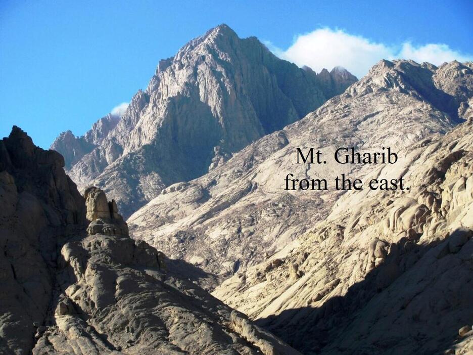
Go back to "HOME".
ENDNOTES
1. Josephus. Antiquities, II, 12. 1.
2. Dare Me to the Desert (1967), by G.W. Murray, 106.
3. Sir John Gardner Wilkinson. Royal Geographical Society (1832), 39.
4. Matthew George Easton. Easton’s Bible Dictionary,
1897, under H. Hagar means “Stranger” or “The
Stranger” (as in foreigner), also “flight” in the sense of leaving one country to go to another.
5. Philo. On The Life Of Moses, 2:70.
6. Josephus. Antiquities, II, 12, 1.
7. Sir Wilkinson. Royal Geographical Society (1832), 39.
8. Paus. 1, 7, 1.
9) Edouard Naville. The Store-City of Pithom and the Route of the Exodus (1903). https://archive.org/stream/ storecitypithom00navigoog#page/n50/mode/2up
10. Hieroglyphic Texts from the Time of Ptolemy Philadelphus, Innovations in Ancient Garb? 281.
11. Ptolemy II and Arabia, W. W. Tarn, 9–25, JSTOR
12. Edouard Naville. The Store-City of Pithom and the Route of the Exodus (1903), 6 and 8. https://archive. org/stream/storecitypithom00navigoog#page/n50/ mode/2up,
13. Hammamat Inscriptions, Inscription of Ramses IV, http://www.reshafim.org.il/ad/egypt/texts/hammamat.htm
14. http://archaeology easterndesert.com/html/pharaonic.html
15. Edouard Naville. The Store-City of Pithom and the Route of the Exodus (1903), 9.
https://archive.org/stream/
storecitypithom00navigoog#page/n50/mode/2up,
16. Marcus Junianus Justinus (3rd century, Roman historian)
XXXVI, 2
17. Jerome. Commentary on Daniel (1958) Xl.
18. The Supposed Expedition of Ptolemy II to Persia, by David Lorton, 163, JSTOR.
19. Line 13 of the Pithom Stele.
20. Philo. The Life Of Moses, II, V, 30.
21. Jerome. Commentary on Daniel (1958), 15–157, Translated by Gleason L. Archer.
22. Ptolemy II. By W. W. Tarn, 249, JSTOR.
23. Idyll XIV, by Theocritus, Greek poet.
24. Appian Praef. 10.
25. The House of Ptolemy (1927), by E. R. Bevan Chapter 3 (public domain).
26. Revenue Law of Ptolemy Philadelphus (1896), by B. P.
Grenfell, M.A., xxix.
27. Eusebius. Preparation for the Gospel, IX, 9:27 & 6. Artapanus was a Jew living in Egypt during the time of the Ptolemy Dynasty.
28. Weights and Measures (1935), 11–83, English translation.
29. Josephus. Antiquities, XII, 2.
http://www.earlyjewishwritings.com/text/josephus/ ant12.html
30. All this from The Letter of Aristeas. Translated into English with an Introduction and Notes by H. St. J. Thackeray (London: MacMillan and Co., 1904).
31. The Letter of Aristeas. R. H. Charles—Editor (1913), section 283. http://www.ccel.org/c/charles/otpseudepig/ aristeas.htm
32. Praeparatio Evangelica, XIII, 12.
33. Josephus. Antiquities, III, 2, 4.
Choice another book or go to "HOME".